

Adventure Report: Zhagana Hiking
Team member: Liang Xueyan, Liu Yu, Liu Yinxi, Chen Xiaofen
Time: July 2025
Length: 60km 4 days
Location: Gansu
Difficulty: 5/10
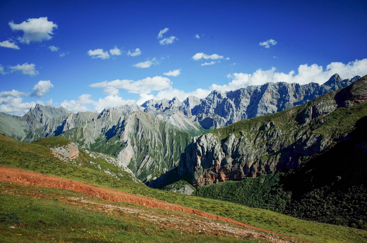
Zagana is located in central China and belongs to the western Qinling mountain range, which is also the southern extension of the Di’e Mountains. In 1925, American botanist Joseph Rock visited Zagana three times and remarked, “Never in my life have I seen such magnificent scenery. Had the author of Genesis witnessed this beauty, the Garden of Eden would have been set here.”
He later published his travels in Gansu and Yunnan in National Geographic, which inspired the novel Lost Horizon and the enduring legend of “Shangri-La.”
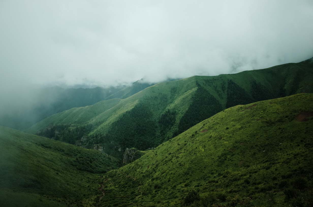
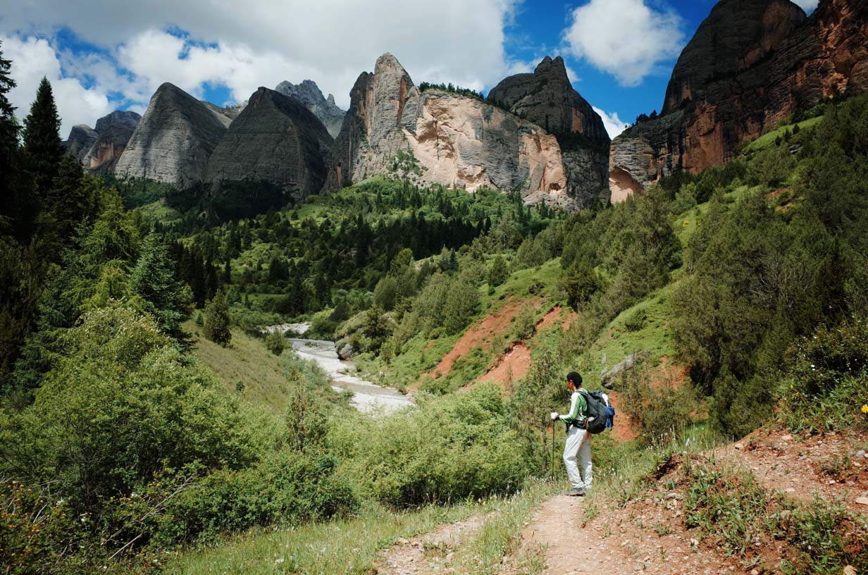
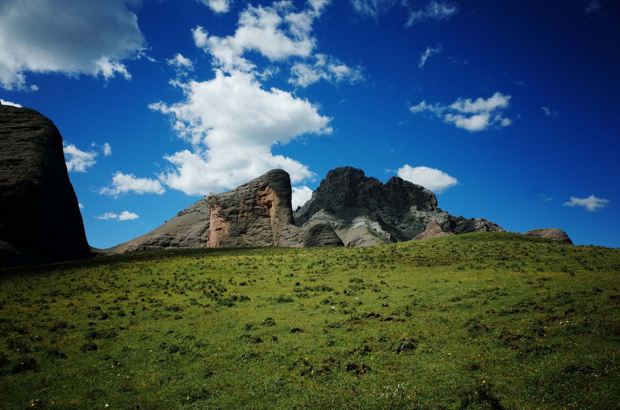
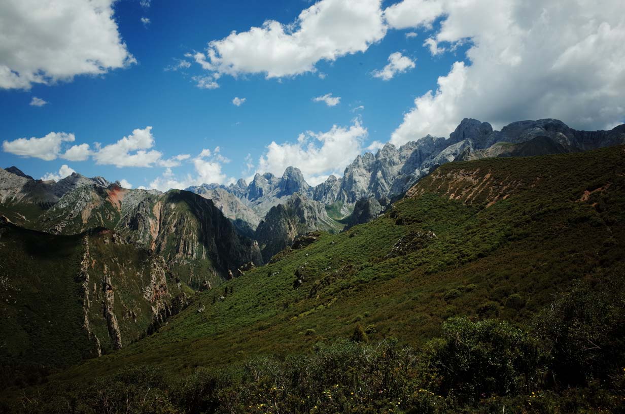
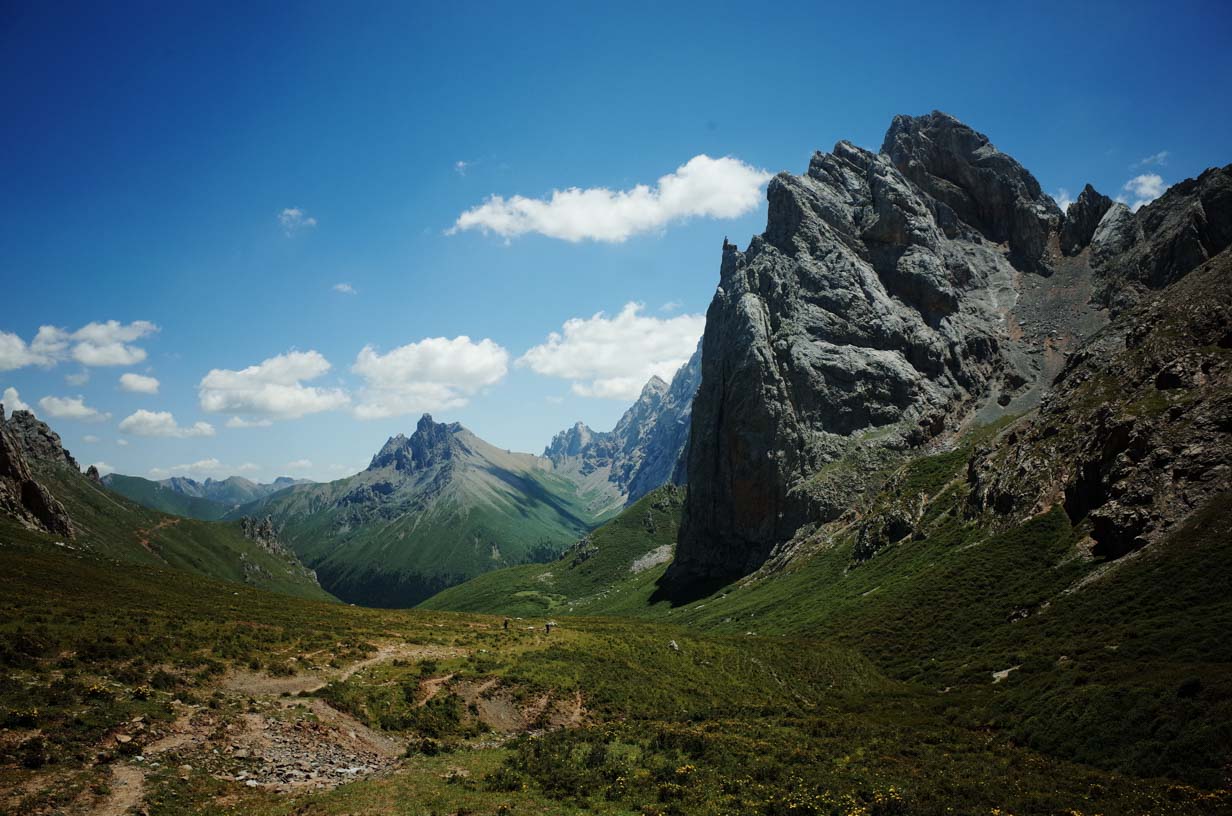
In Tibetan, “Zagana” means “stone box,” a name it earned for its steep stone mountains that resemble a massive stone palace. Among these towering peaks are several popular trekking routes. We took one of them on this journey—a 60-kilometer trek with a total elevation gain of around 4,000 meters.
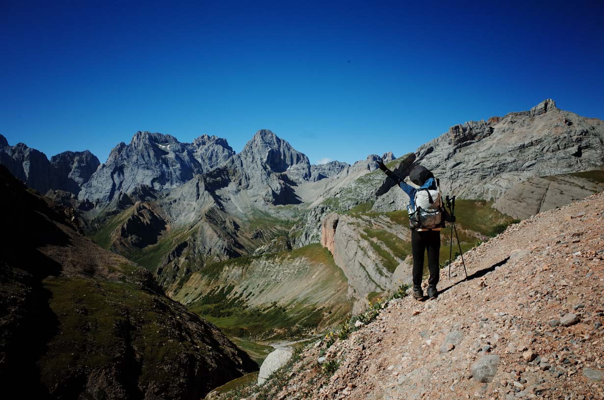
This hike was also part of our gear testing for the upcoming 2026 releases. These included the Lanshan ProLite (585g) and the newly redesigned Tutor backpack (630g). We also helped ICEFLAME test their CORELITE ultralight sleeping bag, which has 300g of fill and weighs just 445g—possibly the lightest box-baffle sleeping bag in the world.
You can download my gear list at the link below.
https://lighterpack.com/r/6byxft
Adventure Report:
DAY 0
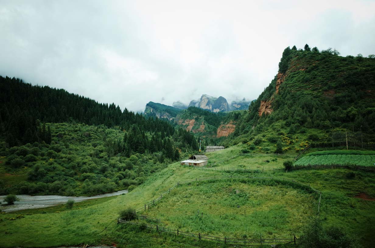
We arrived at the guesthouse near the trailhead quite late. Dayu Valley is a designated scenic area. The local residents used to live by herding livestock, but now they mostly run guesthouses. The owner warmly invited us to join a bonfire party—a small ceremony hosted by several guesthouse owners to welcome guests.
This area is now fully commercialized. Traditional villages have been replaced by polished buildings, though the intricate wooden carvings still hint that this is Tibetan territory.
Accommodation costs 200 CNY (around 30 USD) per night, and the conditions are excellent. The room included a clean, spacious bathroom and two 1.5-meter (about 5-foot) wide beds, with disposable toiletries and slippers provided.

DAY 1
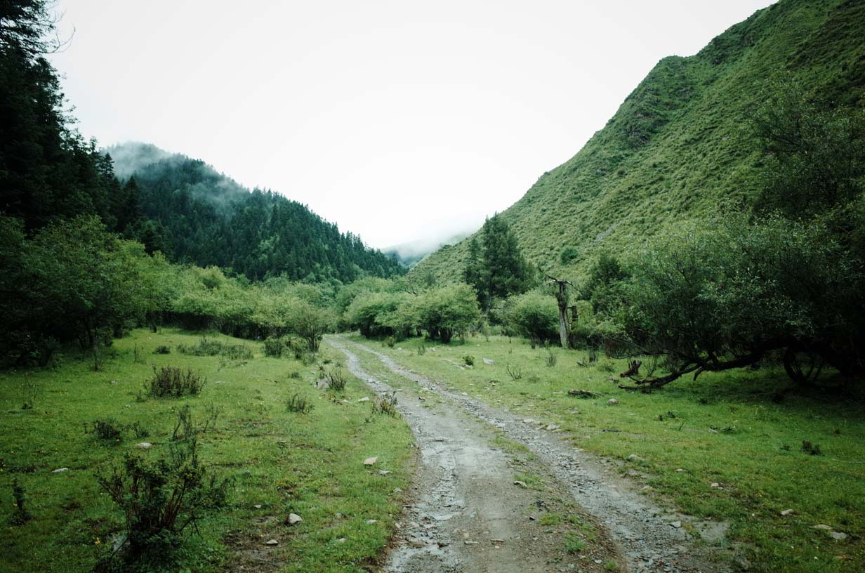
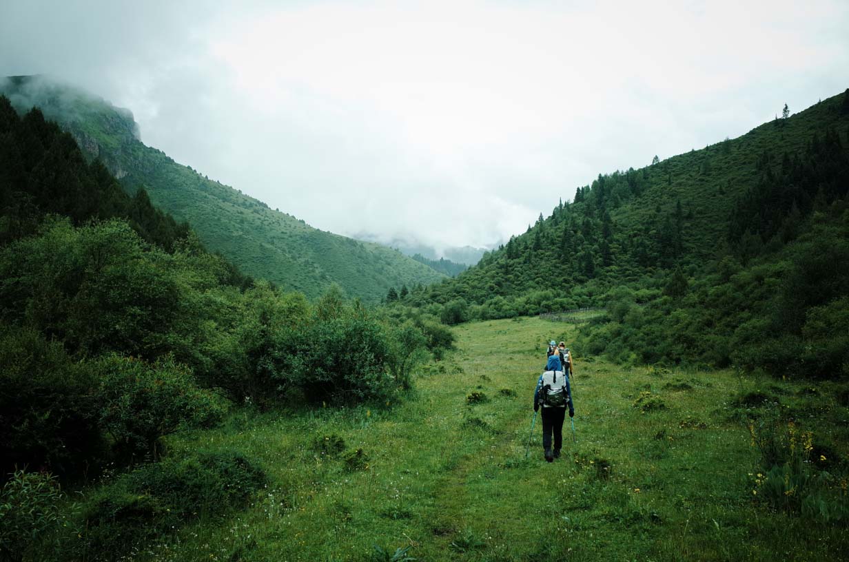
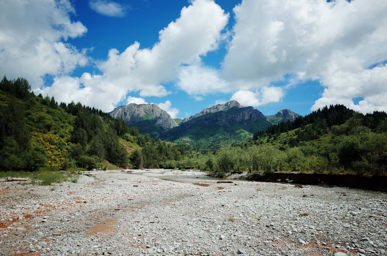
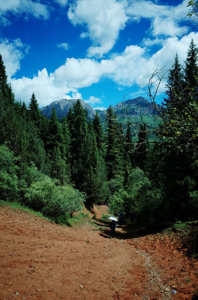
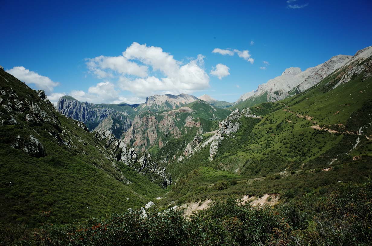
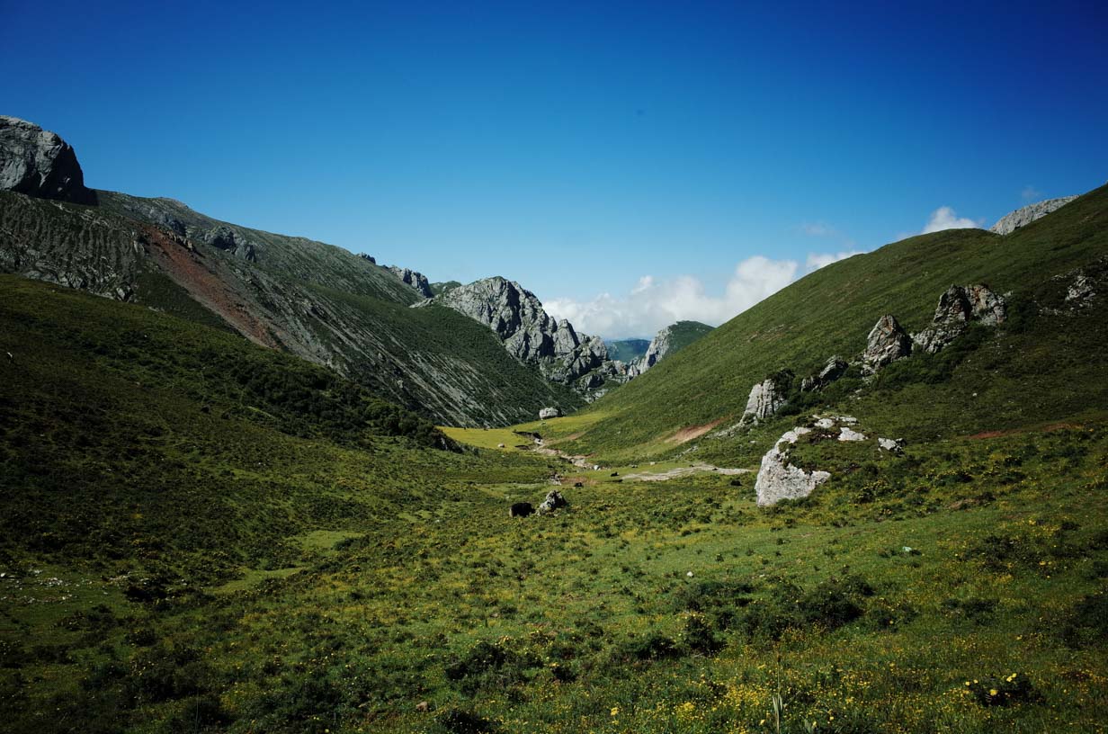
We chose Dayu Valley as the starting point for the trek because its relatively low elevation makes it ideal for beginning a high-altitude hike. Since hiking is not allowed within the scenic area, we began from a completely untouched valley that locals use for grazing—allowing us to access it freely.
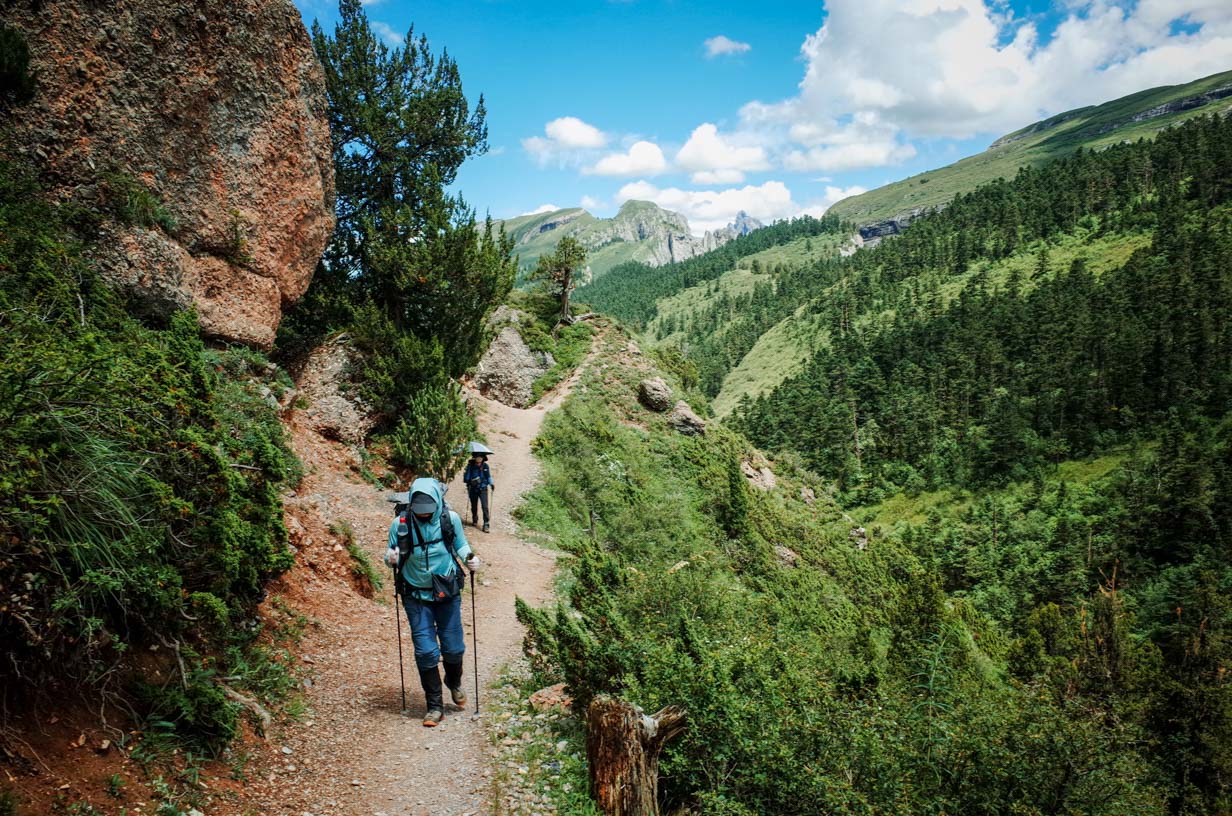
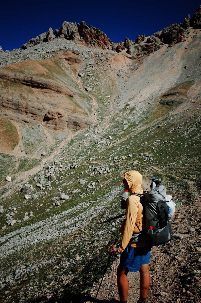
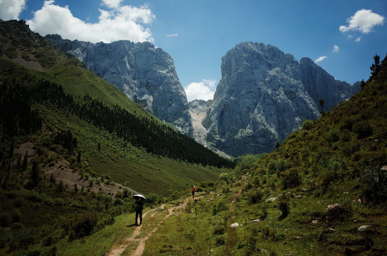
We didn’t encounter any other trekkers on the first day. About 10% of the trail was overgrown with grass, making it hard to follow, but the overall difficulty was manageable. The main challenge was crossing a 3,700-meter (12,140-foot) pass, which tested our endurance and high-altitude adaptation.
After crossing the 3,700-meter (12,140-foot) pass, we faced a steep descent with faint trail markings. Once we reached the valley below, we continued downhill for another 10 kilometers (6.2 miles) until arriving at Camp 1.
Along the way, we passed several uninhabited Tibetan houses—seasonal shelters and farmland used to grow vegetables. We didn’t see any livestock. Some houses were open, but I wouldn’t recommend staying in them as they still have rightful owners.
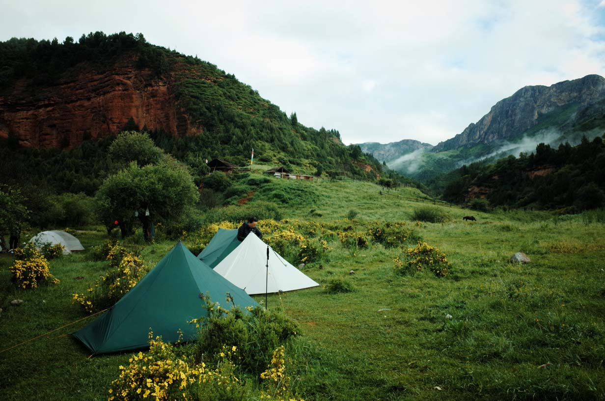
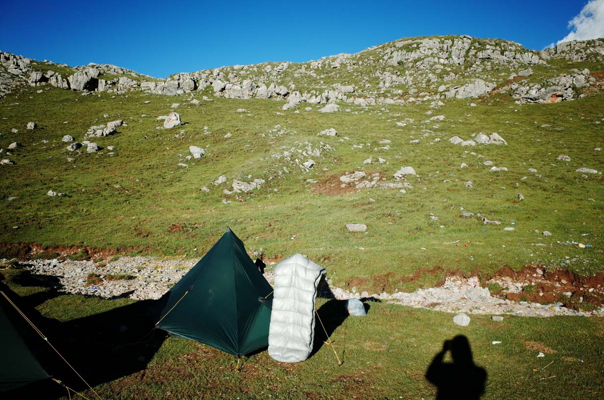
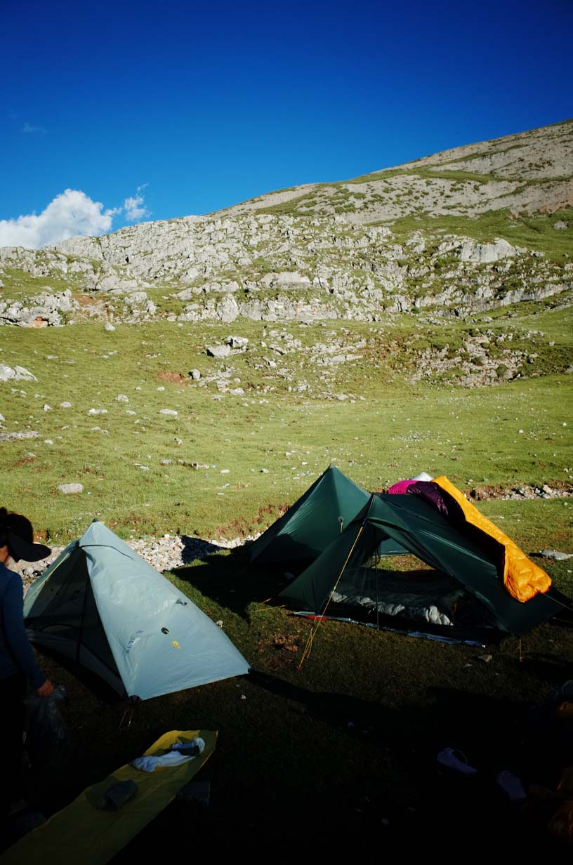
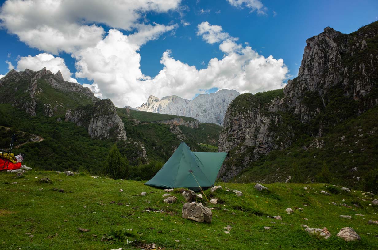
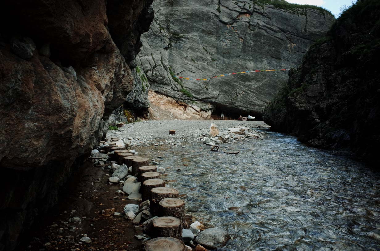
Camp 1 was set up by the river and was very damp. Nearby, there was a herder’s house, and their pigs frequently wandered into the camp, so we had to hang our food in a tree. Avoid pitching your tent too close to the river—not only is the ground soggy, but flash floods during the rainy season can be dangerous.
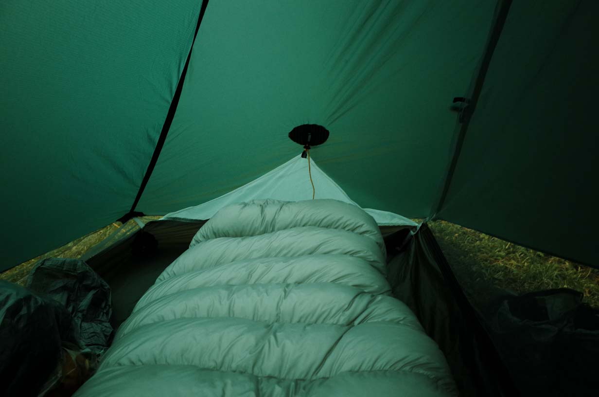
It rained heavily throughout the night, but the tent stayed completely dry with no leakage.
DAY 2
We woke up to perfect weather, and I made pancakes for breakfast—a simple and quick outdoor meal. If you make a few extra, they also work well as trail snacks.
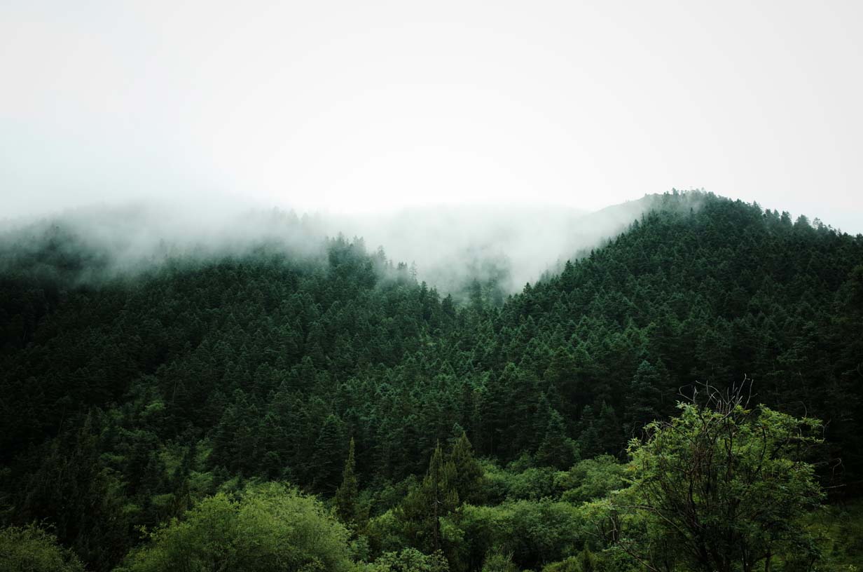
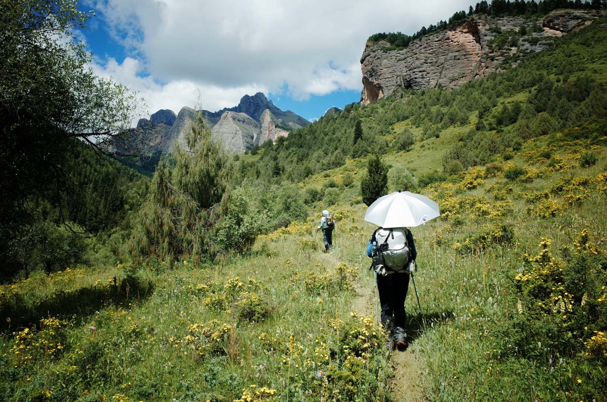
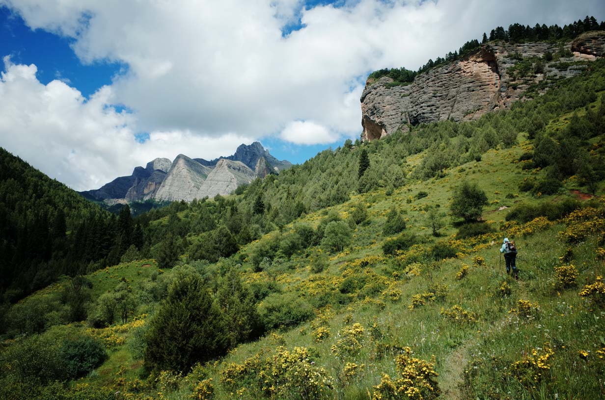
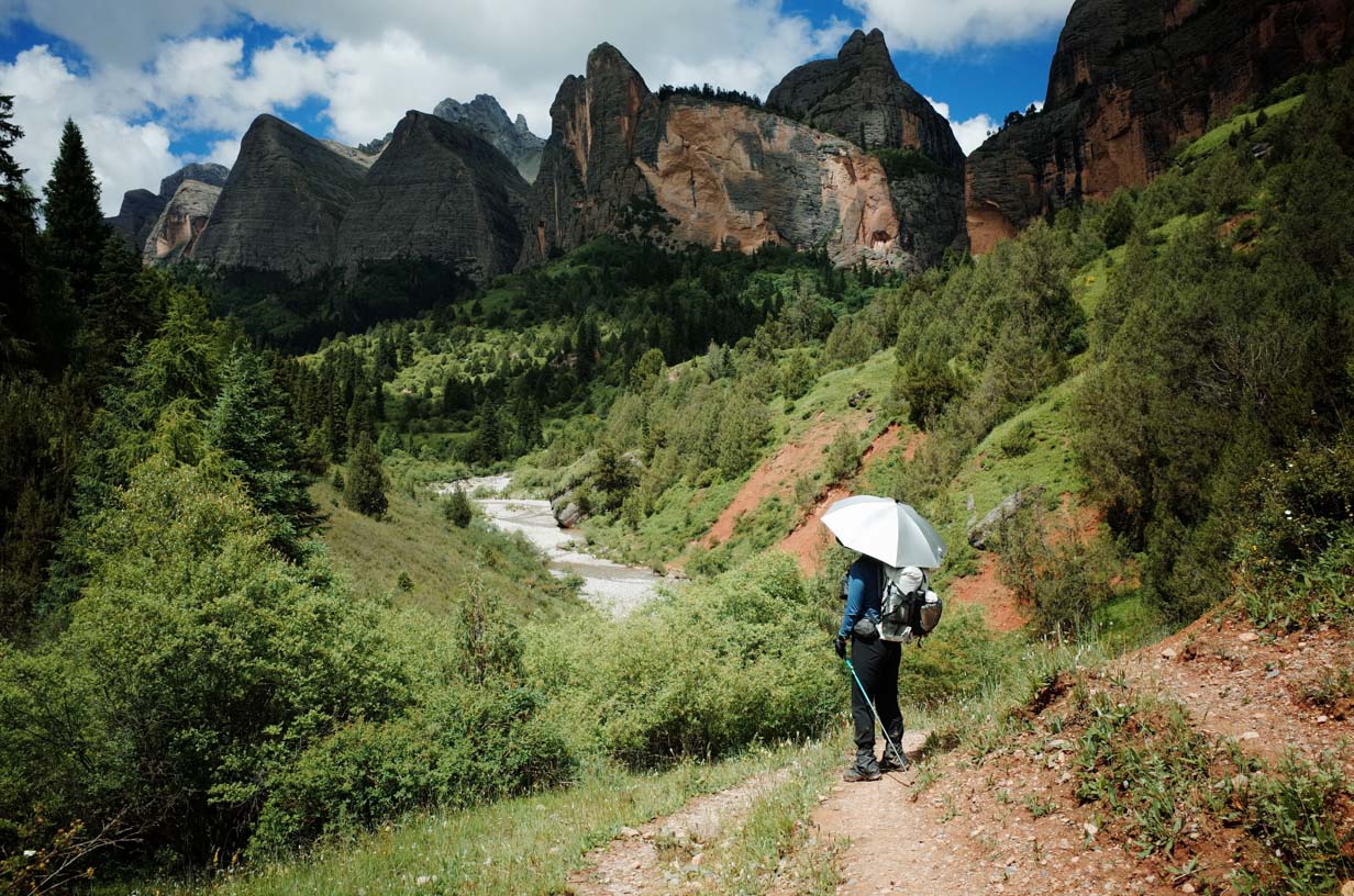
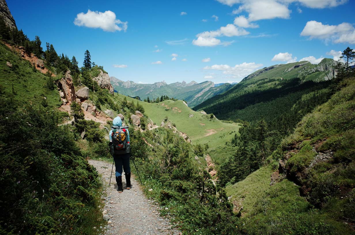
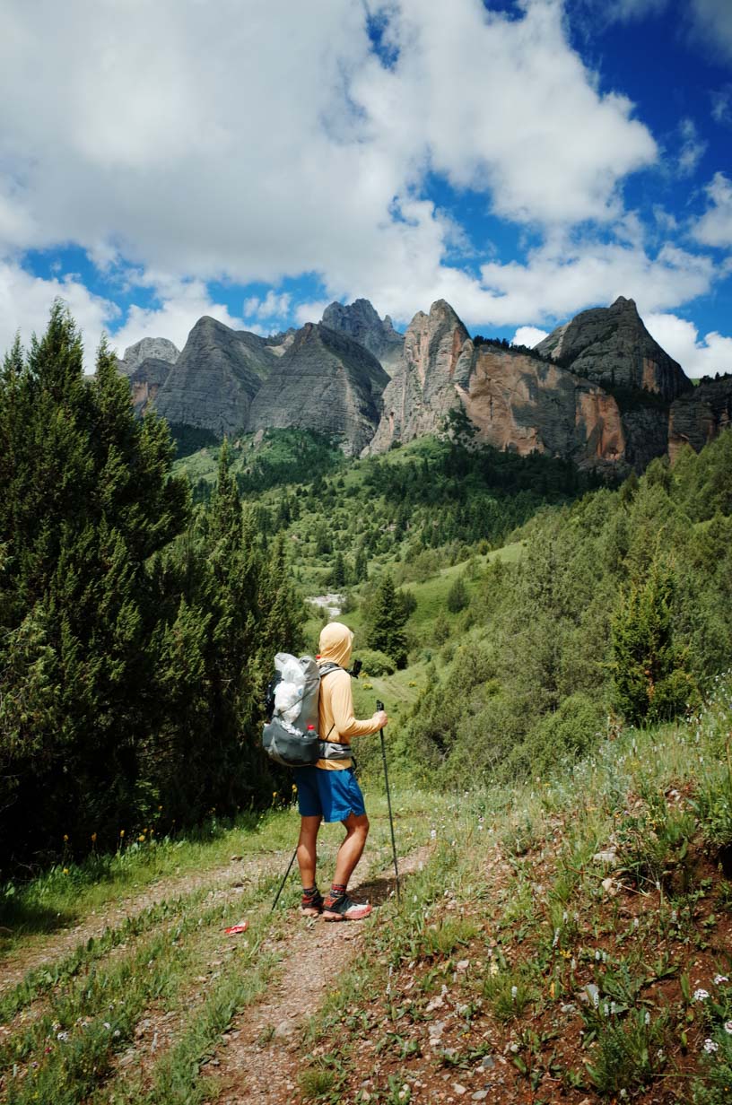
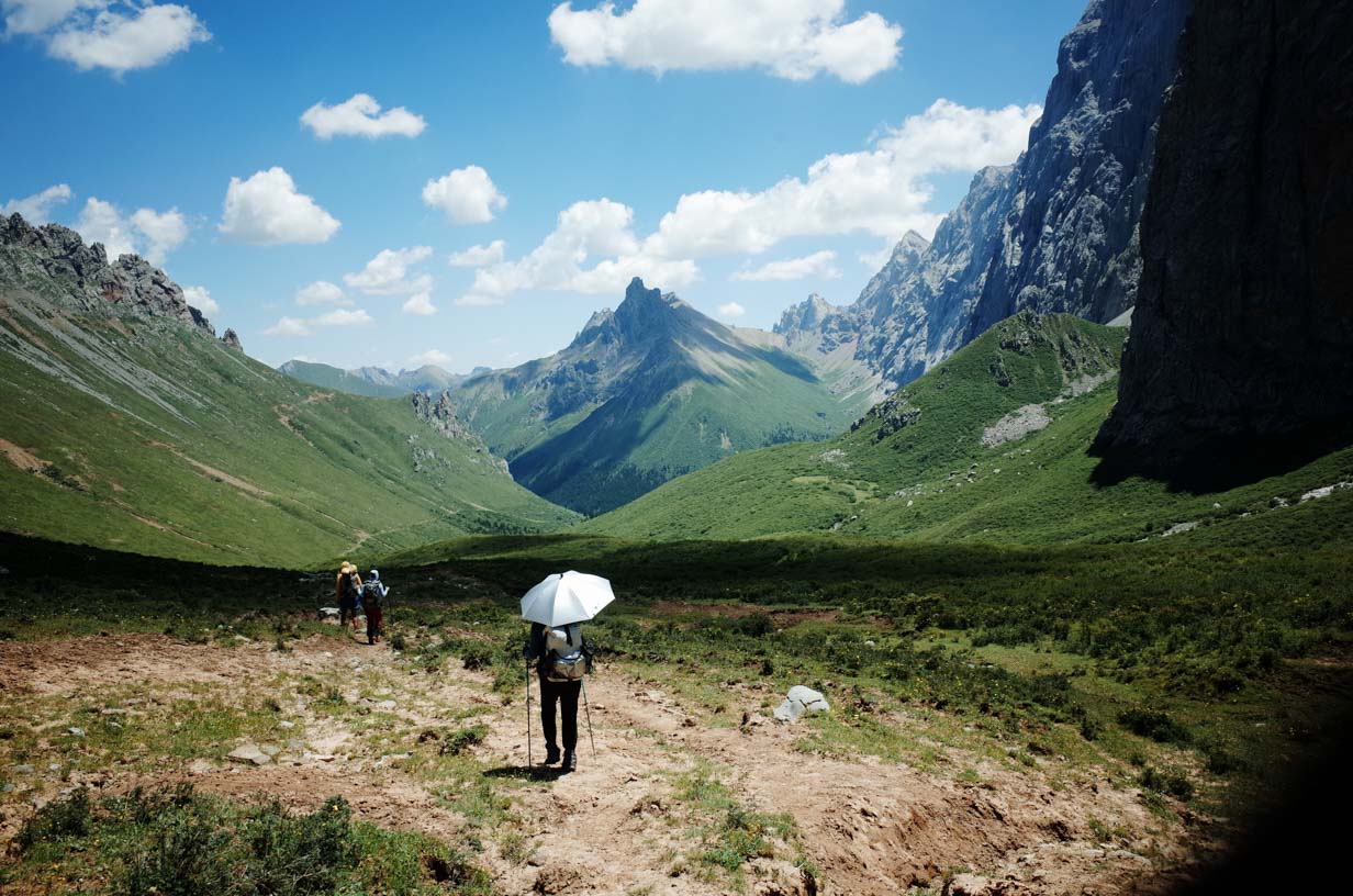
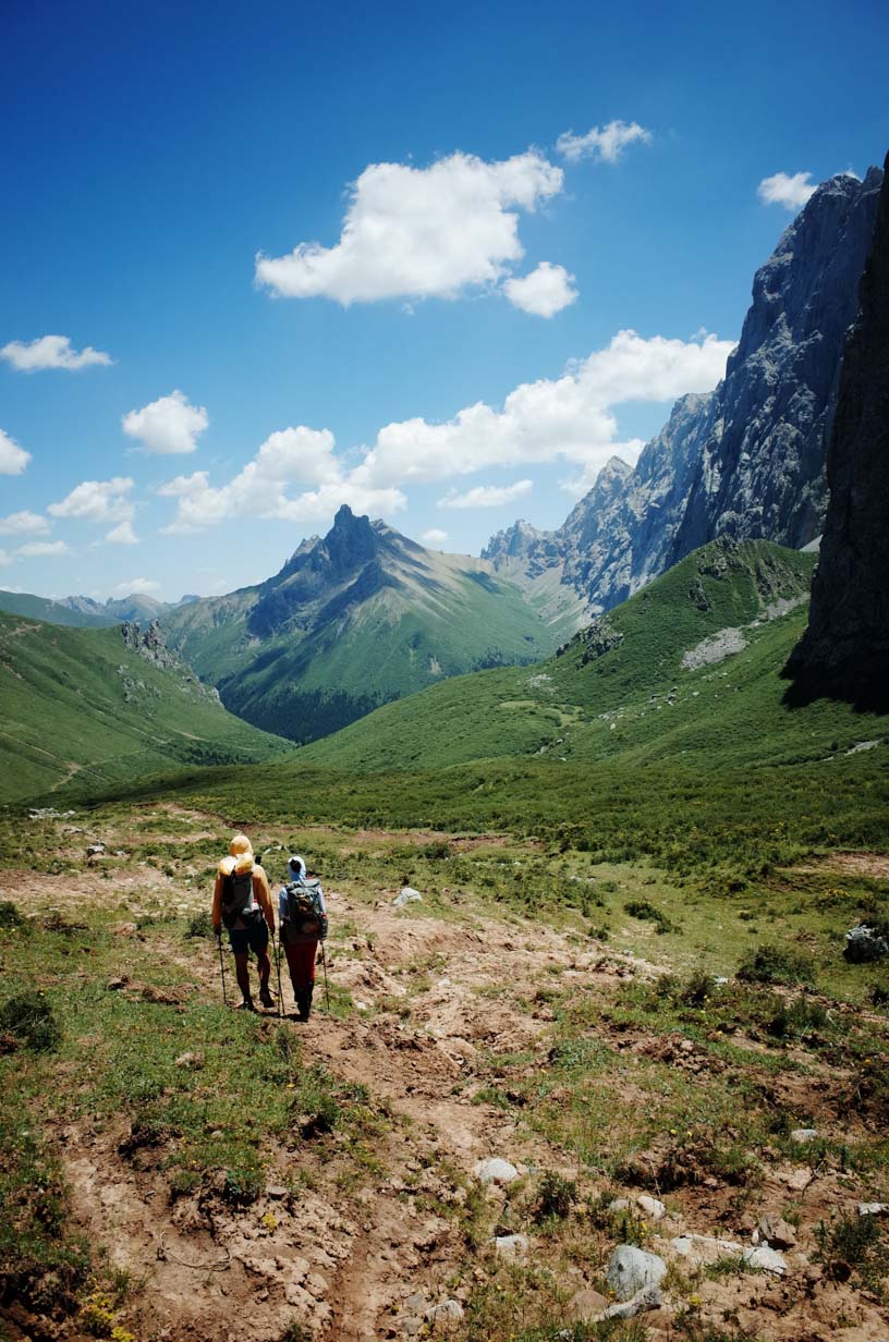
The sun came out quickly, and temperatures rose sharply. But the heavy rain from the previous day had turned much of the trail into soft mud, and the heat made the air feel stifling. Today’s route was mostly uphill, but the scenery was stunning. We passed through several vegetation zones as we ascended from 3,100 meters (10,170 feet) to 3,973 meters(13,035 feet). Along the way, we crossed multiple passes. According to GPS data, we covered 11.19 kilometers (6.95 miles) with a total elevation gain of 1,137 meters (3,730 feet). The day’s trek took about 7–8 hours.
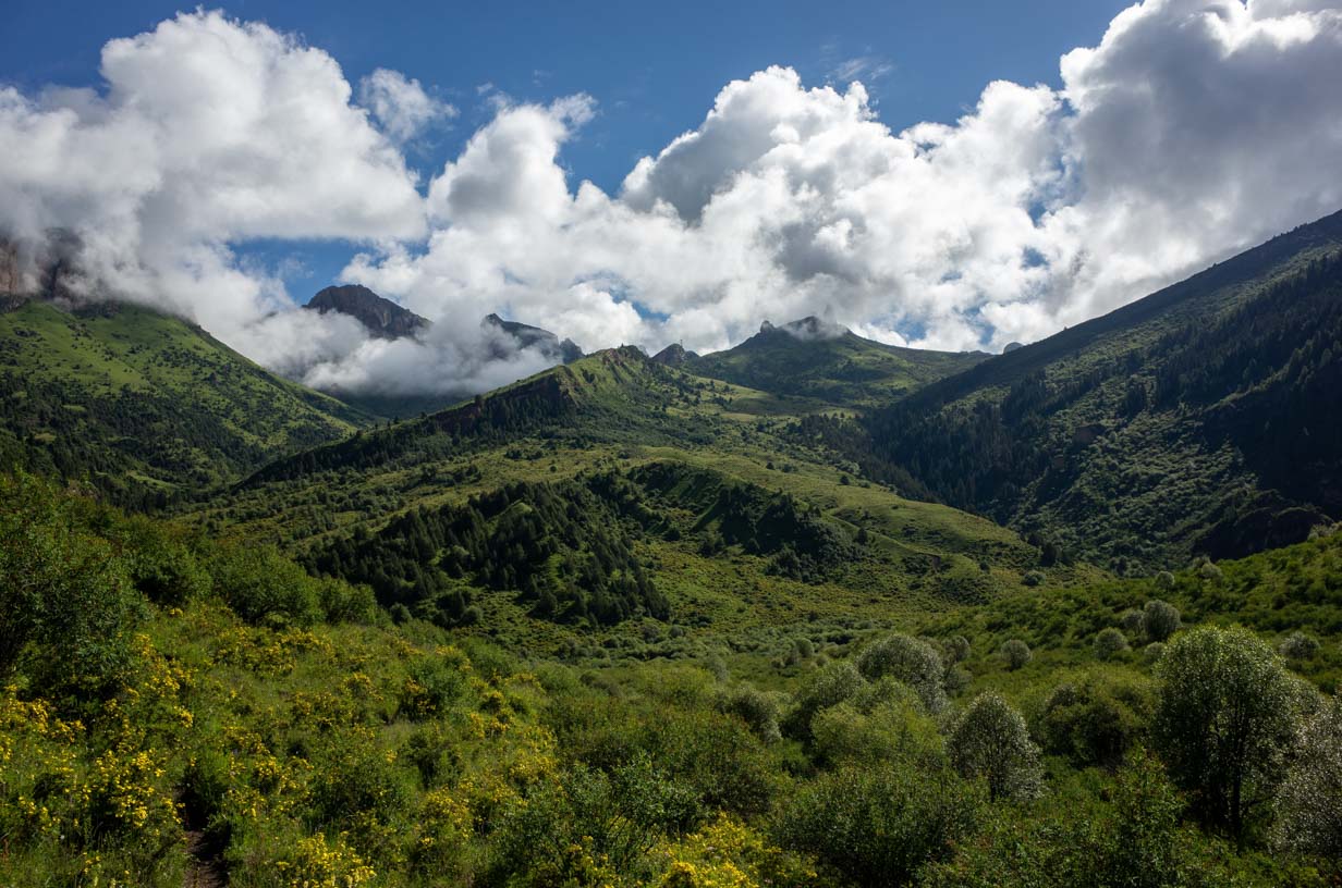
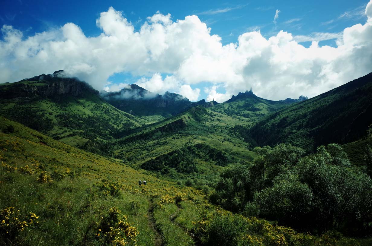
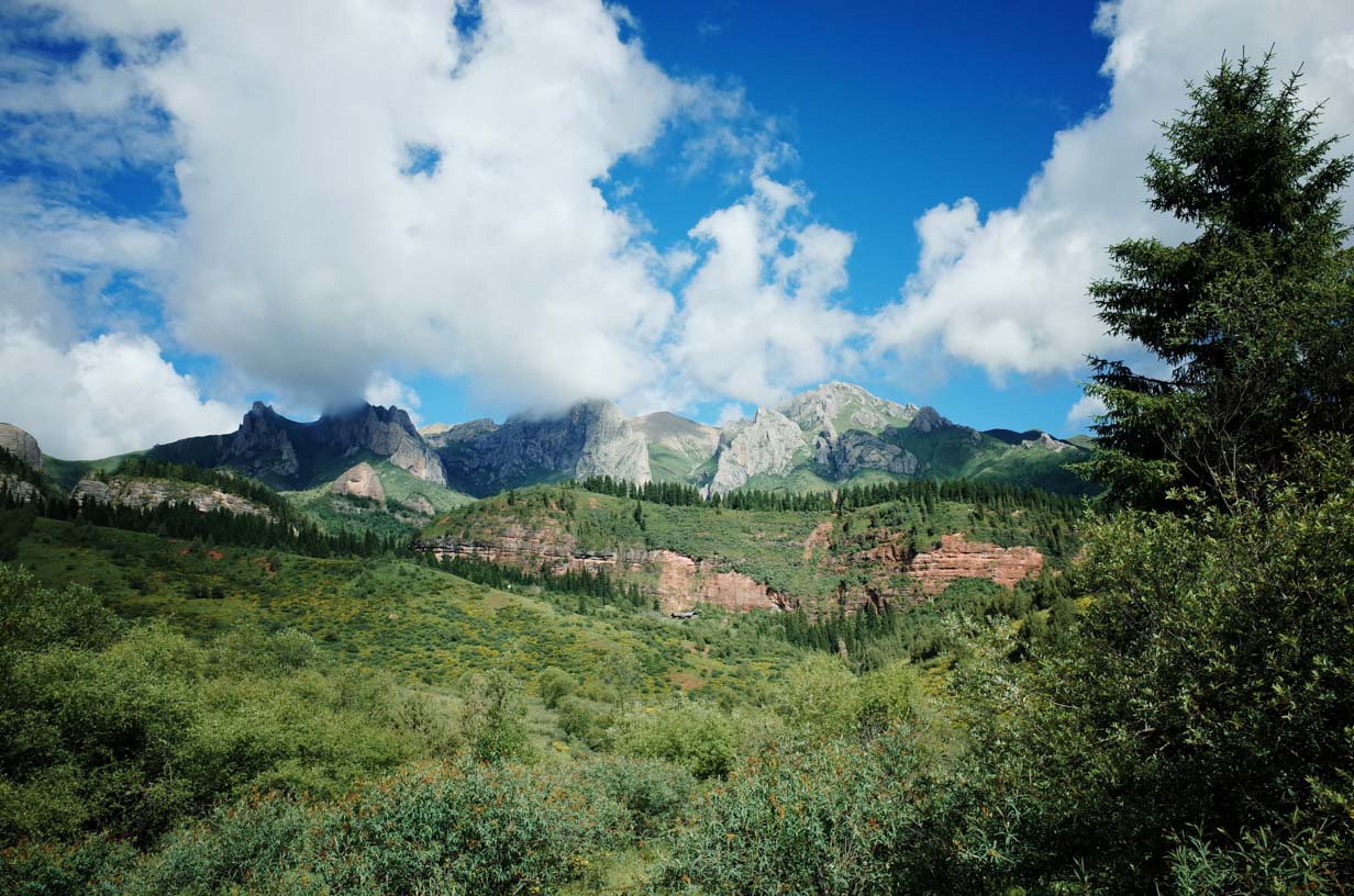
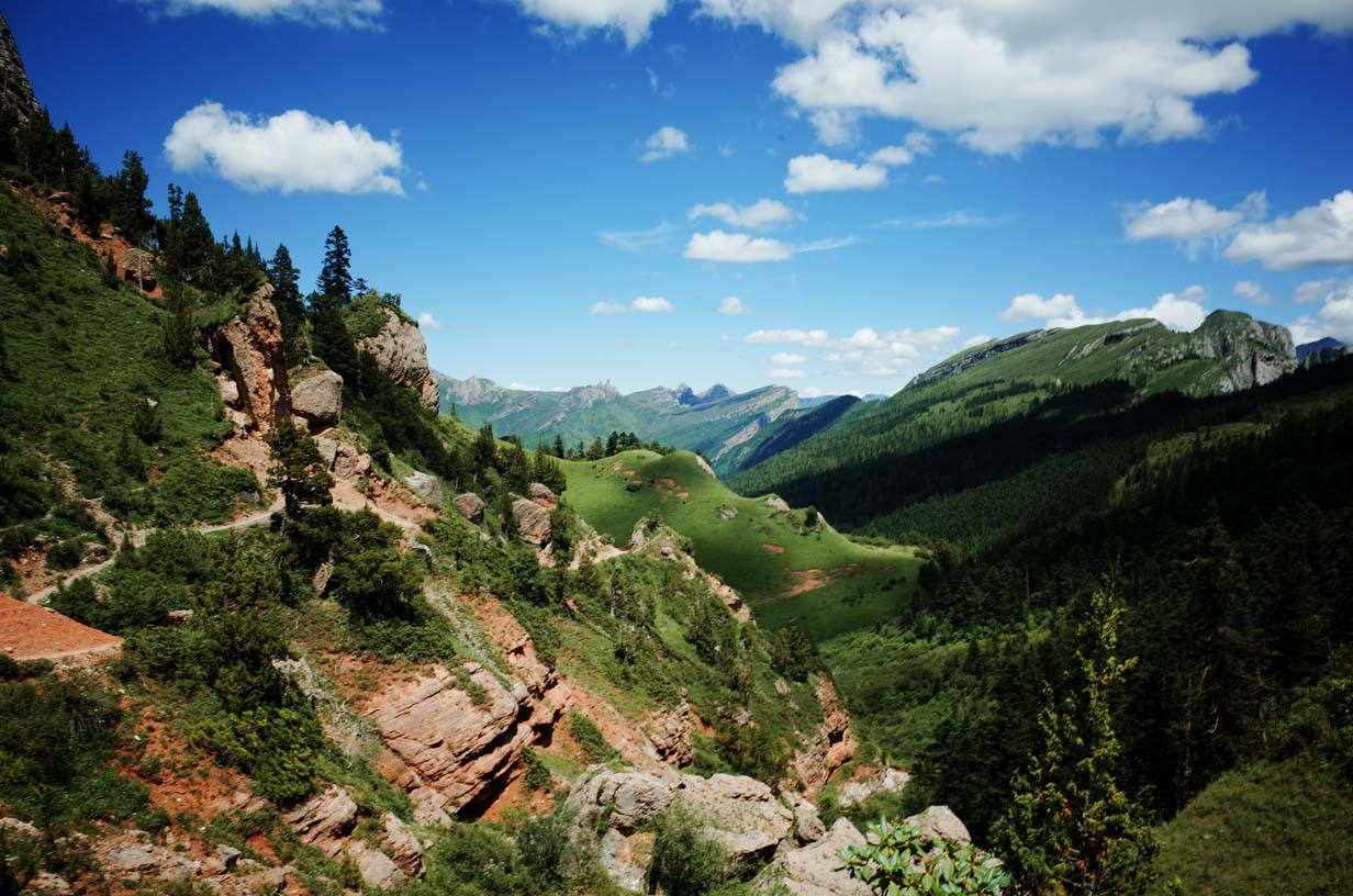
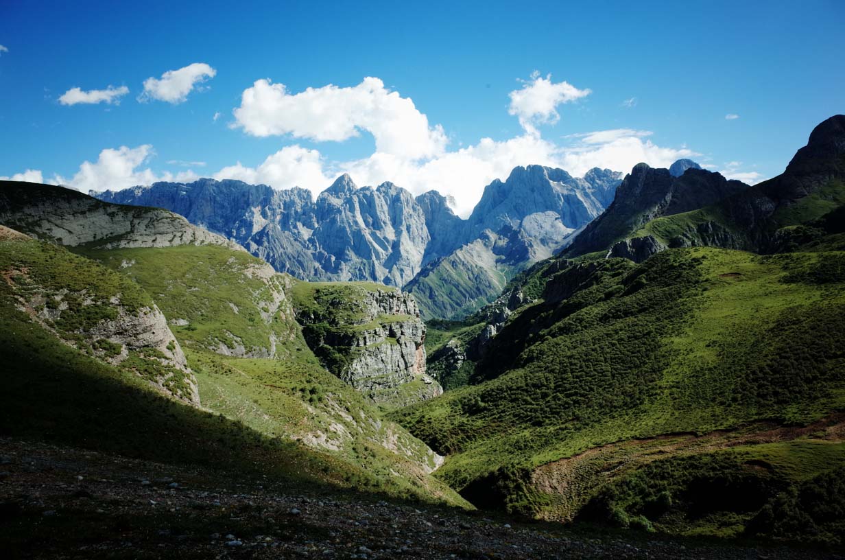
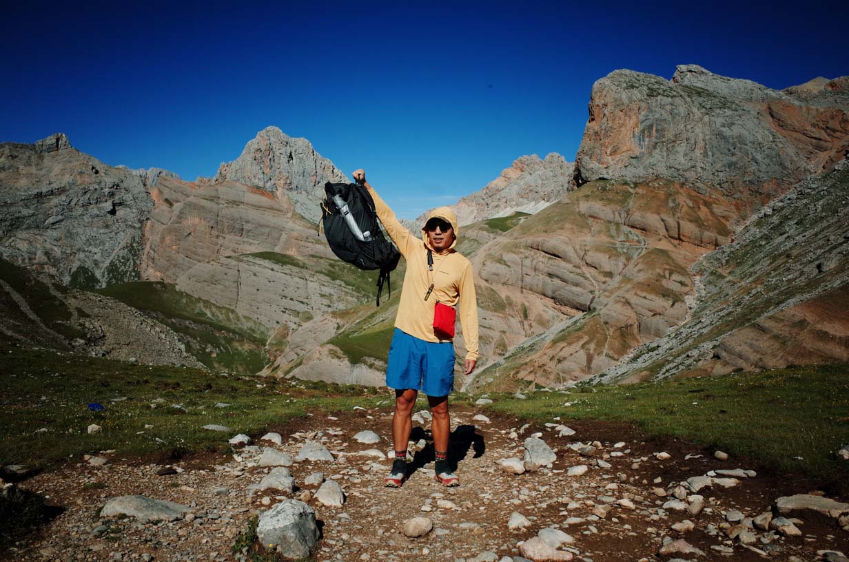
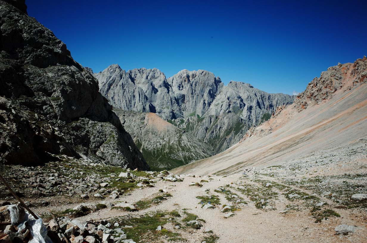
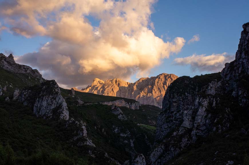
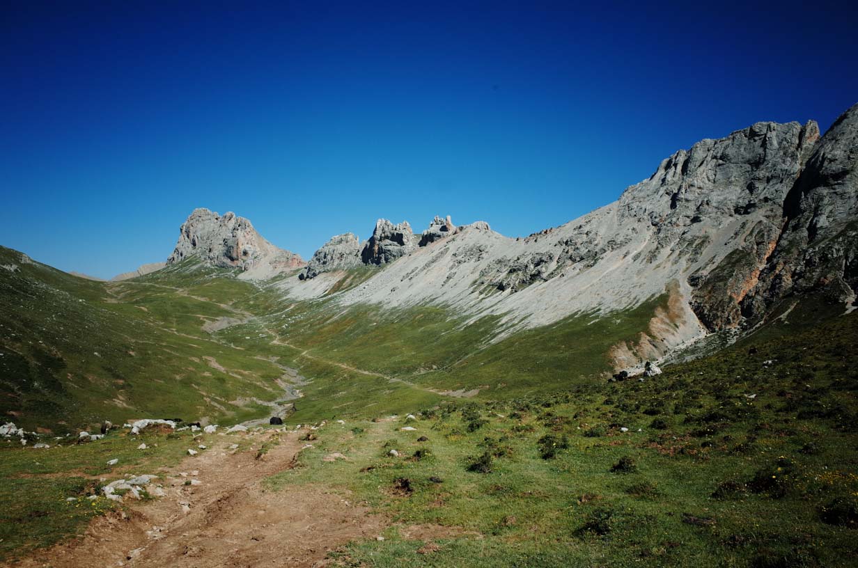
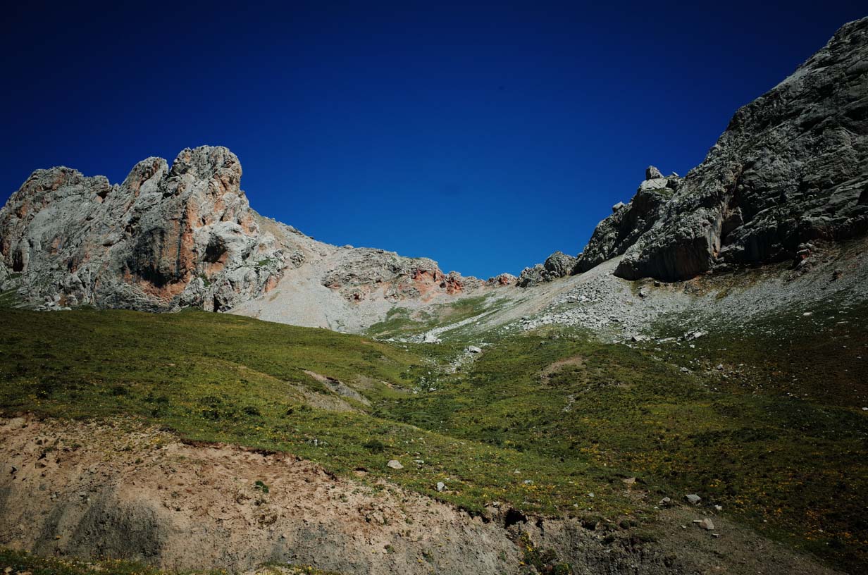
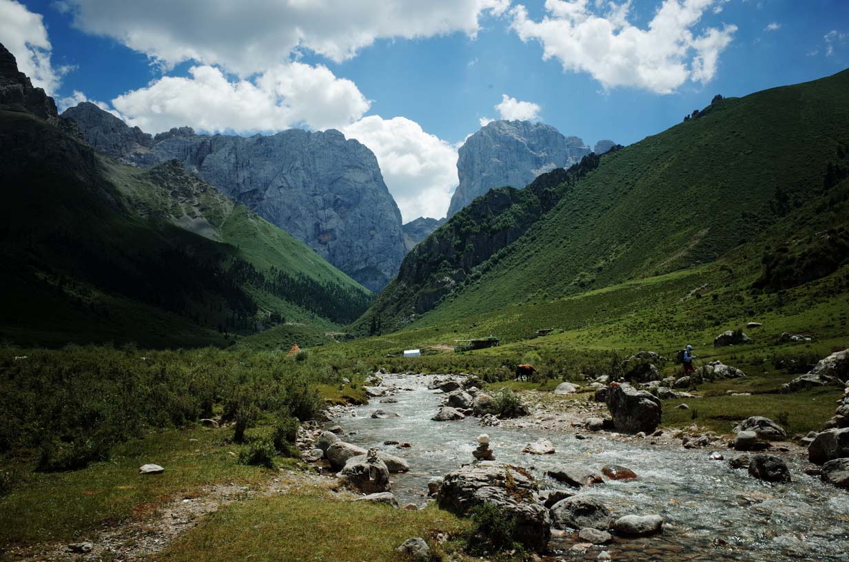
Starting on Day 2, the landscape changed dramatically. We began seeing Zagana’s most iconic sights—massive limestone peaks rising vertically from the ground. Here, the colossal folds formed by the collision of the Indian and Eurasian tectonic plates are visually striking, with fractured and uplifted rock layers clearly visible. This region is still geologically active, so camps located close to cliffs or steep rock faces can be hazardous and should be avoided.
Camp 2 sits at 3,973 meters (13,035 feet) on a high alpine slope, away from cliffs and geological hazards. There is a reliable water source nearby. Although the ground is slightly sloped, it’s well protected from wind and generally safe.
DAY 3
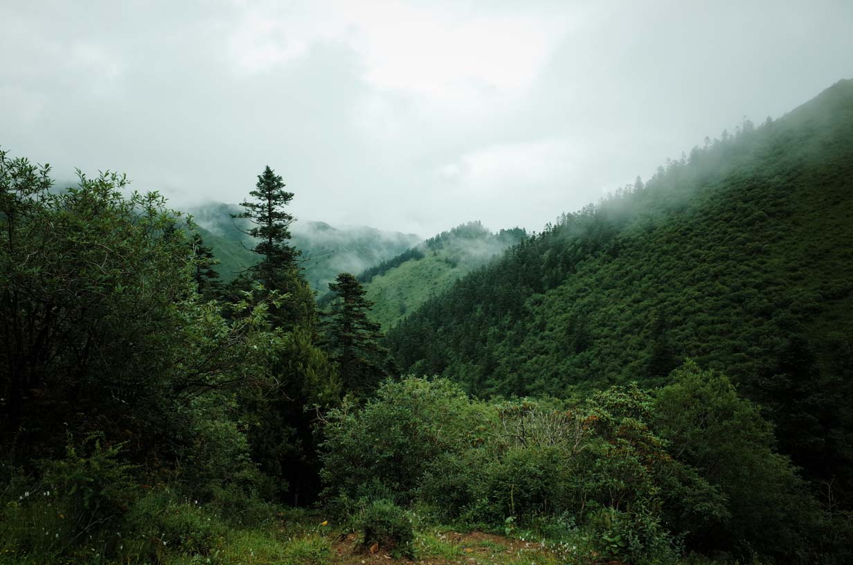
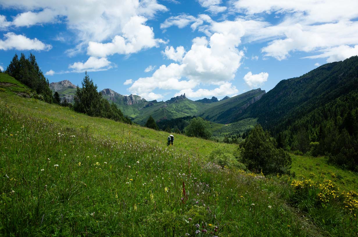
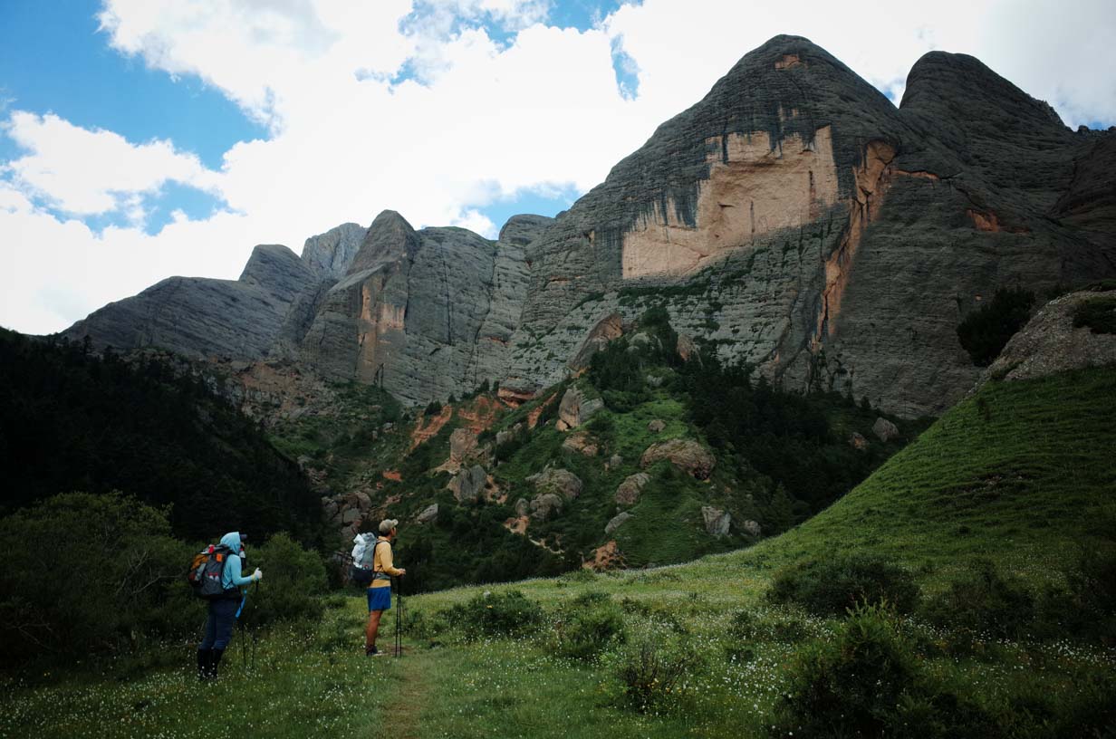
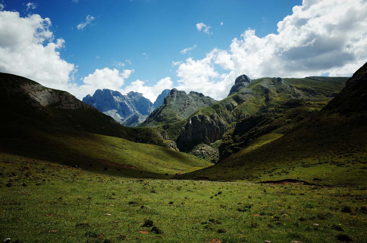
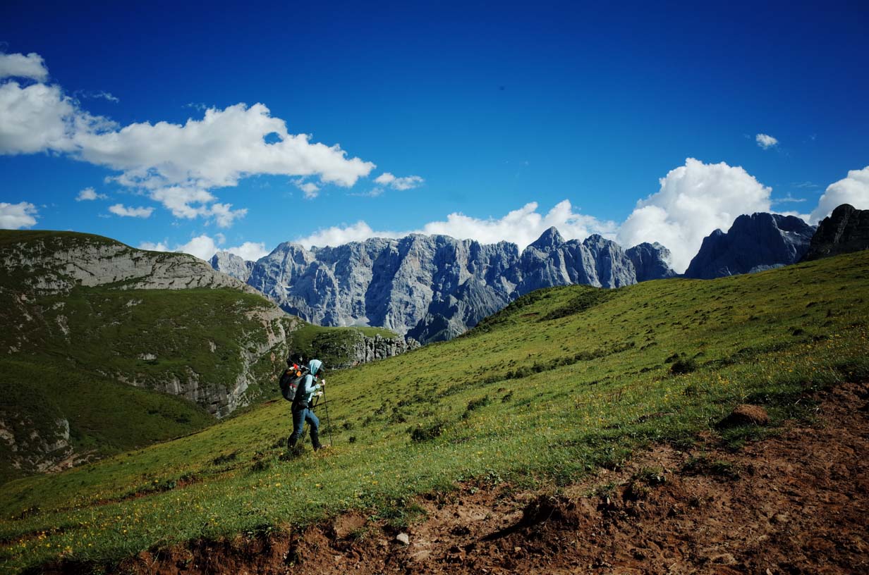
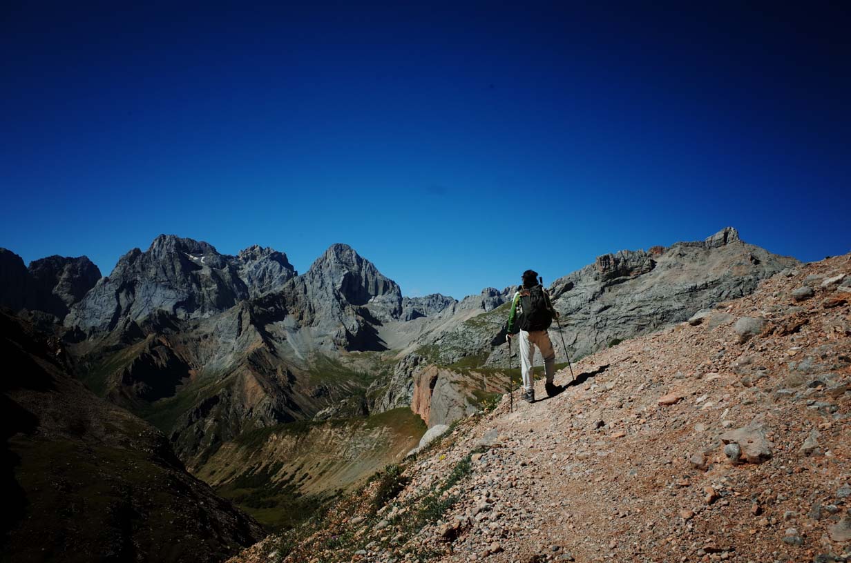
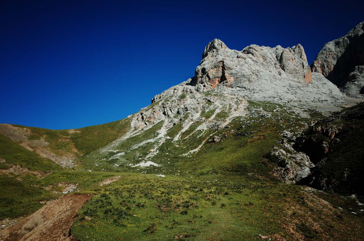
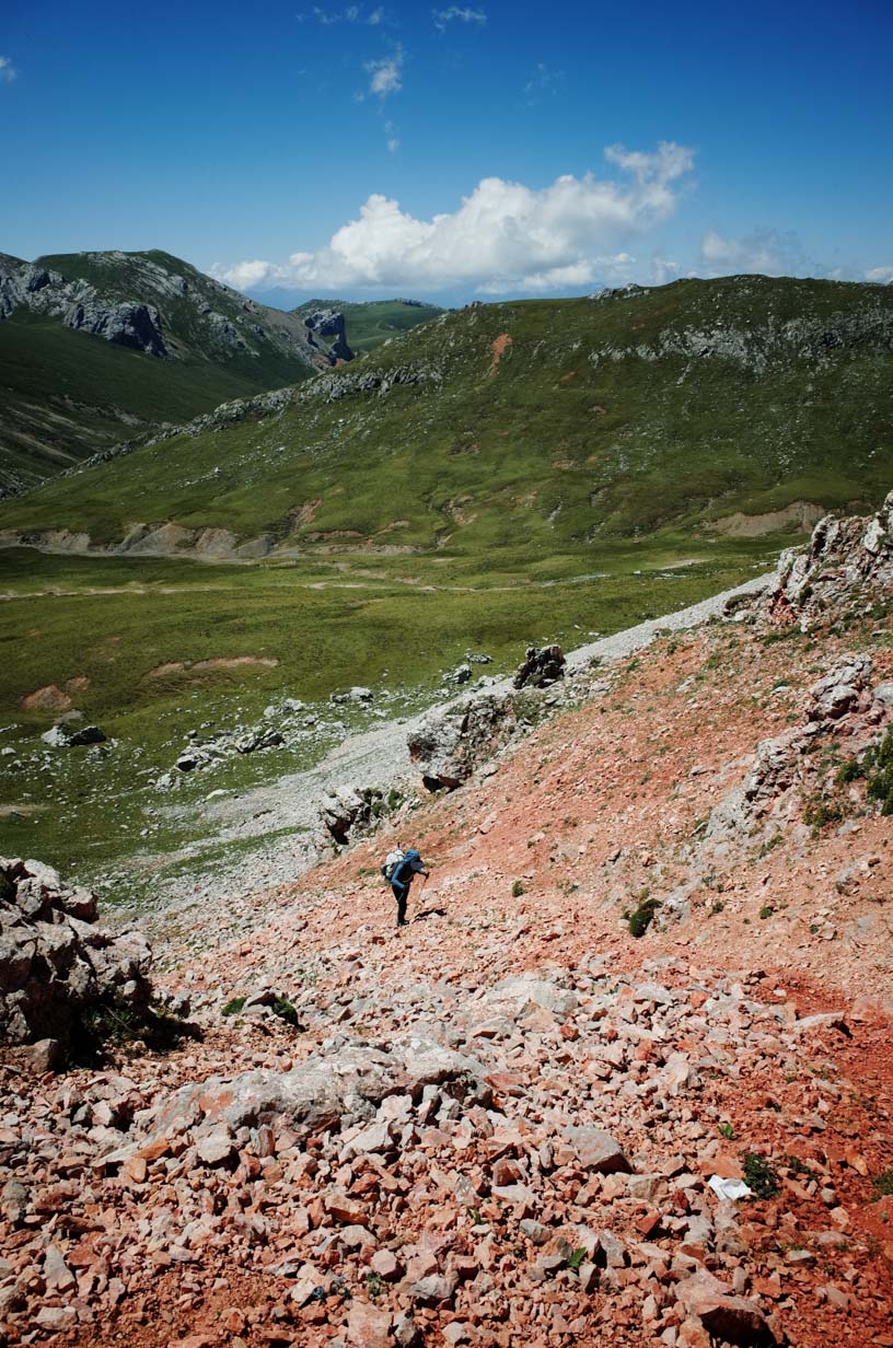
Today’s hike was much easier than Day 2. We gained only 667 meters (2,188 feet) in elevation over a distance of 12.8 kilometers (7.95 miles), which took around 6 hours. We crossed 5 passes or high points, with the highest elevation being 4,257 meters (13,967 feet).
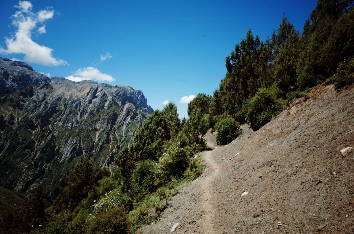
The trail mostly hugged the mountainside, offering wide-open views. Vegetation was sparse, so sun protection was essential. Several streams along the way provided plenty of opportunities to refill water, eliminating any risk of dehydration. Trail conditions were generally good, allowing for a steady pace, although some sections had landslides and posed a minor risk of slipping.
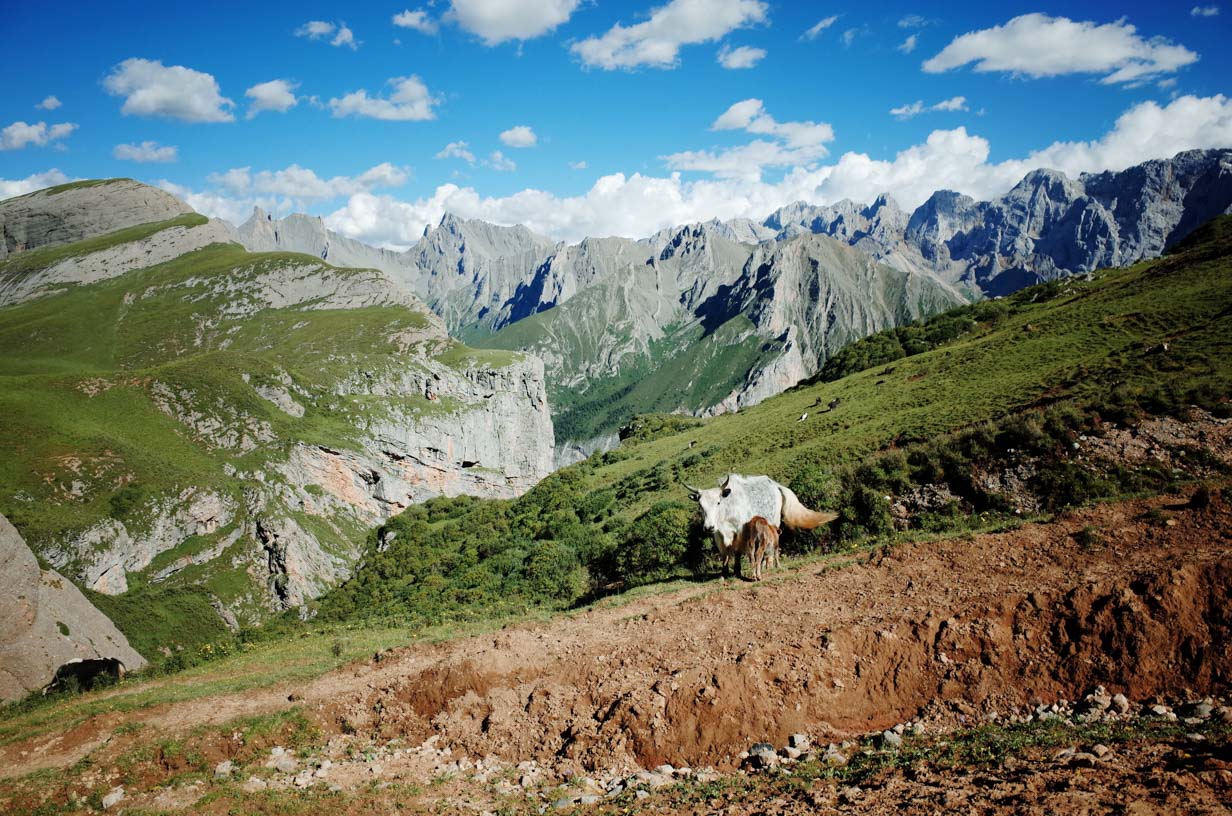
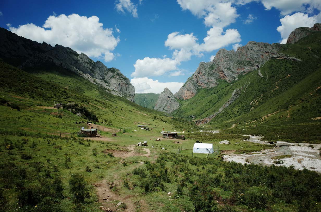
Camp 3 was located on a hillside. We arrived at around 2:30 PM. The area had a large, clean water source—enough to bathe if desired—though the ground was uneven. A local herder lives here year-round and offers services to trekkers. You can purchase food and drinks or even rent a horse. Since we arrived early, you could also choose to continue hiking for another 3 hours to set up camp near the next pass.
DAY 4
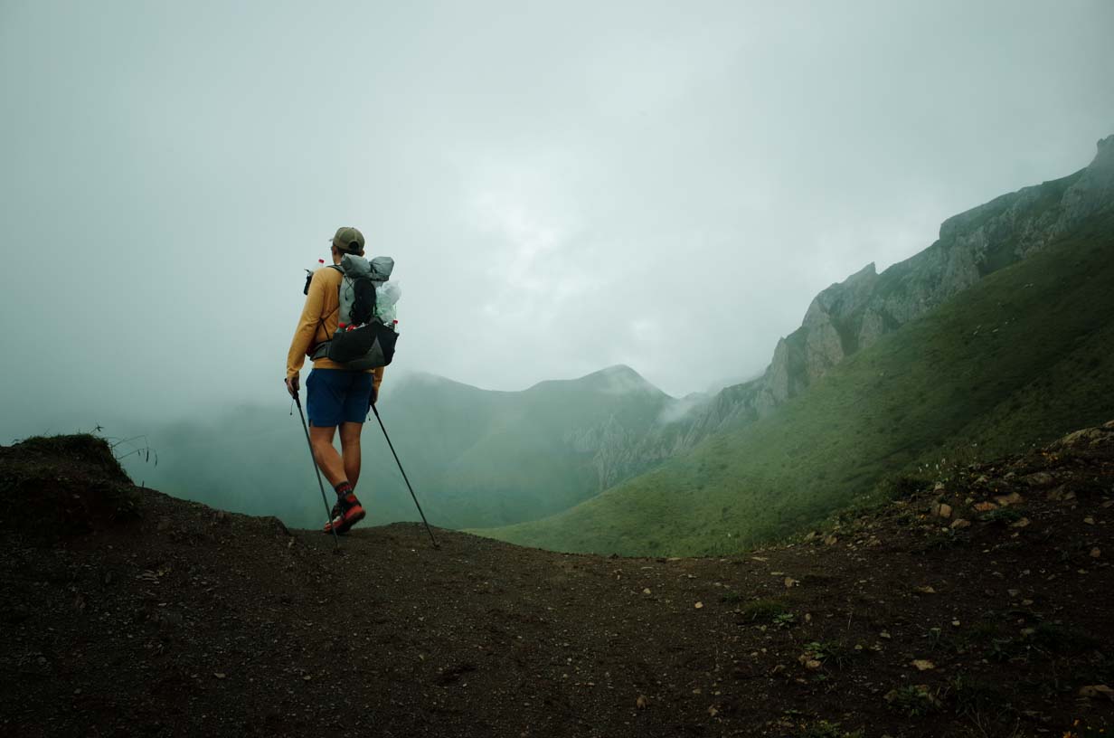
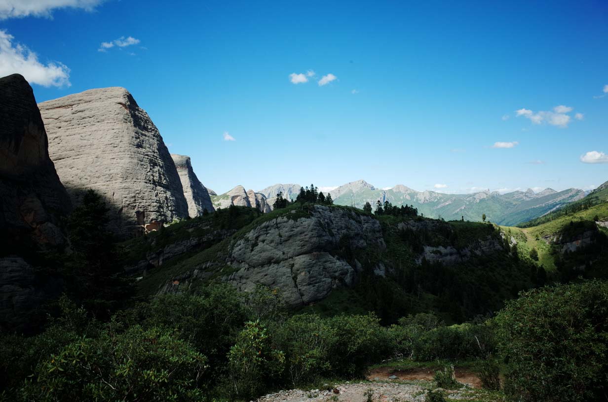
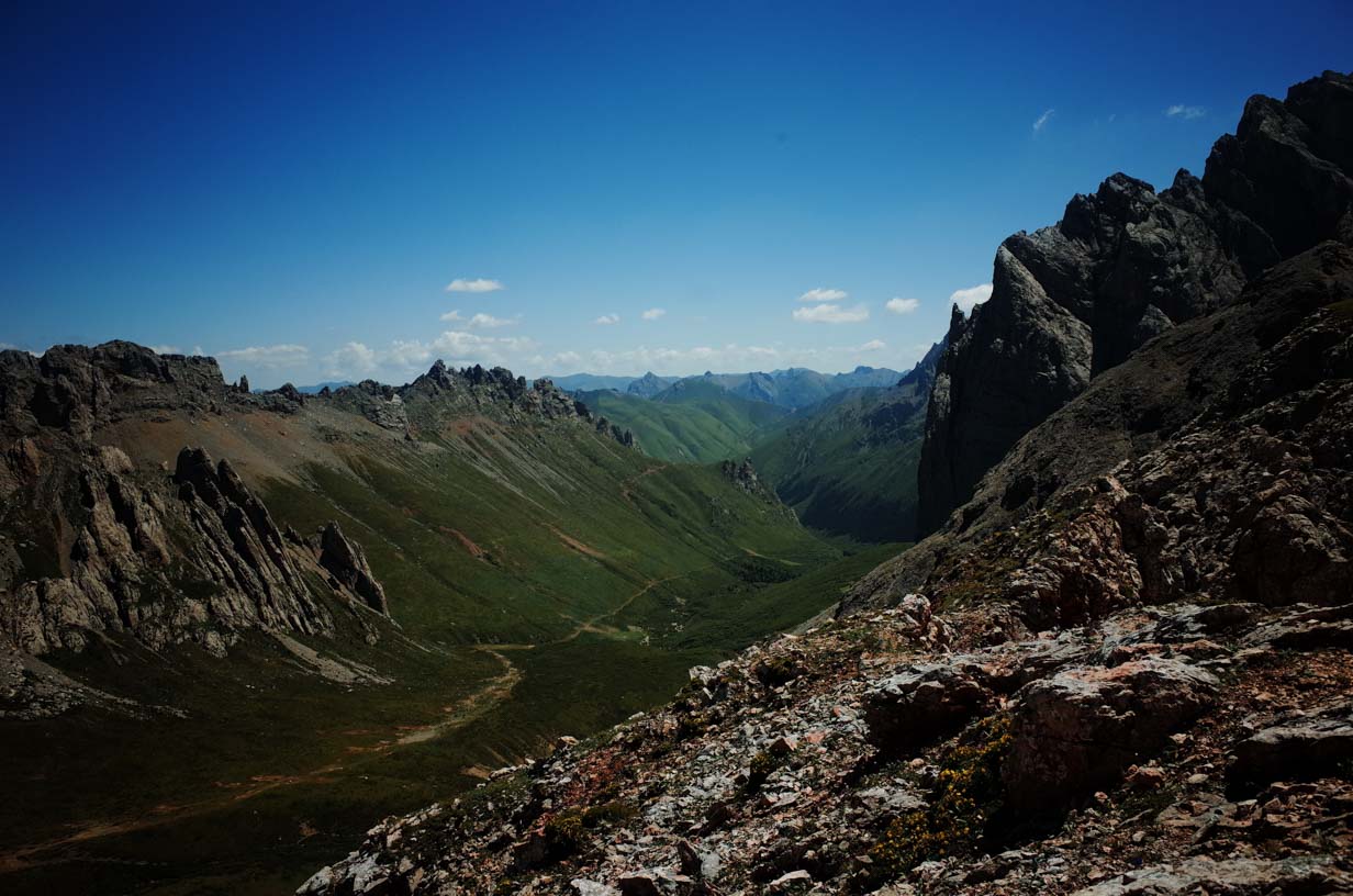
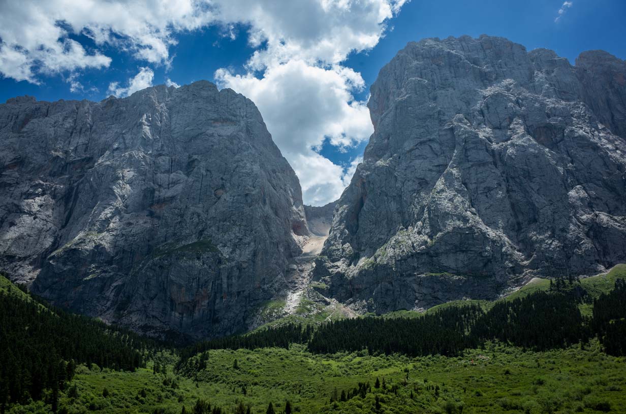
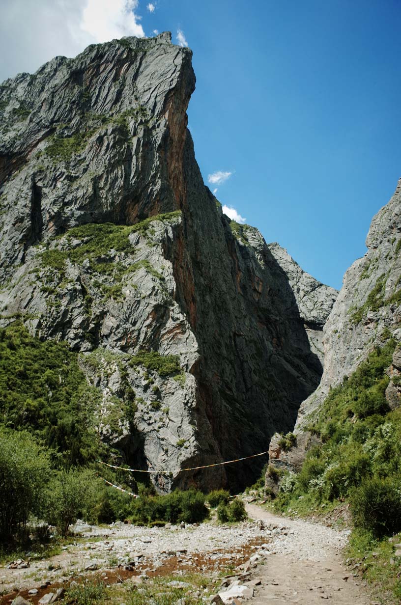
On this day, we took a different route than most trekkers. While the traditional path exits via the Zagana Scenic Area, we chose a more remote location called Jiutian Shimen, or “Heavenly Stone Gate.” This incredible formation consists of two towering stone mountains, each with nearly 1,000 meters (3,280 feet) of vertical relief. The formation resembles a giant gateway—hence the name, which comes from classical Chinese. “九天Jiutian” refers to the highest heavens, as in the famous ancient line “疑是银河落九天”, which describes a towering waterfall of great altitude.
We covered 16 kilometers (9.94 miles) this day, crossing two mountain passes, with a maximum elevation of 4,162 meters (13,652 feet) and total ascent of 680 meters (2,231 feet). The trek took about 7 hours.
The pass leading to Jiutian Shimen is very steep and easy to misnavigate. Without a GPS track, it would be difficult to stay on the correct route. After crossing the pass, we entered another valley. The descent was steep and slippery, adding to the challenge. This trail was pioneered by hikers in recent years; in the past, herders did not use this route.
Once over the pass, we faced a long descent. The elevation dropped rapidly, as did the temperature, until we reached about 3,300 meters (10,827 feet). This exit point is still far from the nearest town, so it’s crucial to arrange vehicle pickup in advance. A satellite phone is strongly recommended, as there’s no other way to let your driver know when you’ll finish the trek.
The drive from the trail’s endpoint to Min County takes about 4 hours, which allows enough time to catch an evening train (after 7 PM) back to Lanzhou
Summary:
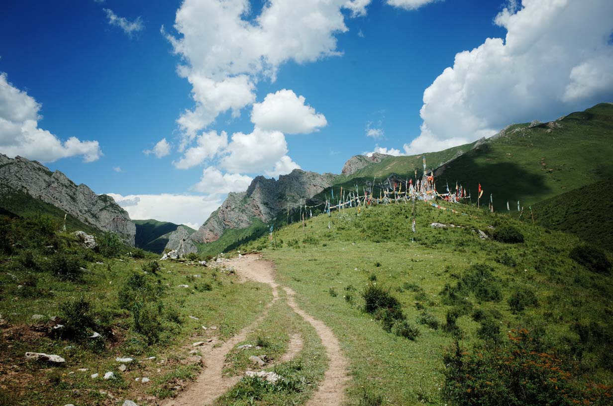
Zagana is an ideal trekking route for hikers looking to level up their skills. It’s located at high altitude—but not excessively high—and the trail itself is relatively easy. The area is rich in vegetation and water sources, and you’ll frequently encounter local herders, which helps keep risk levels low. If your goal is to eventually explore remote high-altitude wilderness routes, this is a great place to start. It also works well as a physical training route.
Another advantage is that several adventure travel companies can provide support services for international visitors. If you’re interested in trying this route, feel free to email us for more information.


Food is just as important as gear. Flour is a lightweight and versatile ingredient that can make delicious meals on the trail—but cooking with it requires practice at home beforehand. Freeze-dried meat retains only about 15% of the weight of fresh meat. When rehydrated and combined with flour, then pan-fried, it can closely mimic the taste and texture of fresh meat.

Gear Tested
Lanshan 1/2 ProLite
Our ultralight version of the Lanshan Pro, made with 10D SilNylon, weighs just 585 g (1.29 lbs) for the 1-person version and 760 g (1.68 lbs) for the 2-person version. Removing the condensation baffle—similar to the previous generation—can save another 20–30 g (0.7–1.1 oz), but we don’t recommend doing that. We’ve found that the condensation baffle helps protect your sleeping bag from moisture.
While 10D SilNylon tends to sag more than 20D in high humidity, experienced hikers will likely find this acceptable. Personally, I’d gladly take two minutes to adjust a guyline if it means saving 100 g (3.5 oz). The tear strength of 10D SilNylon is comparable to 20D SilPoly, so durability is not a concern.
We are also planning to offer a 20D SilPoly version of the Lanshan Pro. Since 10D SilNylon and 20D SilPoly are both slightly less tear-resistant than 20D SilNylon, we redesigned the tent’s structure to eliminate horizontal seams that weaken the fabric. This enhances overall structural integrity and also simplifies seam sealing.

TutorPack (Temporary name)
Over the past few years, I’ve received inquiries from hikers around the world asking when the Tutor Pack would return. We’ve now decided to redesign and reintroduce this backpack.
The new TutorPack features a more comfortable hipbelt, a breathable back panel, and a removable carbon fiber frame. The total weight is just 630 g (1.39 lbs). It carries loads up to 12 kg (26.5 lbs) comfortably. On this trip, my base weight was 8 kg (17.6 lbs) and 9 kg (19.8 lbs) with water—it felt great.
From the start, we designed this pack with both lightweight performance and affordability in mind. Its price will be comparable to our popular Qidian Pro model.

ICEFLAME CORELITE Sleeping Bag
I tested a prototype sleeping bag from ICEFLAME, a design I personally created to match my exact needs. It’s the best sleeping bag I’ve ever used, and I believe experienced backpackers will love it too. I truly hope it makes it into production.
The shell weighs only 145 g (5.1 oz)—at that weight, even down quilts become less appealing. The full box-baffle design allows for 300 g (10.6 oz) of 900 FP down, which kept me comfortably warm at 0°C (32°F). During this trek, we camped at 4,000 m (13,123 ft), and the nighttime low was around 2–3°C (35.6–37.4°F)—I never felt cold.
The shell fabric is one of the lightest and most breathable in the world, weighing just 17 g/m² (0.5 oz/yd²). Despite the extreme humidity in Zagana, the down stayed completely dry, which I attribute to the shell’s excellent breathability. This will be my go-to bag for the next two years of trekking expeditions.
LIGHT-TOUR R4.2 Inflatable Sleeping Pad
I’ve long been a fan of Therm-a-Rest, but this time I decided to try something new. LightTour’s pad comes with ASTM insulation testing, so R-value performance wasn’t in doubt—what I really wanted to test was comfort.
Compared to the Therm-a-Rest NeoAir, the LightTour pad is slightly heavier at 530 g (1.17 lbs), but the comfort level is noticeably better. If your route isn’t too extreme and sleep quality is a priority, this pad is definitely worth considering.
