

Adventure Report: The Secret Realm of Gyirong
Team member: Liu Yu, Liang Xueyan, Mingyue, Longkui, Chengjin, Shanren, 2+2, Xiaoyao, Suqiao, Junfeng, Shouhu, Lijiangrong
Time: October 2025
Length: 60km 7 days
Location: Himalayas
Difficulty: 7.5/10
“It’s all snow-capped mountains, just like the EBC,” Daxiang said, holding his beer glass. “The only problem is the pass—it’s hard to cross. Step down, and the snow comes up to thighs.”
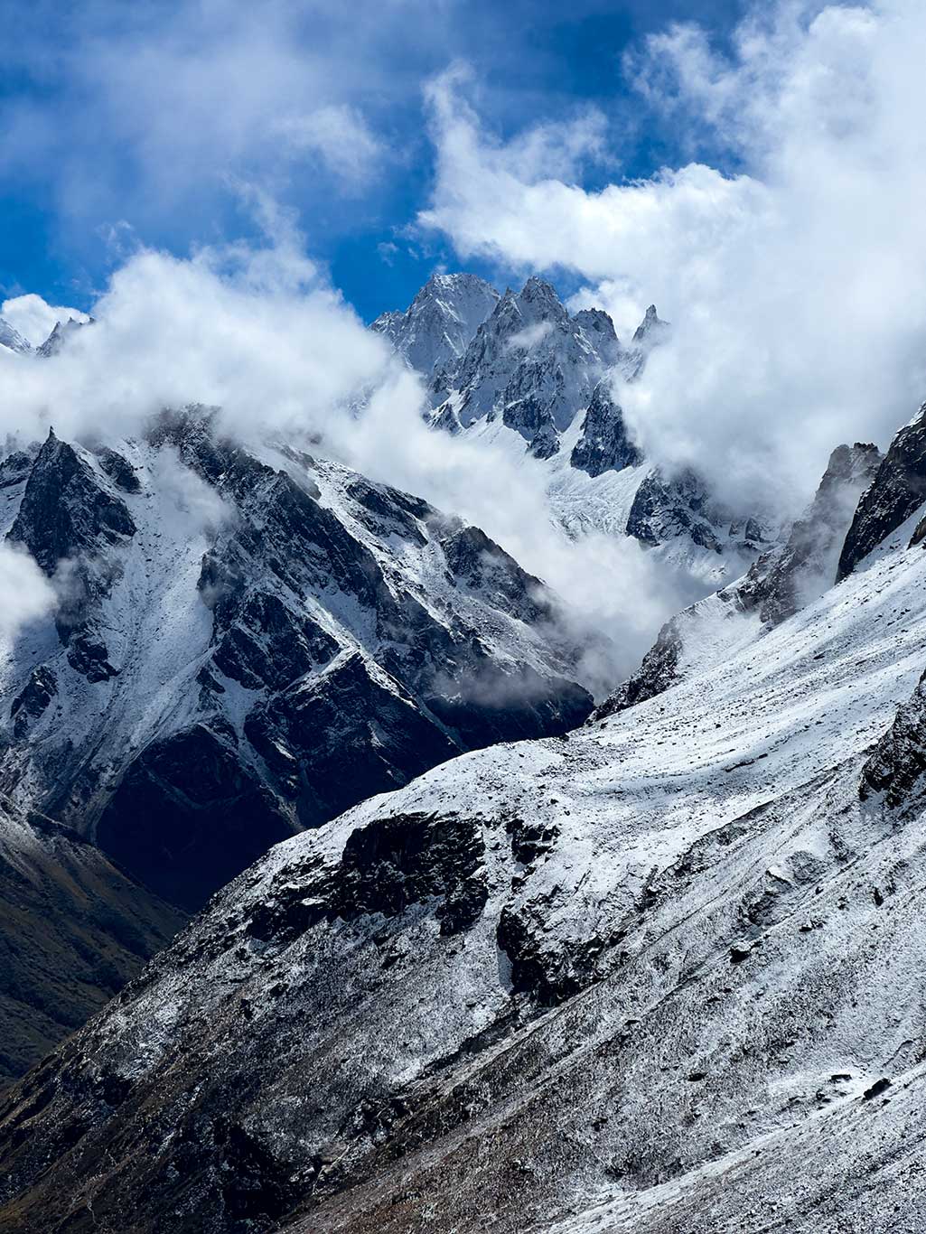
His words immediately drew me in. You can imagine it: a valley flanked by 6,000–7,000-meter snow-capped mountains, towering into the clouds, breathtaking scenery everywhere. And then a pass, like a snow-capped peak, waiting to be challenged. Any adventurer would be captivated.
“What’s the route called?” I asked.
“Actually, Dong Fei just drew a circle on the map,” Daxiang replied.
In 2024, my friend Daxiang (trail name) and Yan Dongfei’s team explored an unnamed valley on the southern slopes of the Himalayas. Since it is near Gyirong(Jilong) Valley, they named it the Secret Realm of Gyirong.
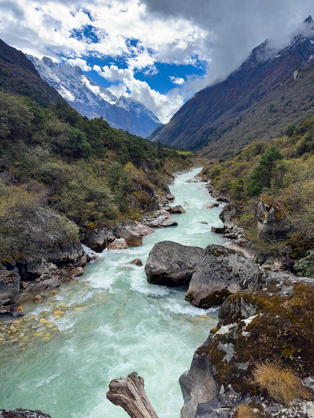
From satellite maps, most of this valley is at relatively low elevation with rich vegetation. In autumn, the colorful foliage would add to the already magnificent snow-capped mountains. The route is on the southern slopes of the Himalayas, directly affected by warm, moist air from the northward Indian Ocean currents, resulting in abundant precipitation. This means snow above the snowline will be thick, and we must be prepared with snowshoes to pass efficiently.
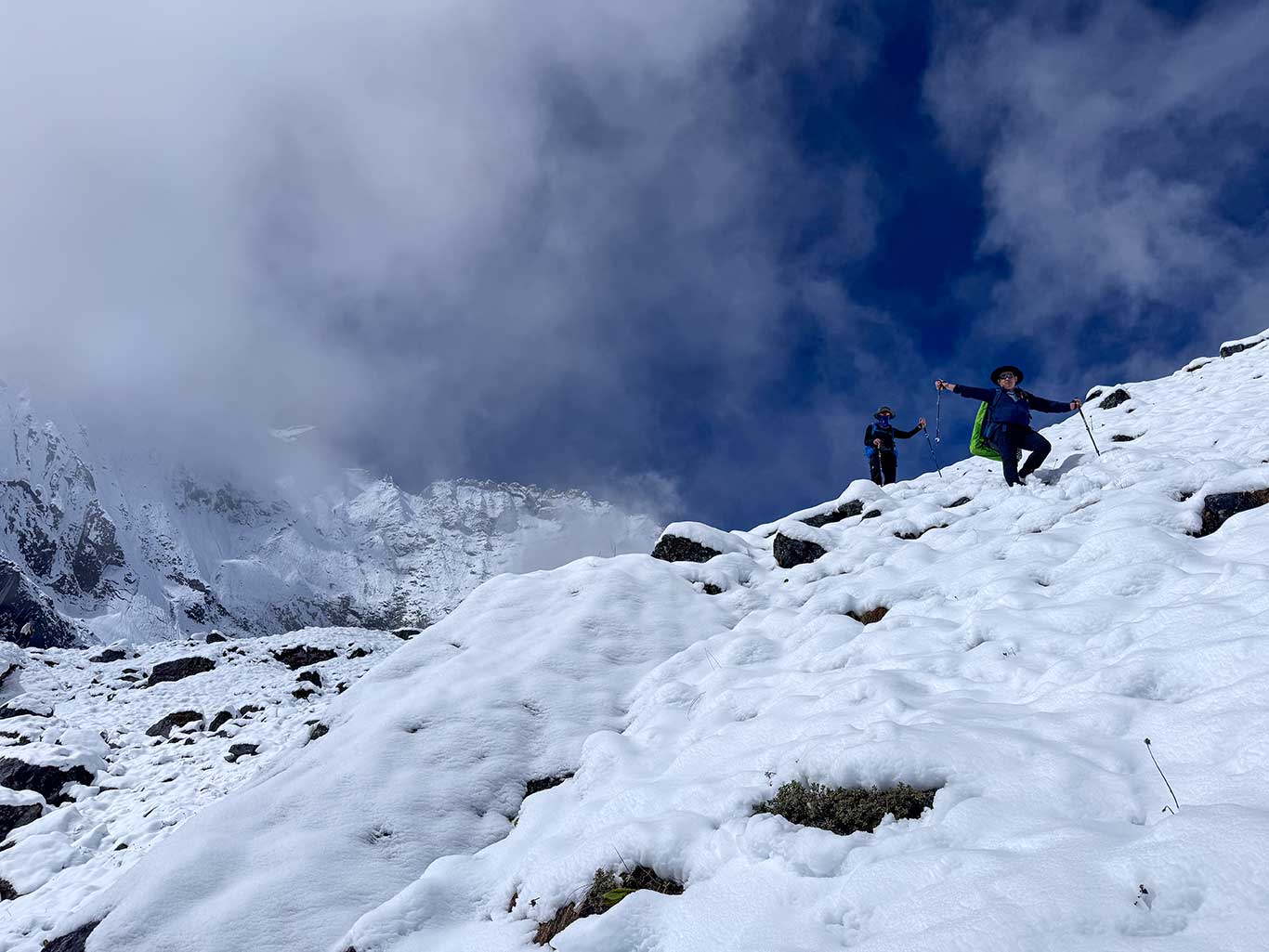
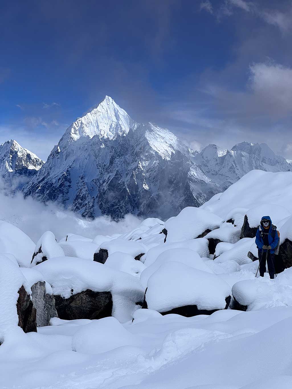
The route starts at Zhuo Village on the west side of the Donglin Zangbu Valley. Heading north, the valley splits into a group of mountains at a summer pasture called Langpu. The core challenge of our expedition was figuring out how to cross this mountain cluster and link the two valleys into a loop. The mountains separating the valleys exceed 5,000 meters, appearing nearly impassable on the map, but Yan Dongfei’s team found a pass at 5,100 m. In fact, this pass had been traversed before. Although there was no trail and everything was covered in snow and loose rock, a mani stone pile was found atop the glacier, likely left by Tibetan herders. The time of their passage could not be confirmed, as there were no signs of recent human presence, no camps, no debris.
This route shares a trait with last year’s Tianshan route: it is more akin to snow-mountain climbing than trekking. I therefore recommend that hikers carry the suggested mountaineering equipment. Snowshoes are essential; crampons are mostly unnecessary due to the deep snow. The route’s difficulty is concentrated over two days crossing the 5,100-meter pass; the remaining days are relatively easy.
Adventure Report:
How to get there:
Shigatse(Rikaze) is the closest transport hub to Gyirong Valley. You could fly closer to Dingri Airport, but flights are limited. I generally recommend flying to Peace Airport. From Shigatse, the only option is by car: private hire costs ¥2,700, while public transport is much cheaper but requires advance booking.
From Gyirong(Jilong) town to the trailhead, it’s another two hours over poor roads, requiring a local 4×4. Cost: ~¥700.
Day 1: 17 km, ascent 828 m, descent 304 m
Zhuo Village 3,400 m – Langpu 3,400 m – Baiku 3,830 m – Mantang 4,015 m
We didn’t stay in Gyirong town, instead staying at Nai Village like my friends, a famous viewing platform. Unfortunately, we had no luck seeing the snow-capped mountains. I don’t recommend staying in Nai Village: it’s not on the main route, and the next day requires backtracking to Gyirong town, losing an hour of sleep. Accommodations are also inferior to the town.
Returning from Nai Village involves a winding mountain road through the town, then east to the trailhead at Zhuo Village. Along the way, you pass Zha Village and a mountain pass over 4,000 m.
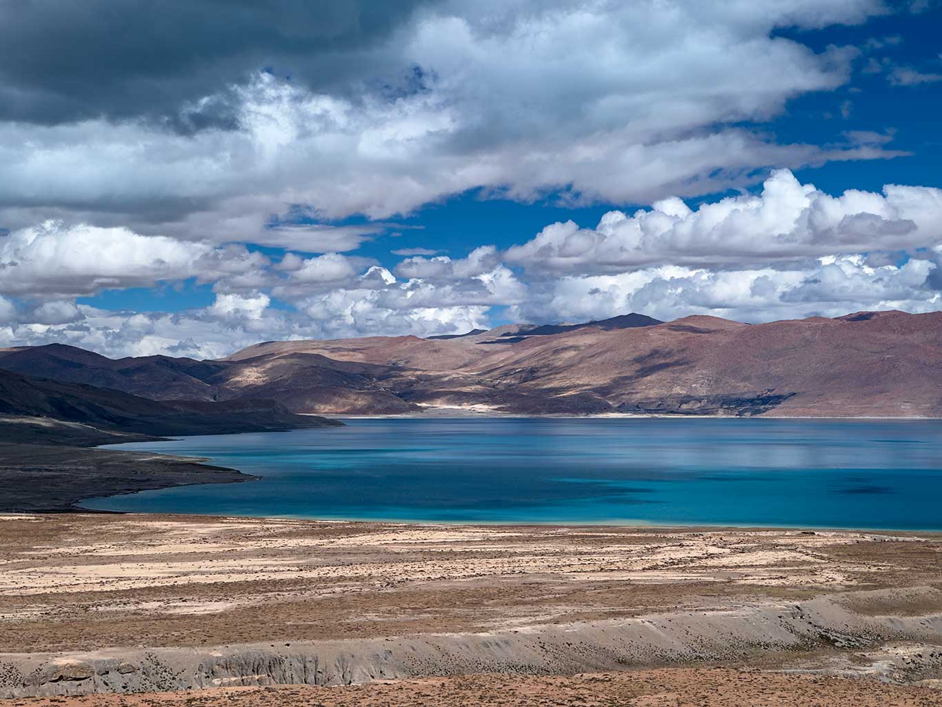
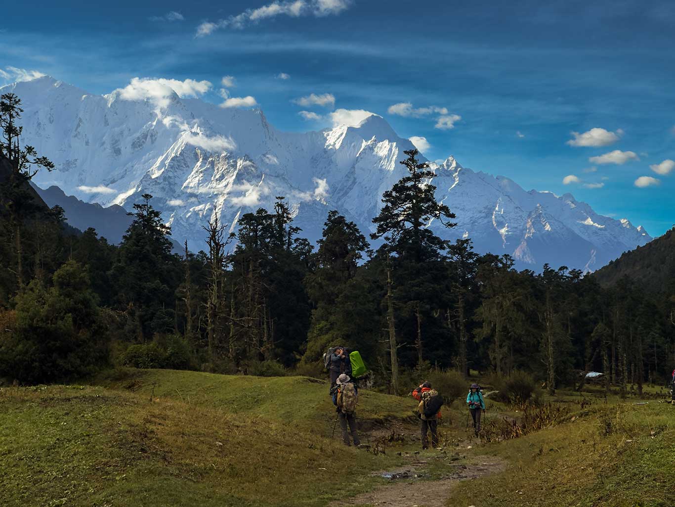
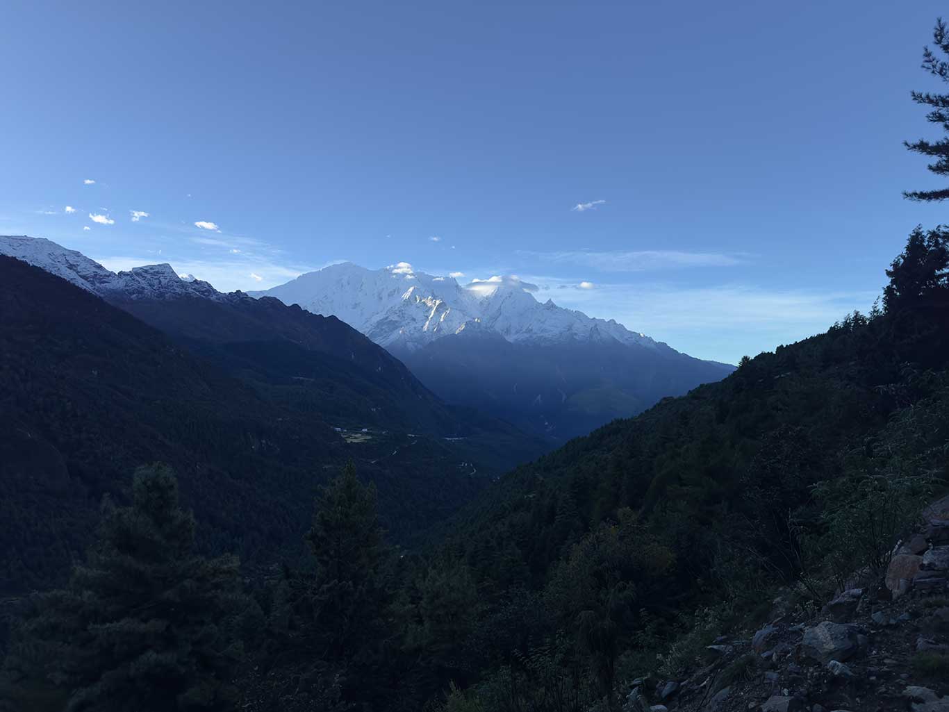
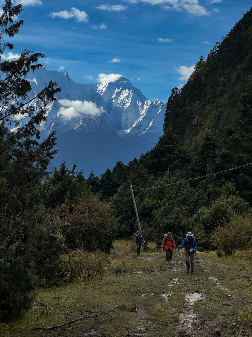
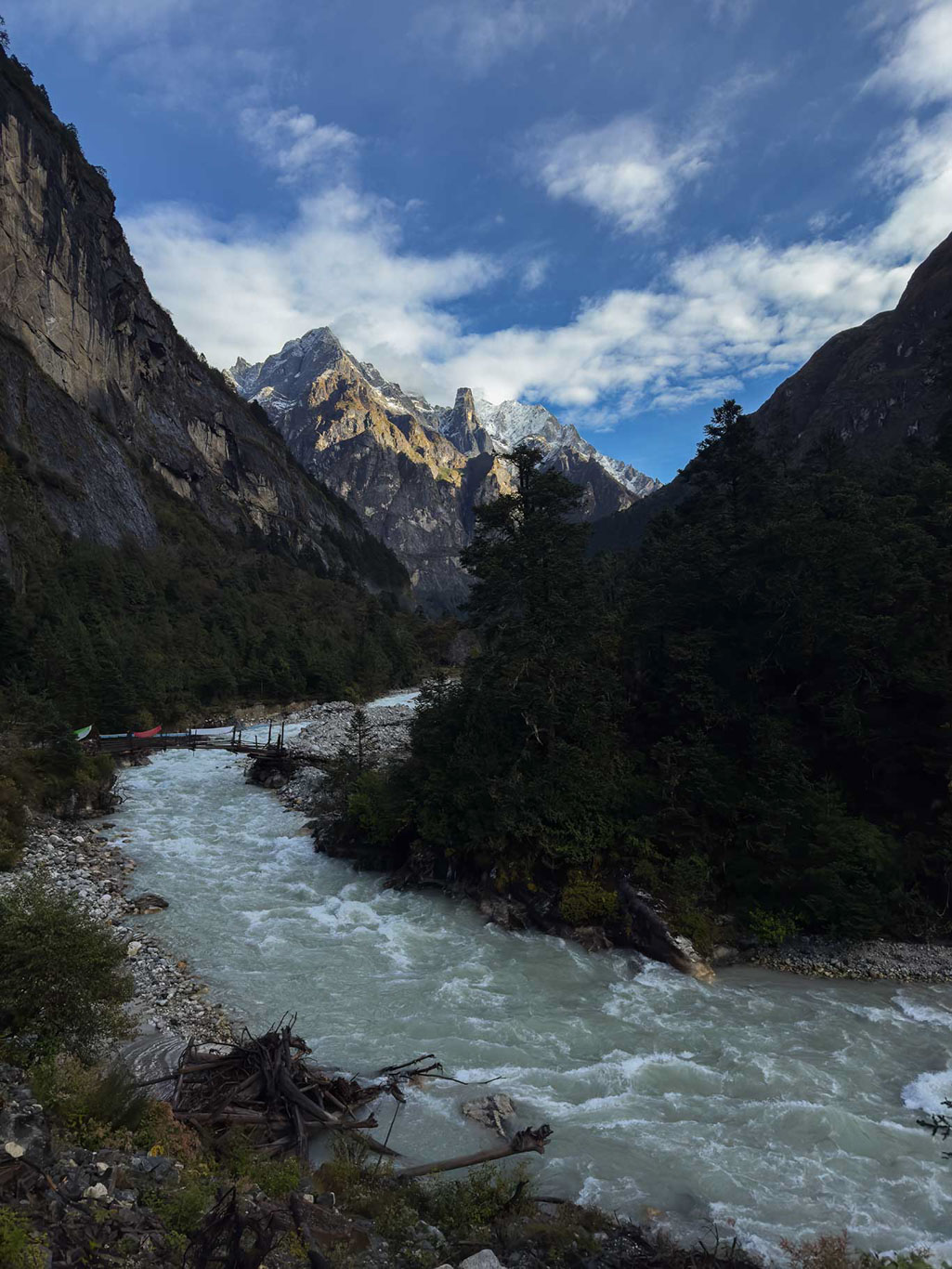
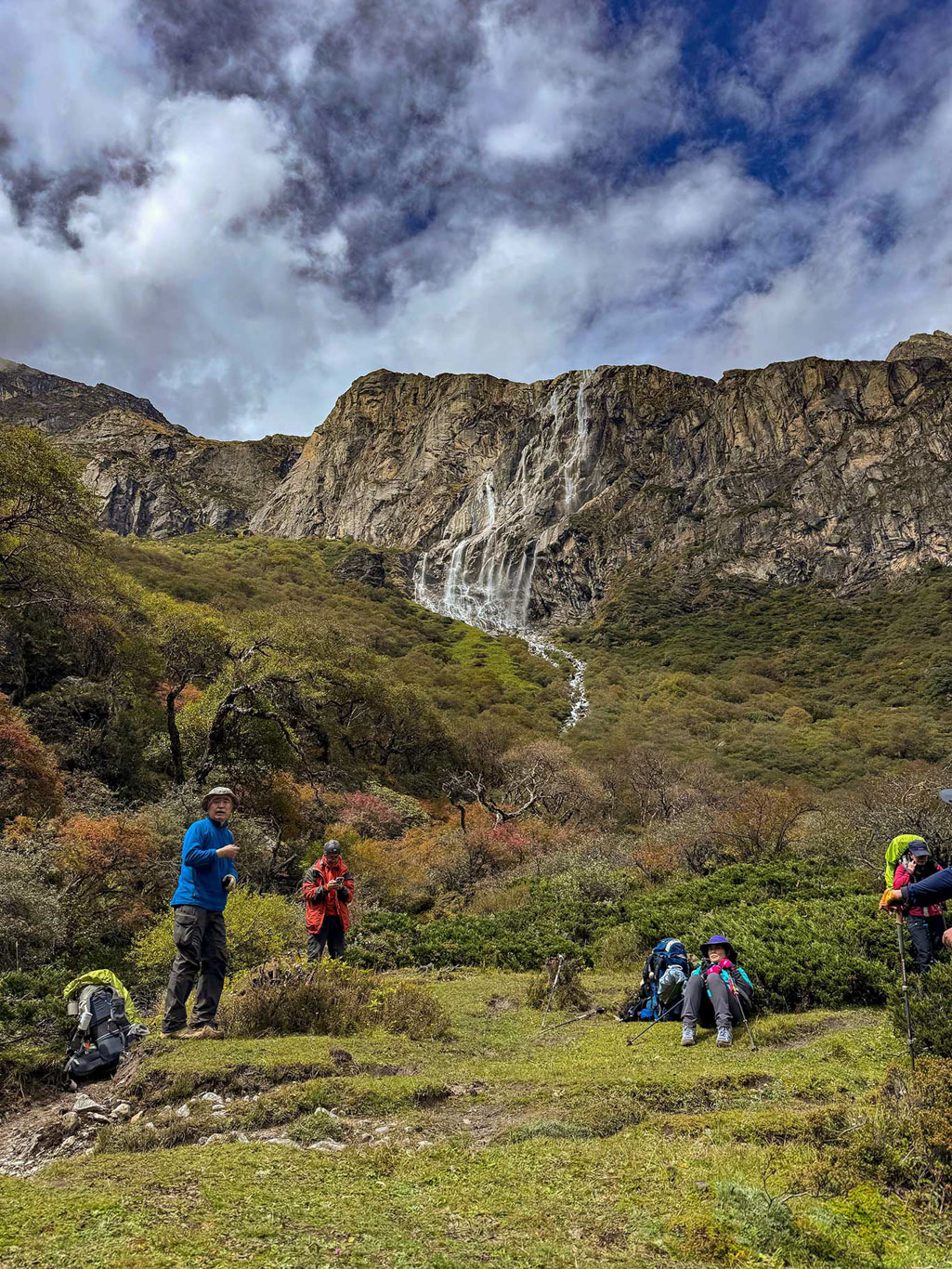
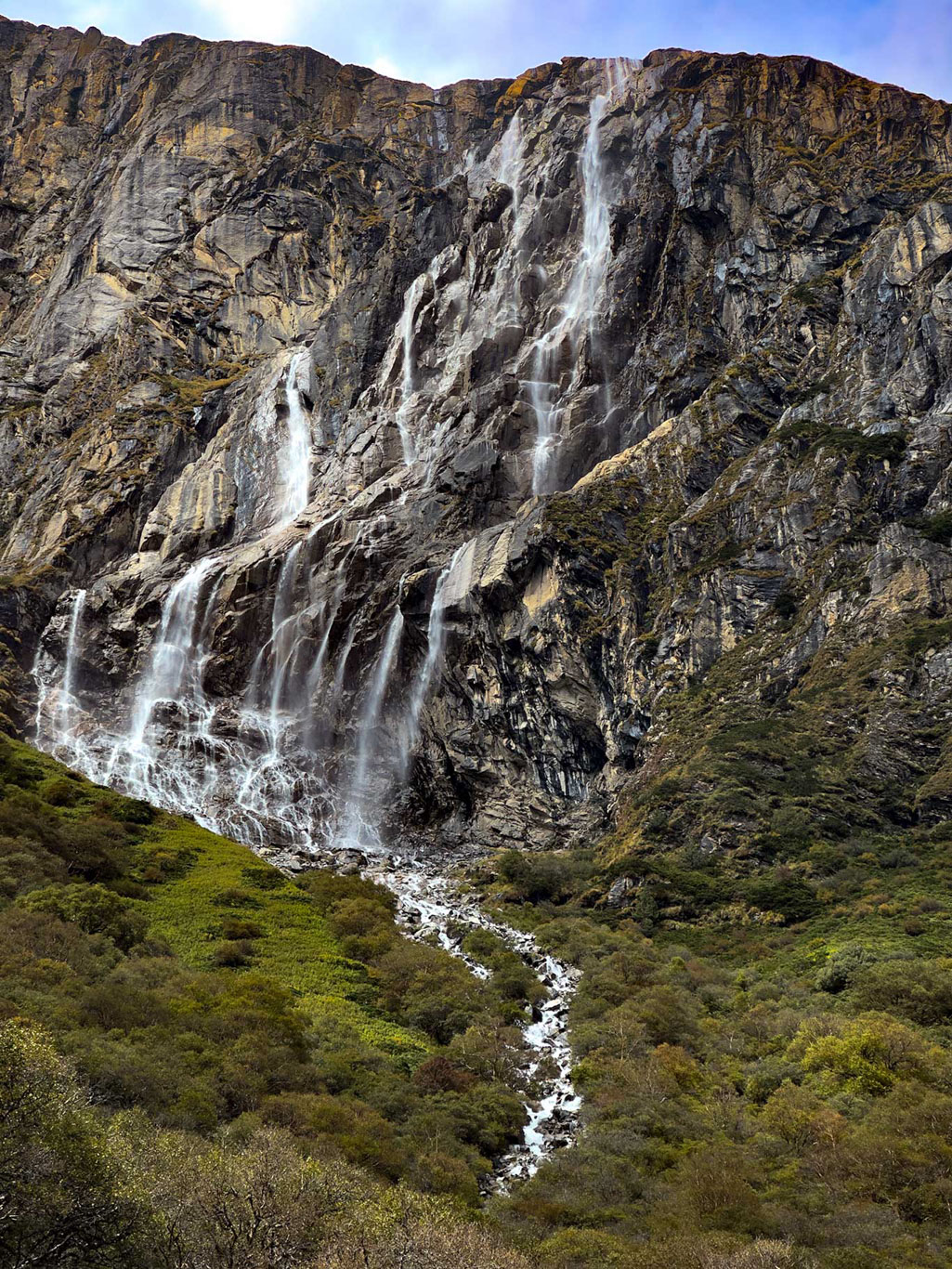
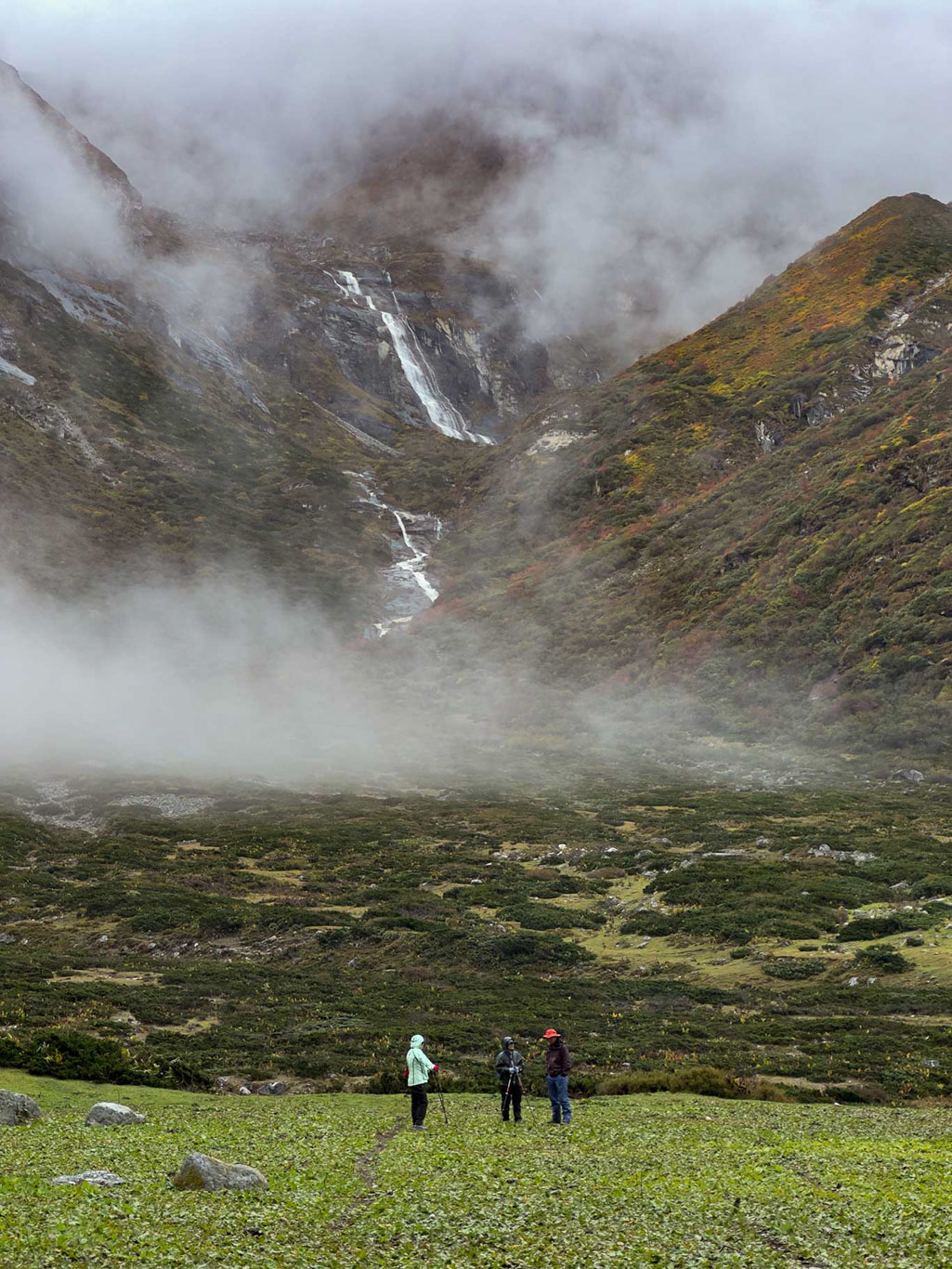
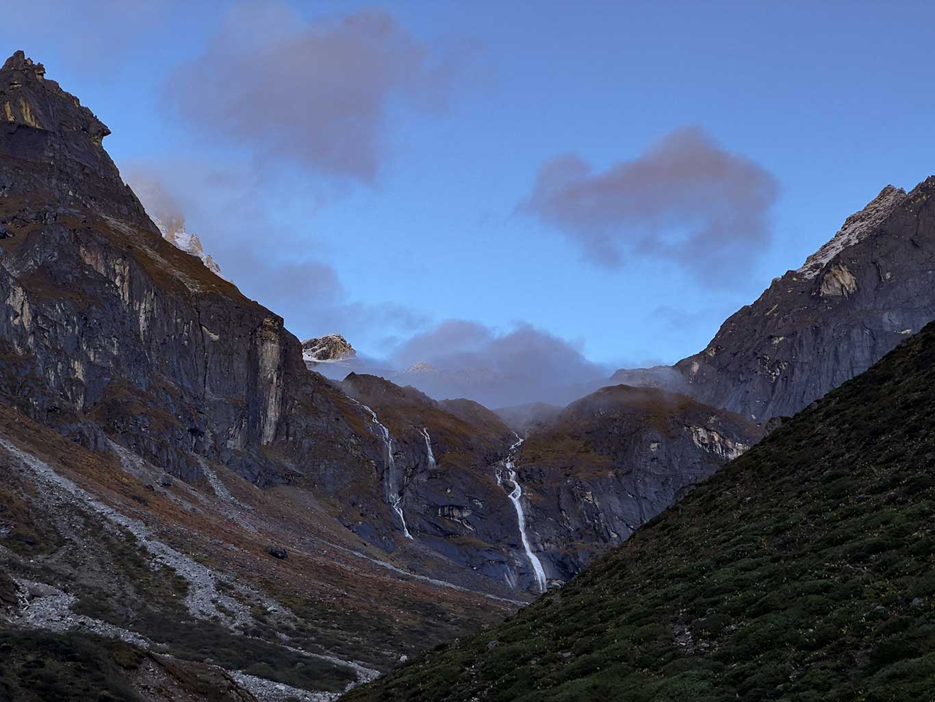
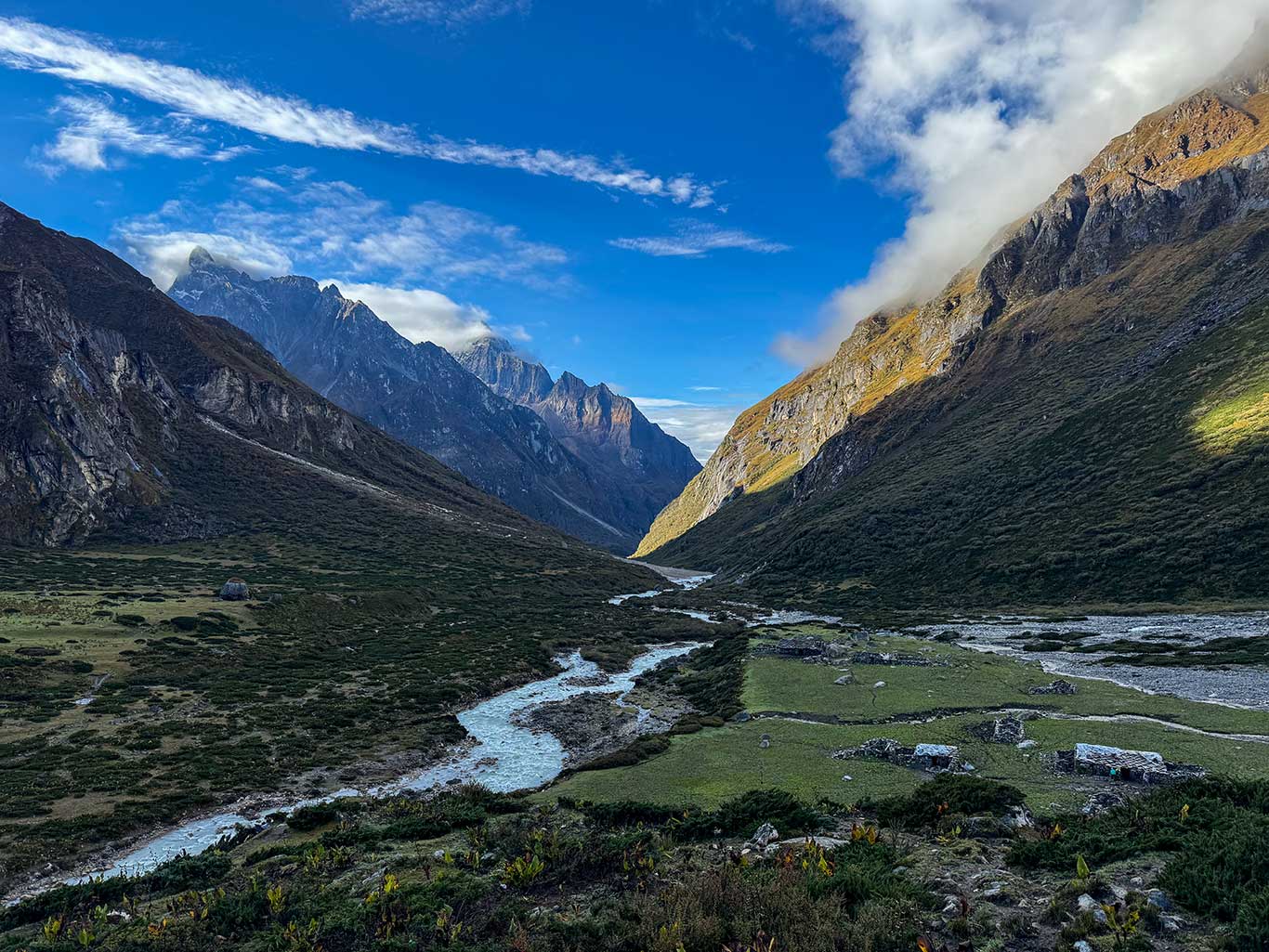
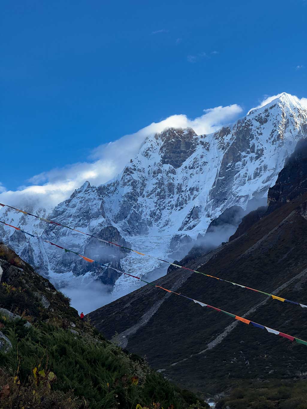
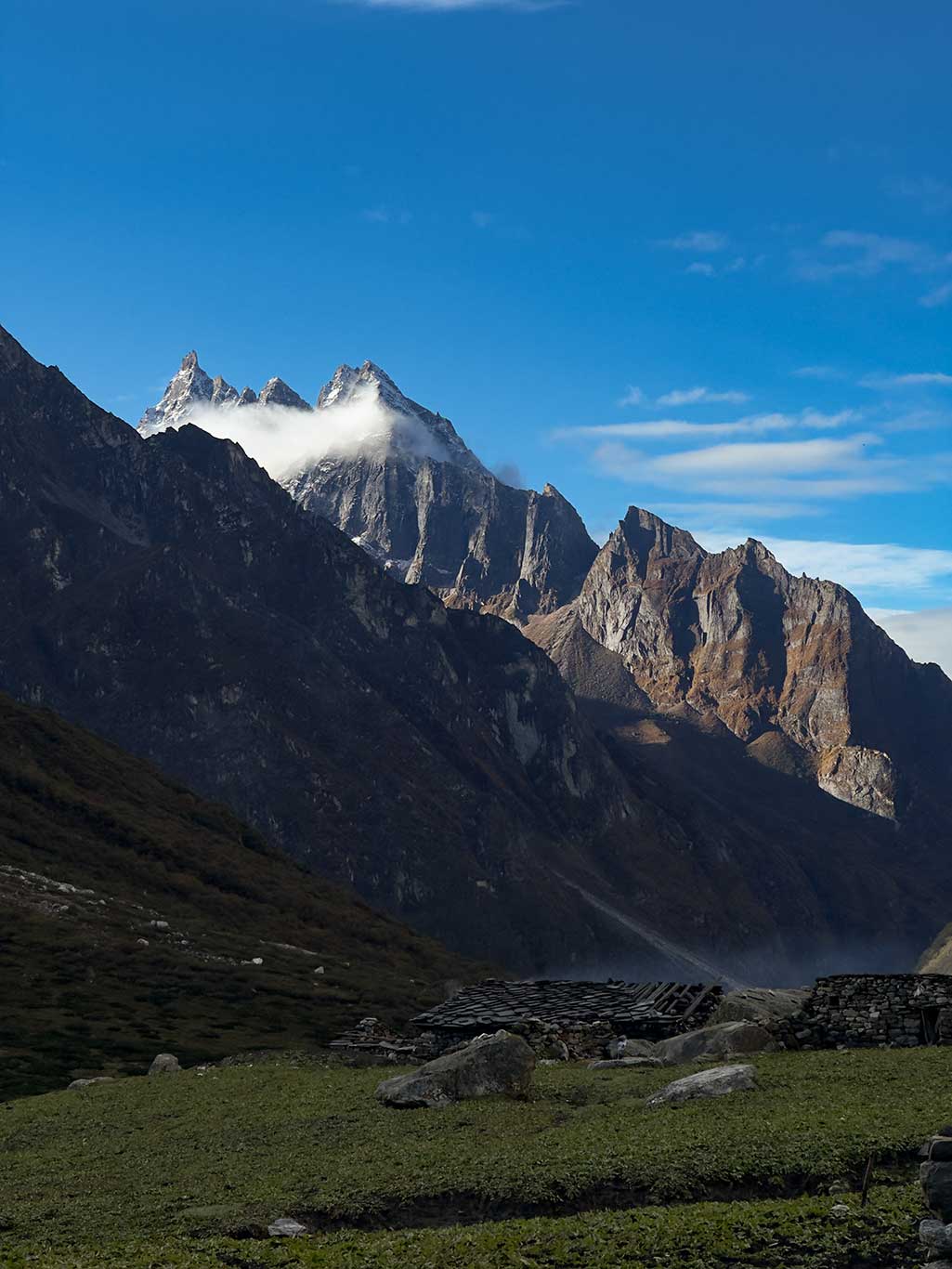
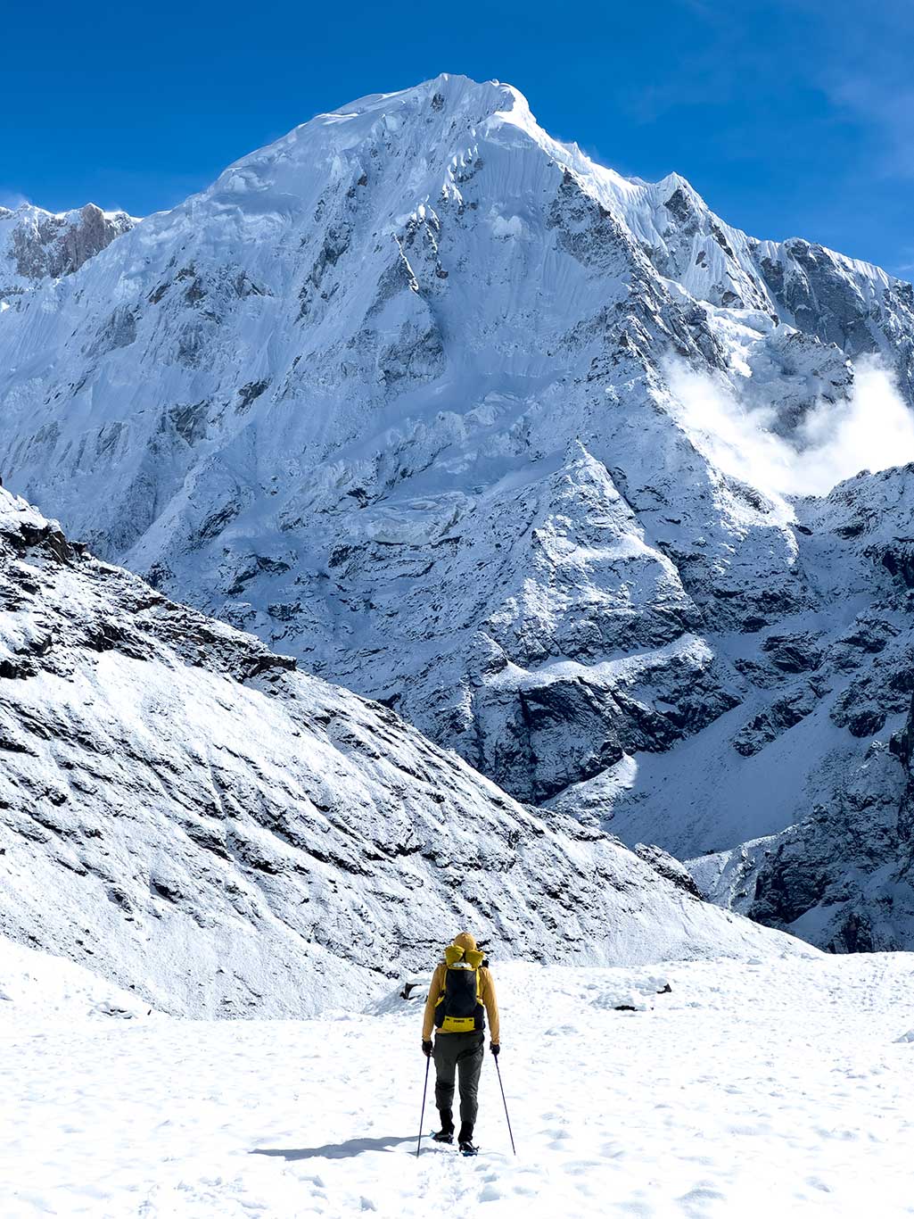
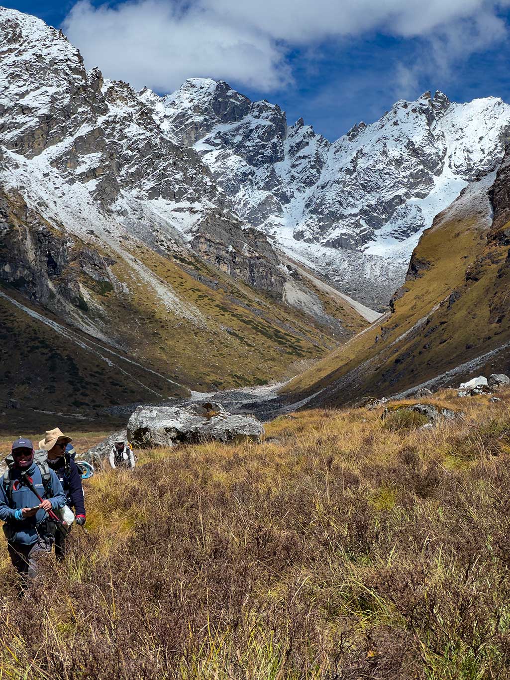
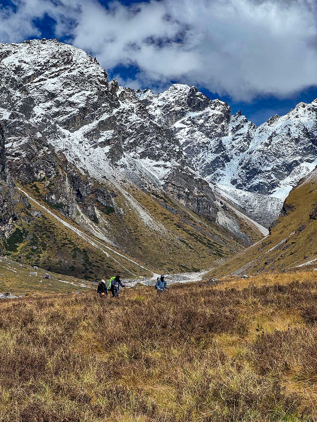
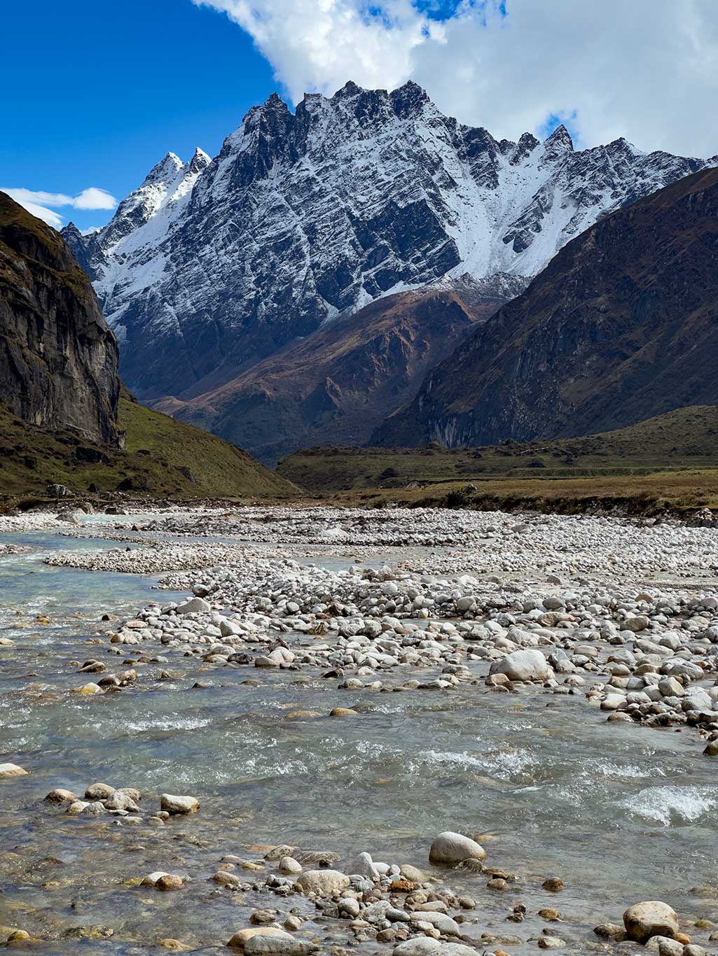
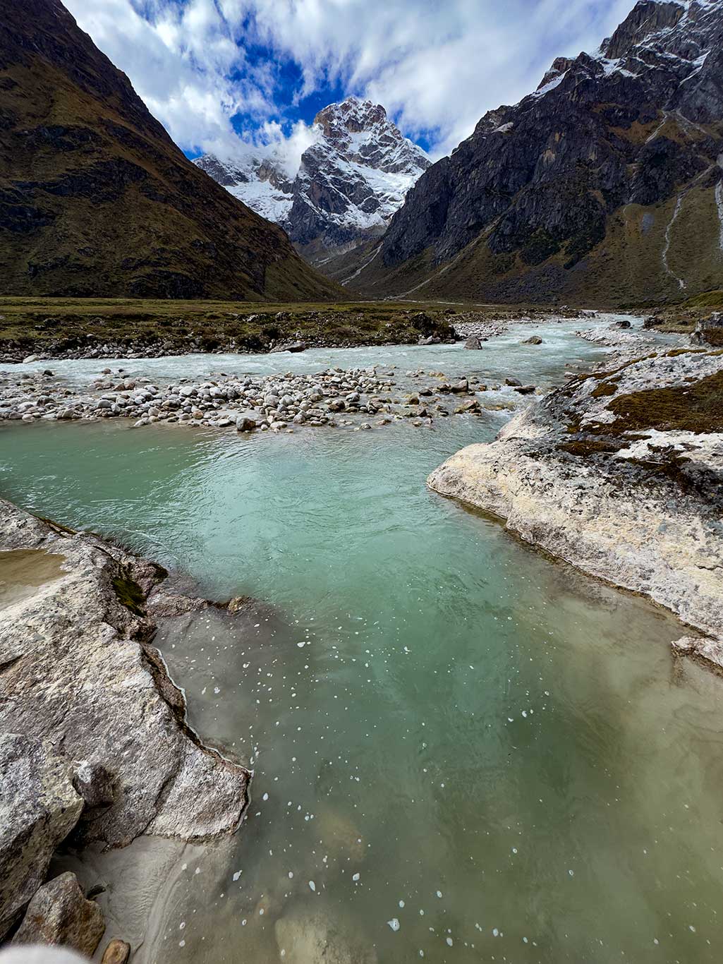
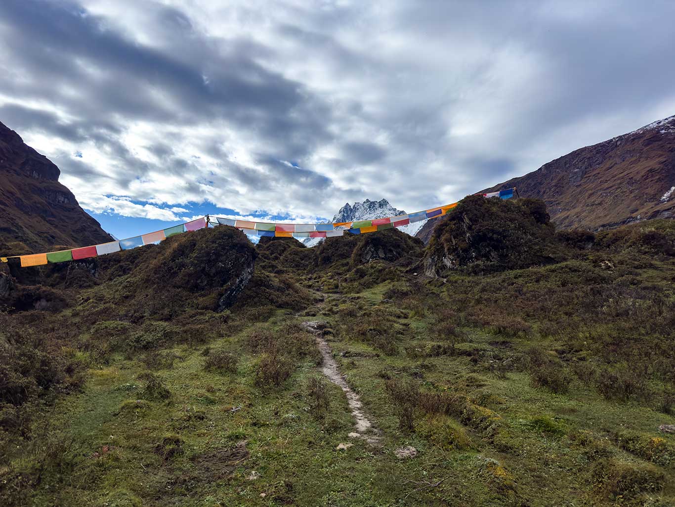
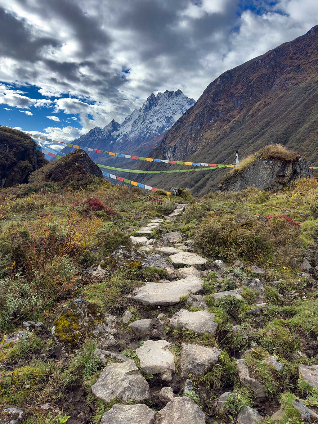
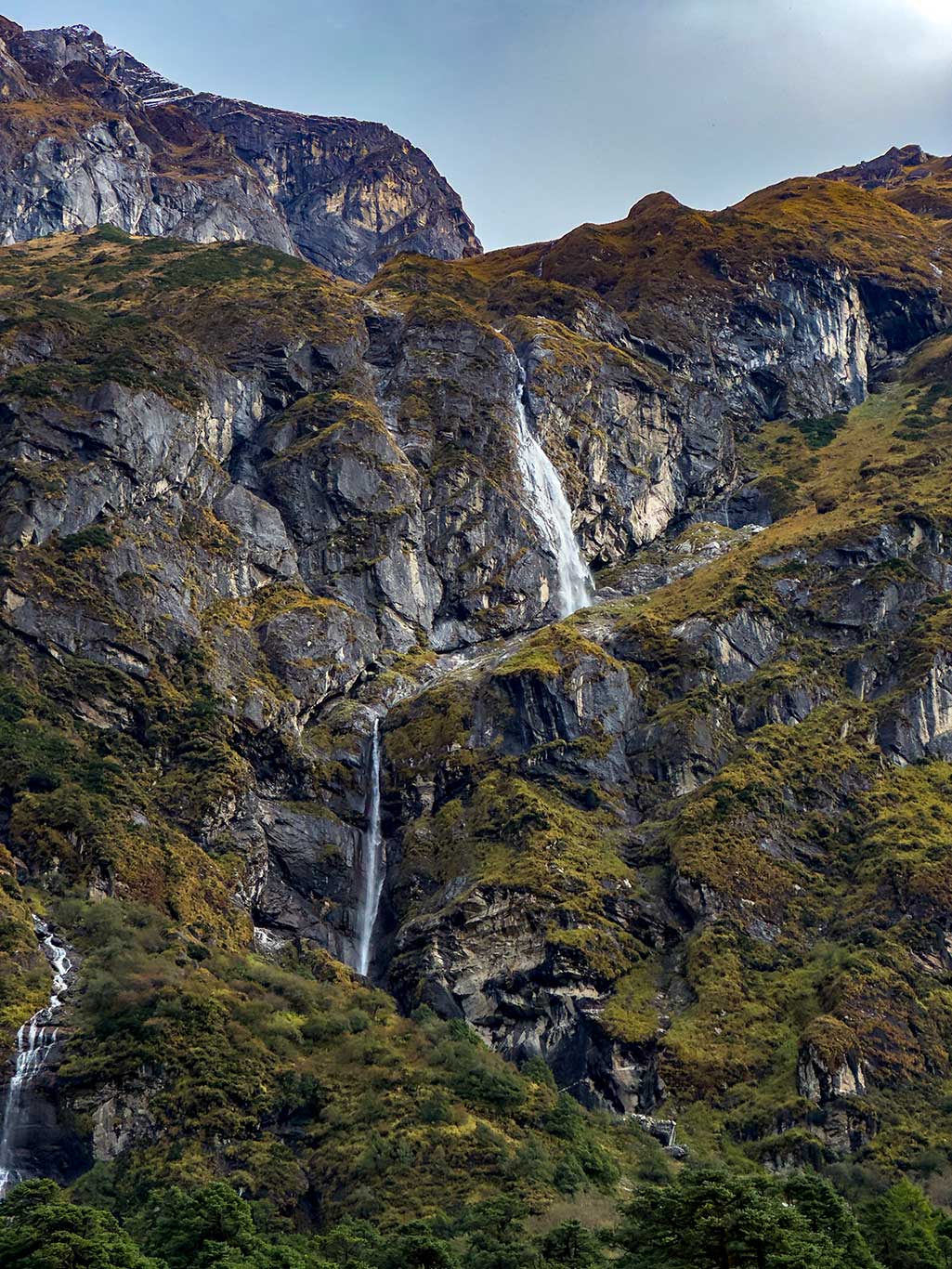
Zhuo Village, on the west side of Donglin Zangbu Valley, is small, clean, and tidy. From here, you can see a dramatic waterfall on the east valley wall and the snow-capped Langdang Lirong (7,227 m) and its satellite peaks to the south—a truly spectacular view. This village has enormous potential for tourism development.
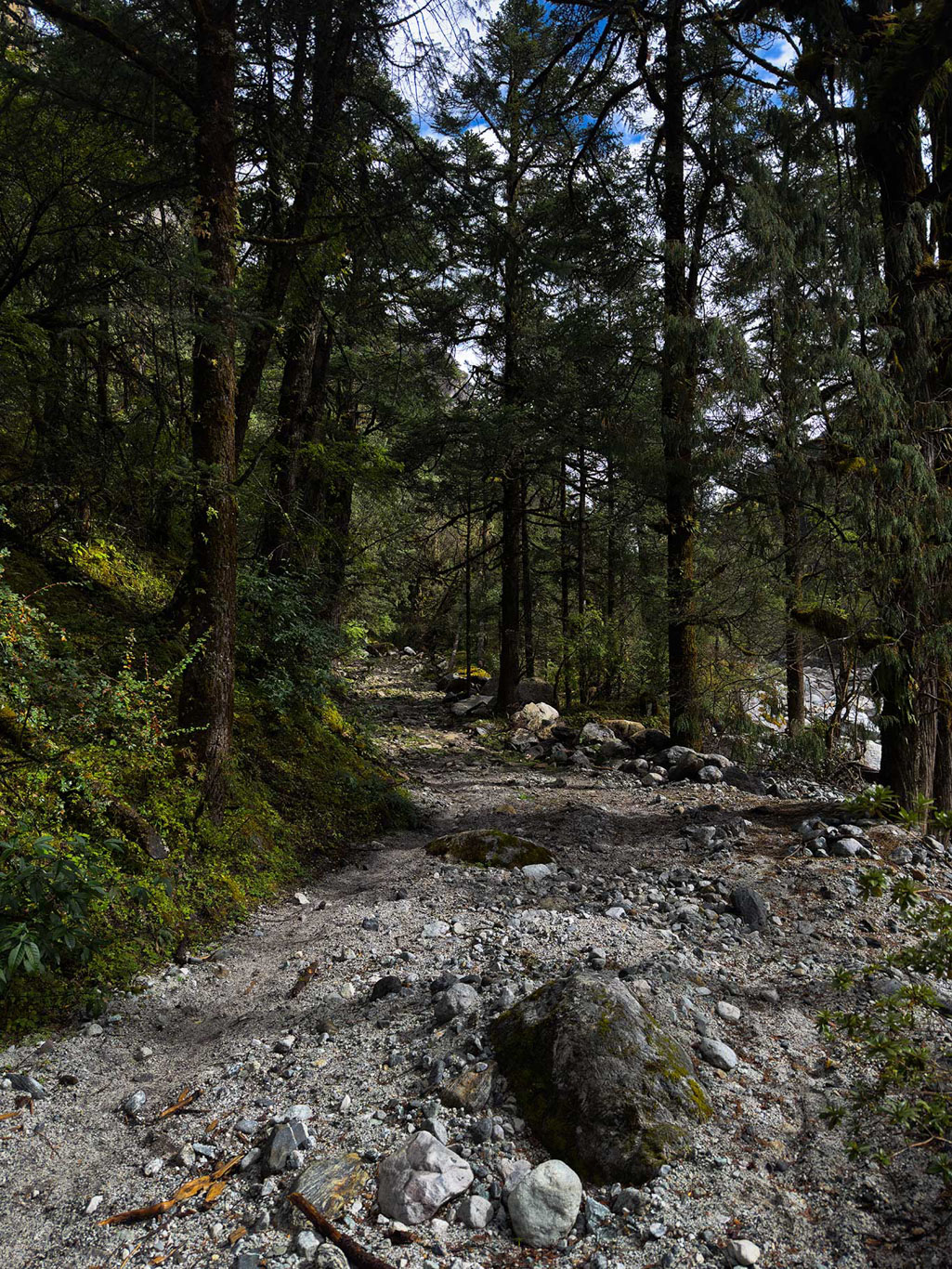
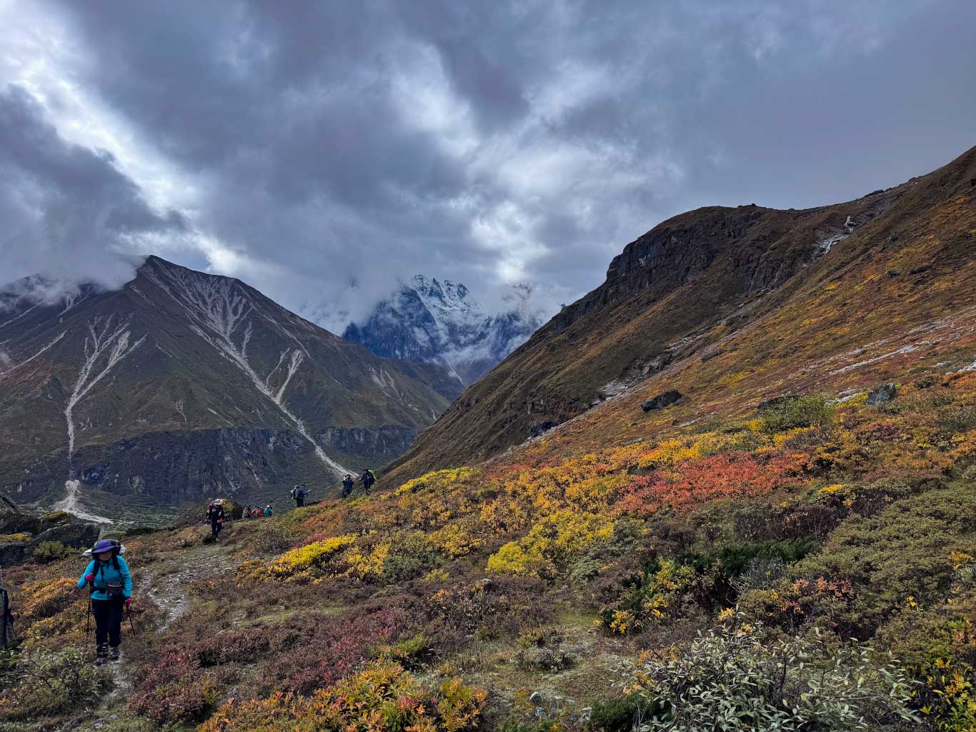
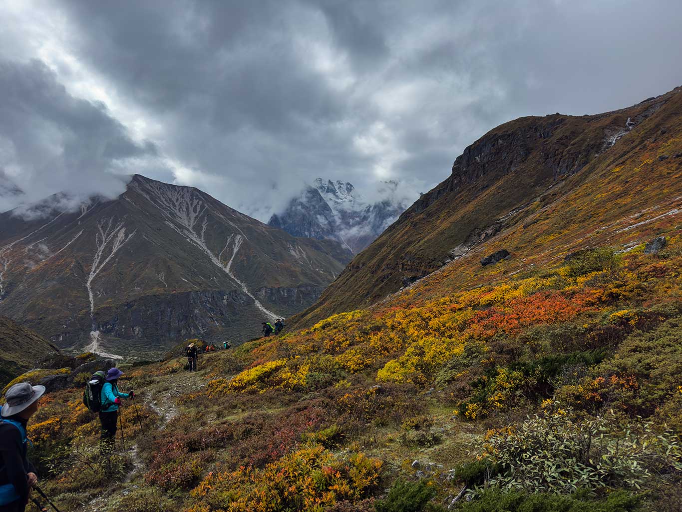
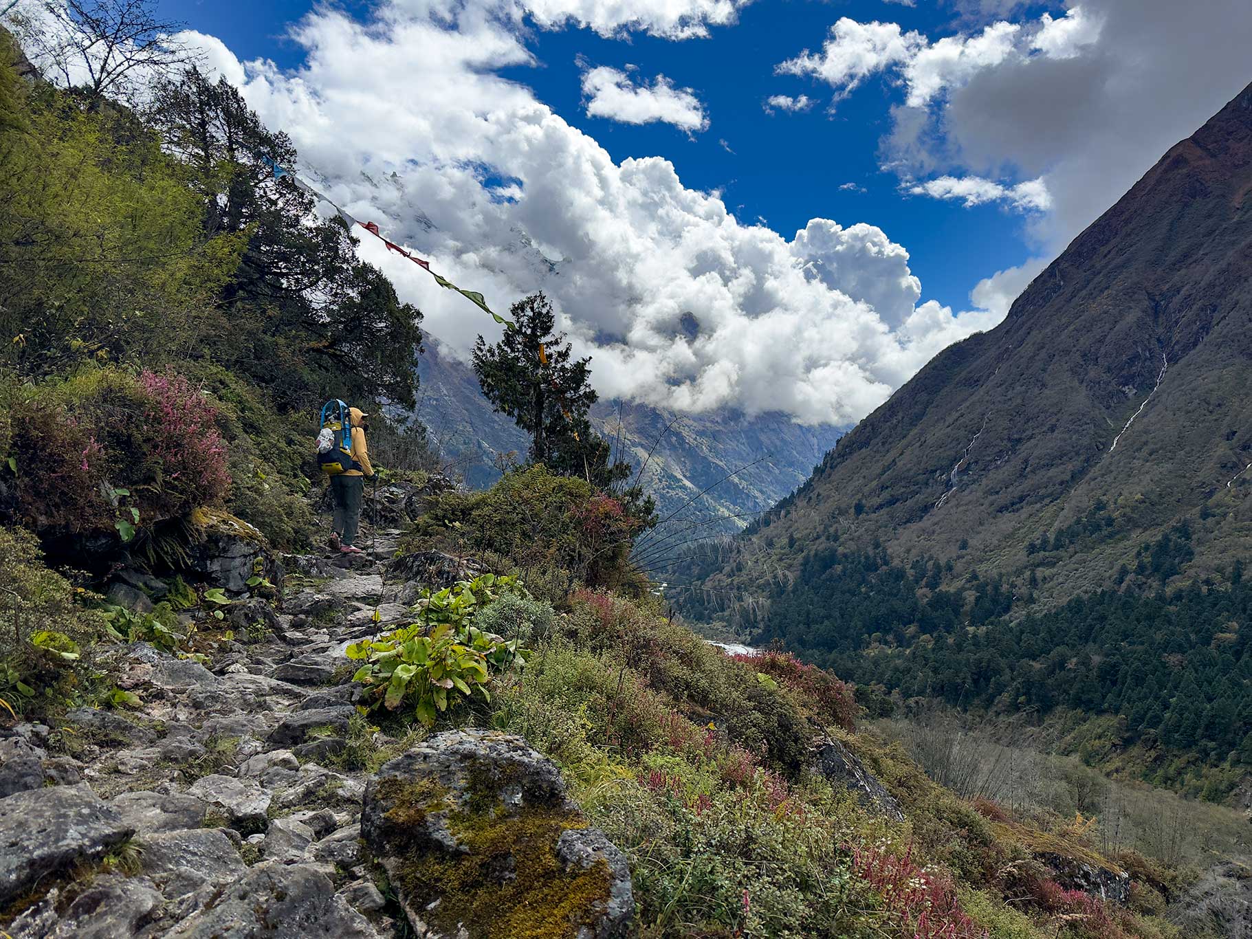
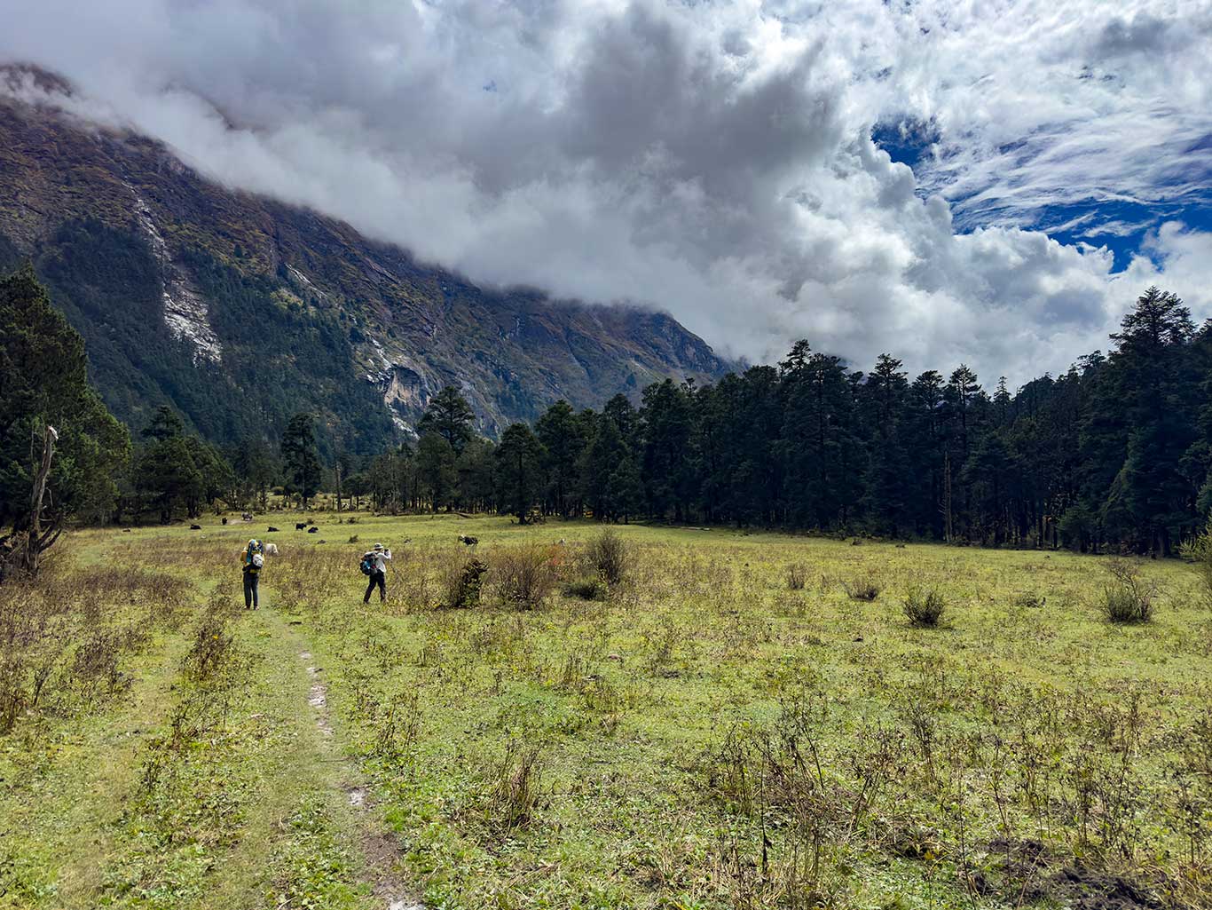
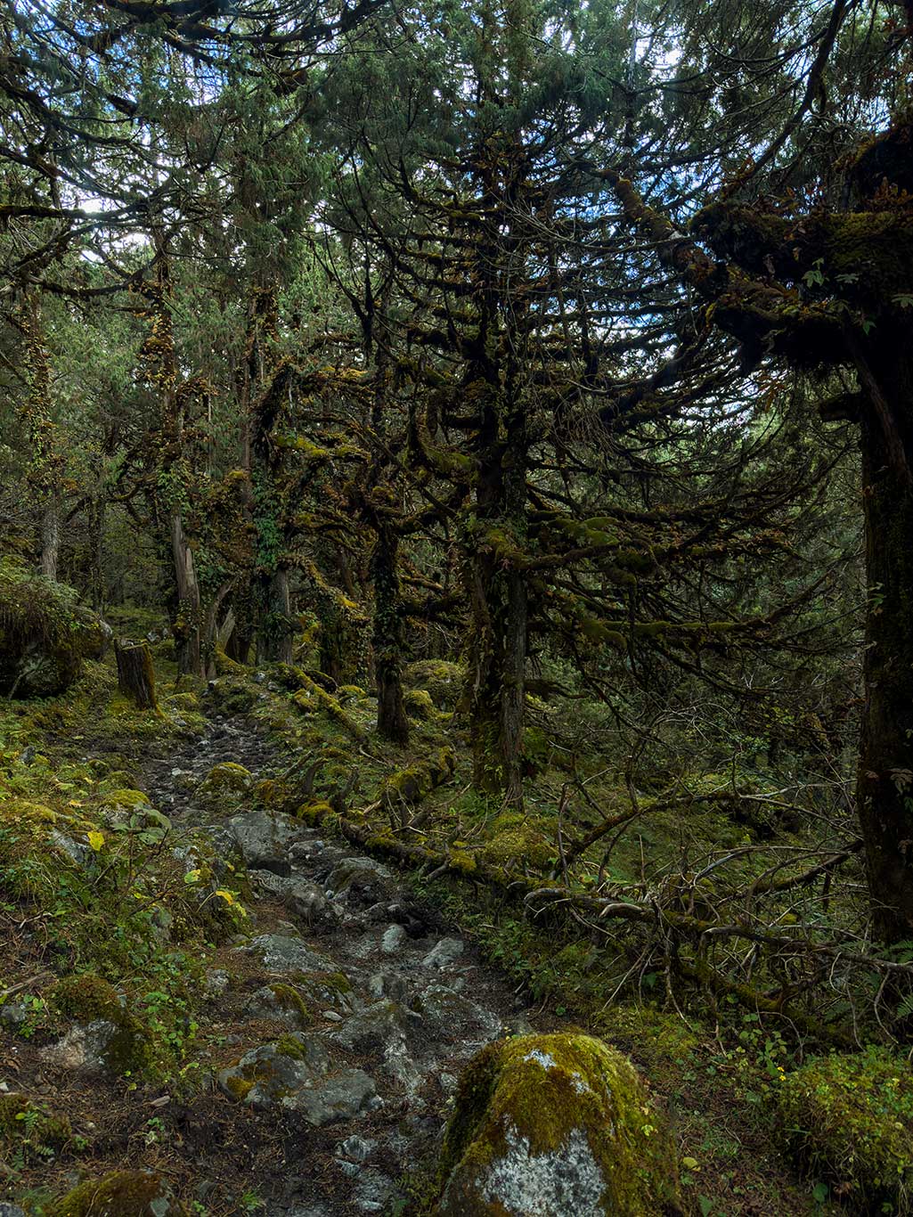
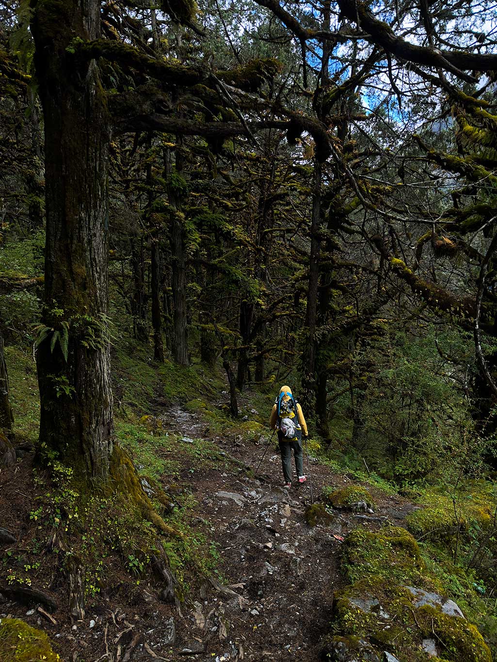
The first half-day of hiking is easy: broad farm roads suitable for motorcycles, passing two beautiful summer pastures, Lemtang and Langpu. At these lower elevations, moisture is abundant, and tall pine trees cover the valley. Flat, tidy grass lies beneath. In the forest, one can find edible red and purple boletus mushrooms, often collected by locals, though proper cooking is required to avoid poisoning.
Between Lemtang and Langpu is a wooden bridge; I recommend crossing 1–2 people at a time to avoid collapse.
Langpu is at a river confluence: left leads to Sangbudo pasture, right to Mantang. Like Daxiang’s group, we went right, though in hindsight, the left route would have been more logical.
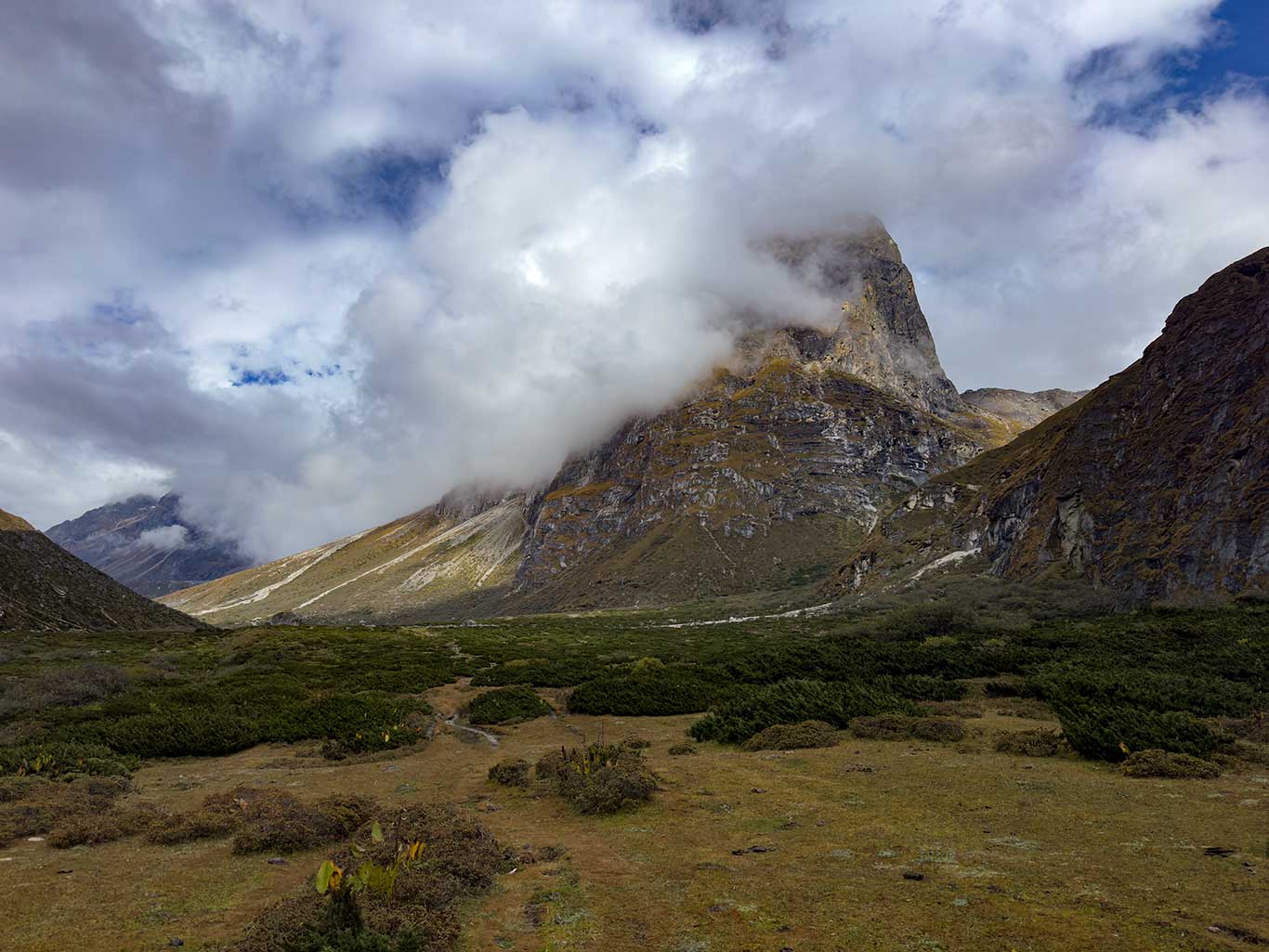
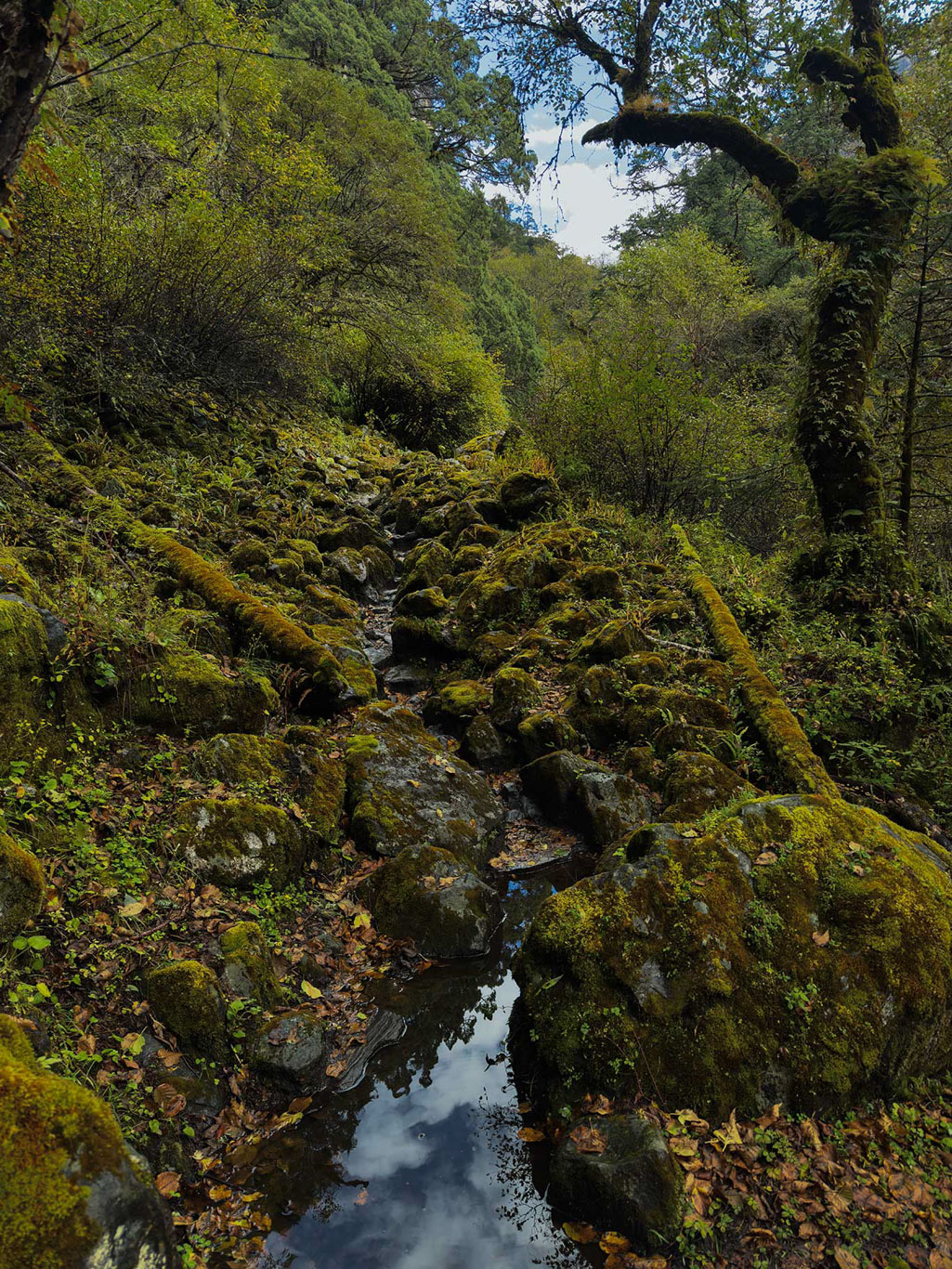
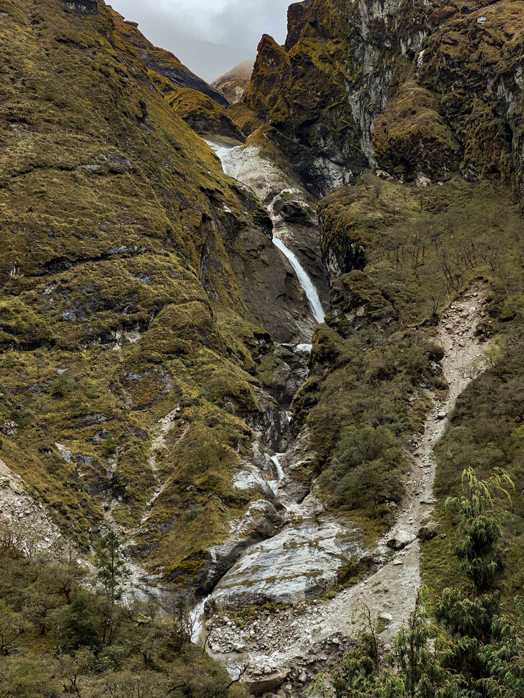
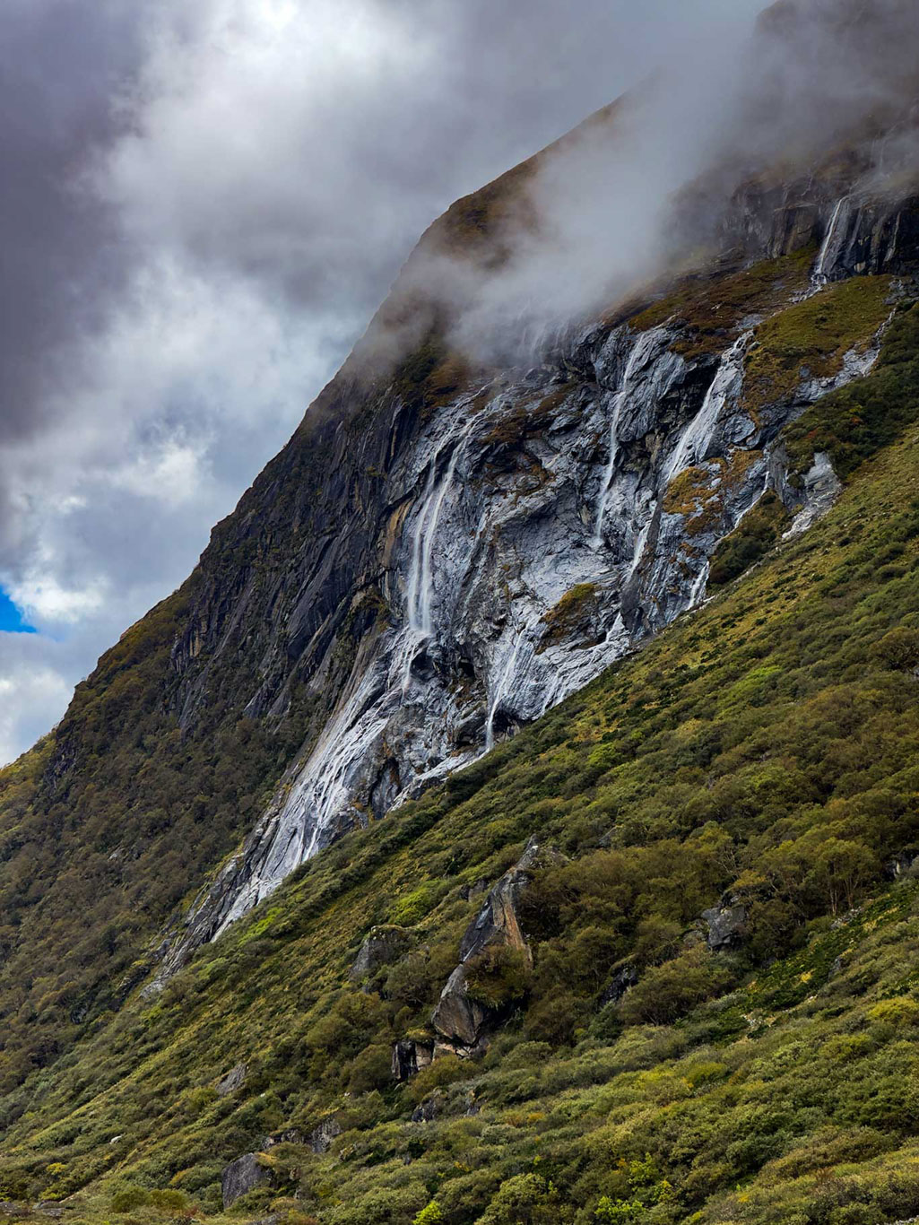
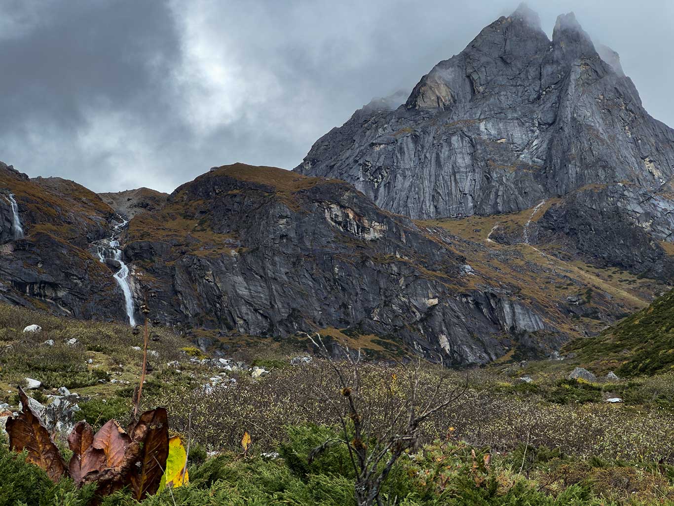
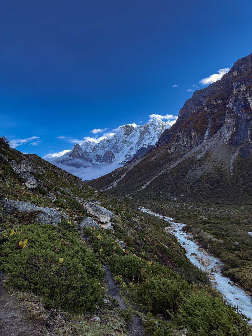
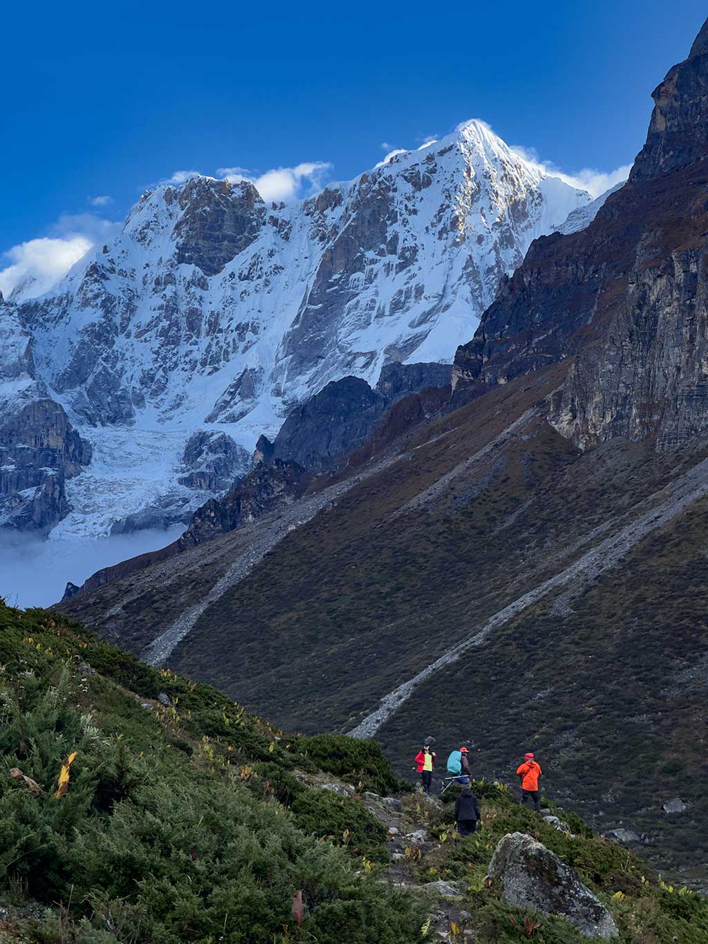
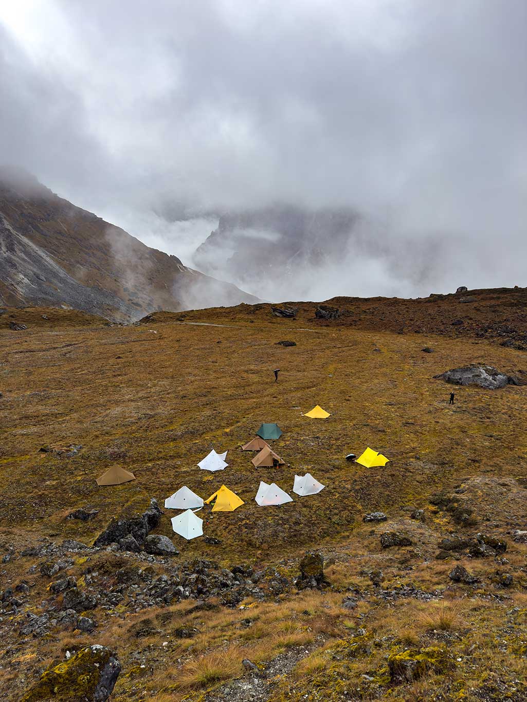
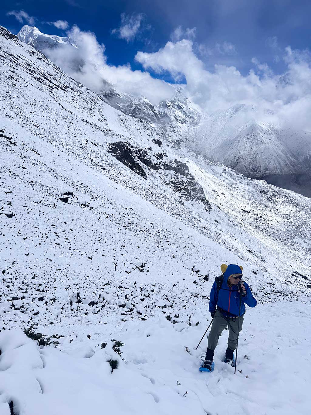
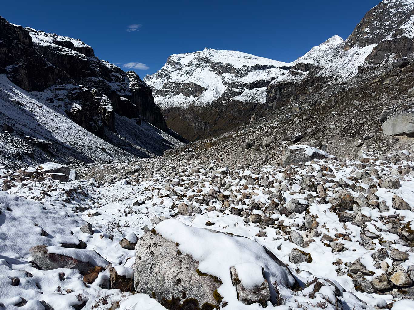
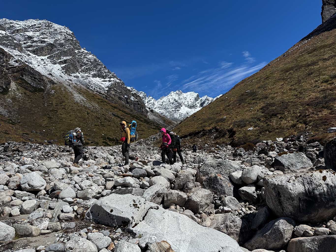
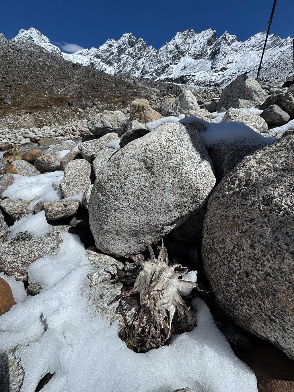
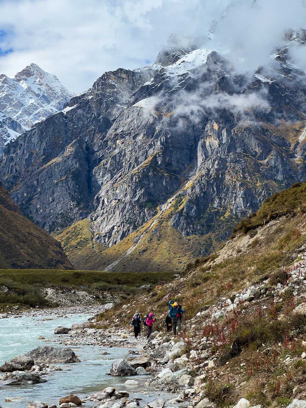
Beyond Langpu, vegetation changes noticeably: tall forests thin and vanish, waterfalls crash against dark boulders, and white water roars through the valley. Trails narrow, shrubs appear and gradually replace the forest. By Baiku, almost no trees remain; low shrubs indicate an altitude near 4,000 m.
For those aiming to see the 7,300-meter Gangpengqing Mountain, this is the ideal campsite. The next day, you can travel light to the east valley. We continued north, as fog and rain began to pour in. We had to reach Mantang before the rain worsened, where shepherd huts provided dry warmth.
Day 2: Rest or light trip to northern valley (easy reconnaissance)
After arriving at Mantang, we tackled the dilapidated cow shed. We thoroughly cleaned the floor and repaired the roof, yet the nighttime rain still reminded us of Mother Nature’s power. The rain continued the next day. A few team members went north to view the snow-capped mountains, but saw nothing, the clouds and fog were thick. We were forced to stay another day in the cow shed.
Day 3: 5.47 km, ascent 741 m, descent 53 m
Mantang 4,015 m – Advanced Camp 4,650 m
The morning started with decent weather, though cirrus and altocumulus clouds were visible. High-altitude winds from the south indicated changing conditions. We aimed to reach the advanced camp during this brief window.
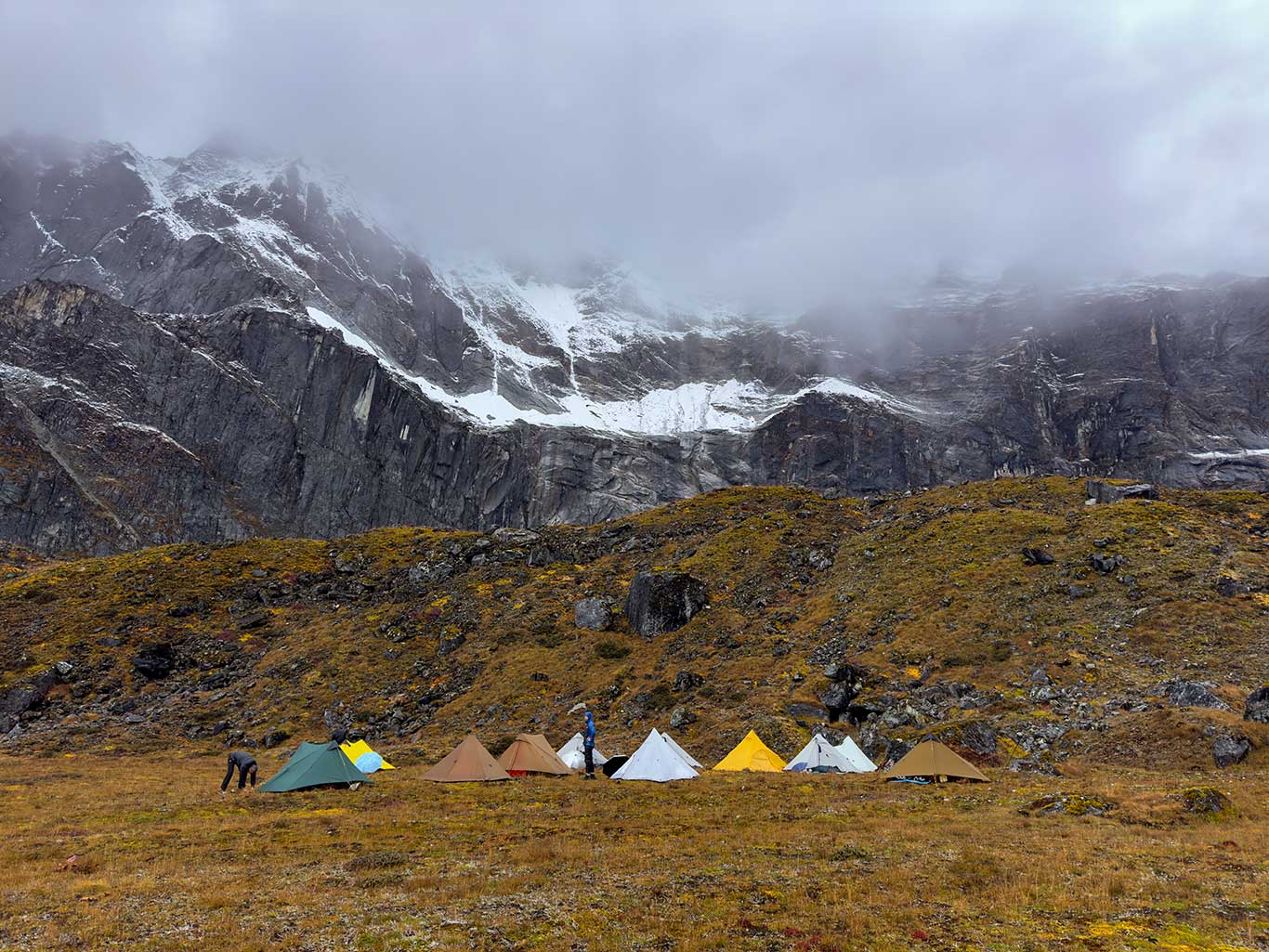
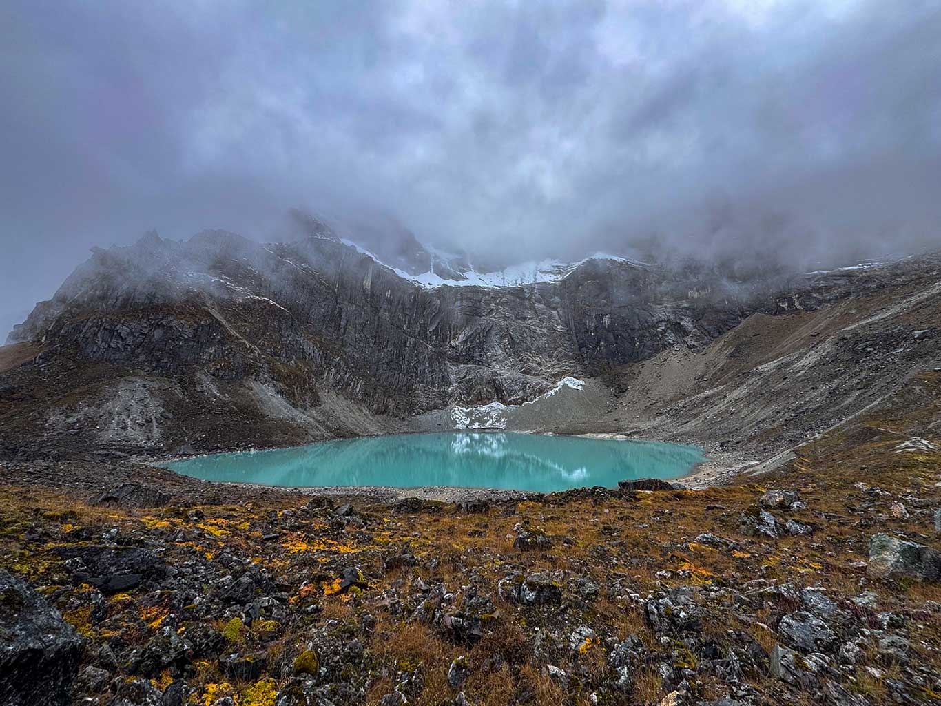
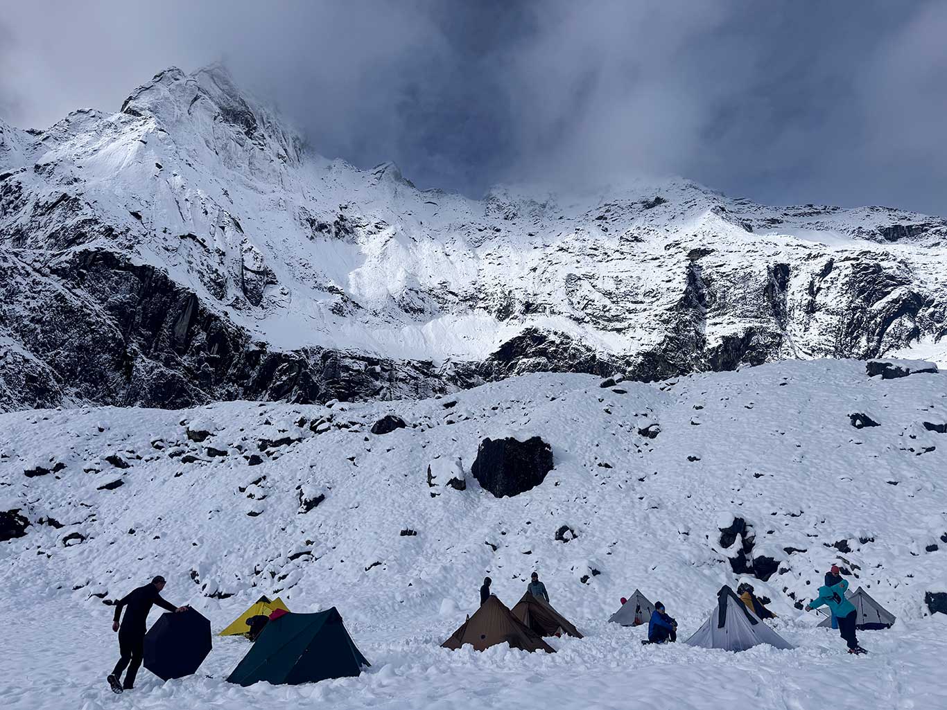
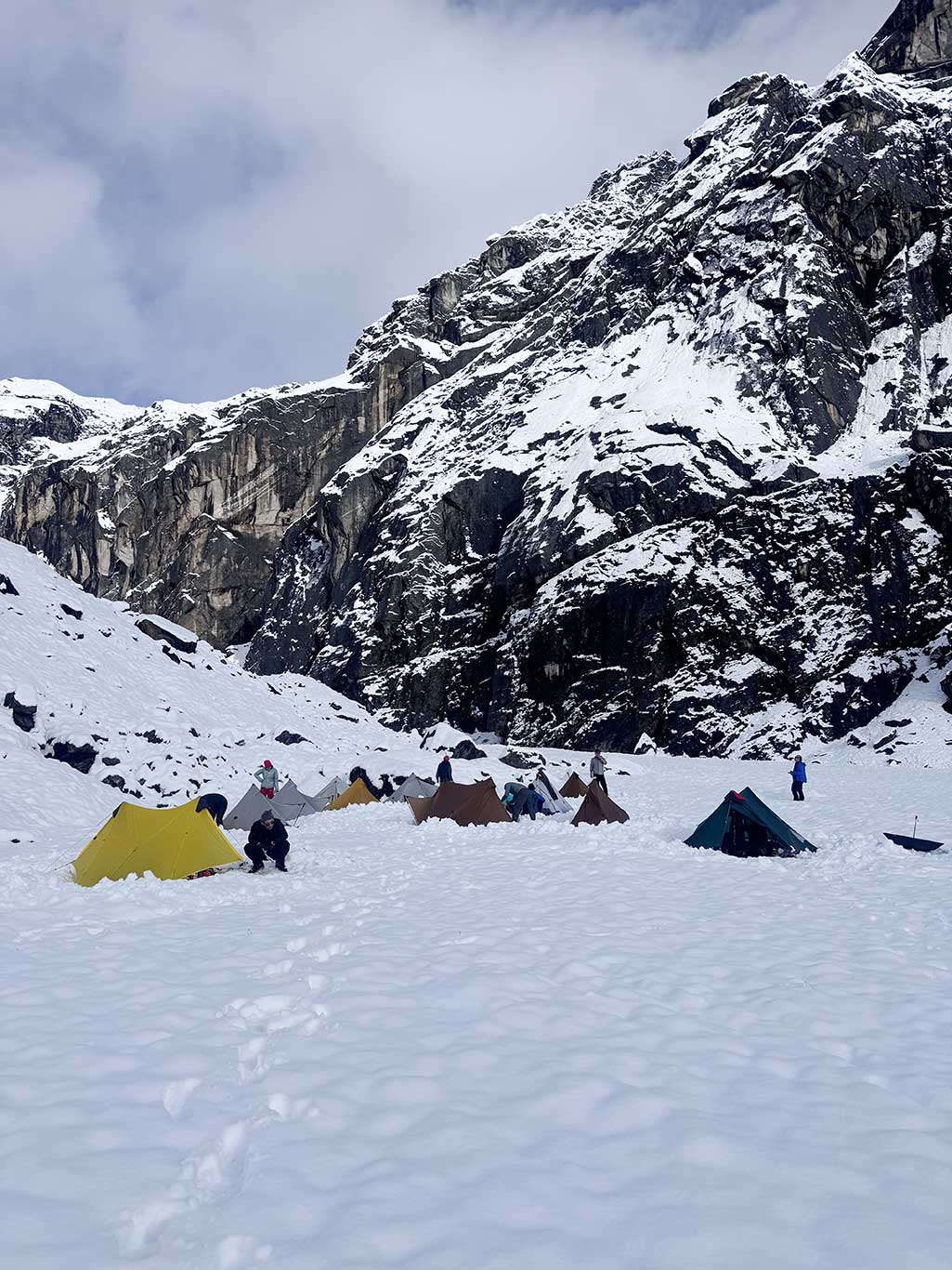
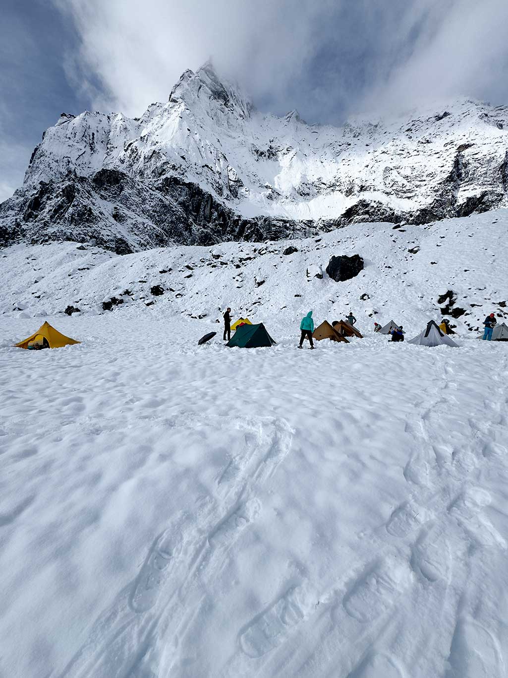
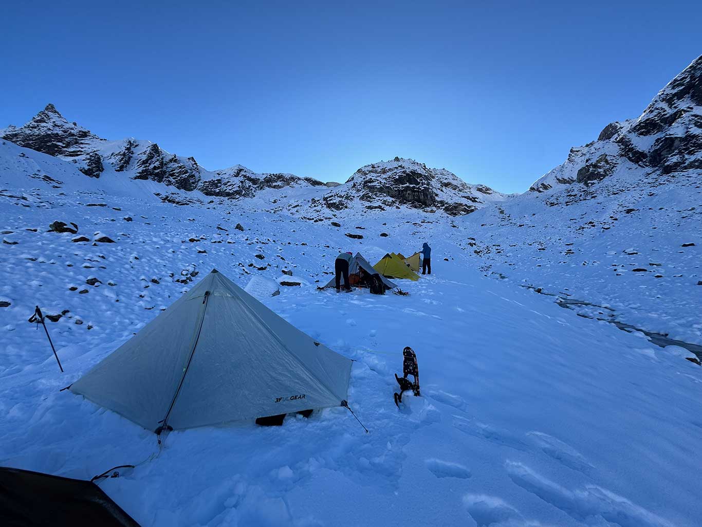
In 2024, Yan Dongfei’s team had camped among boulders at 4,570 m. This time, with 11 team members, that site was too small. We chose a flat area near a cirque lake on the left side of the valley, at 4,650 m. The topography was flat according to the map.
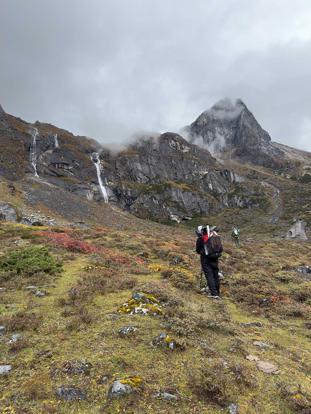
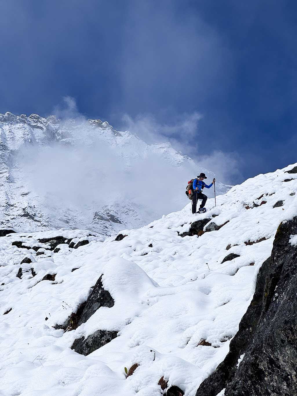
The trail disappeared shortly after the start. Above this point, there was no vegetation, only a sea of loose rock and boulders. Even yaks avoided it. The cirque lake platform lay approximately 700 m west of the summit route, requiring cross-country travel that consumed considerable energy. Sudden weather changes and low visibility compounded the difficulty.
When we reached the platform, the cirque lake wasn’t visible, it lay behind a ~20-meter rock escarpment. We searched along the escarpment for water and fortunately found a spring beneath a massive black rock wall, saving the effort of hauling water over the escarpment.
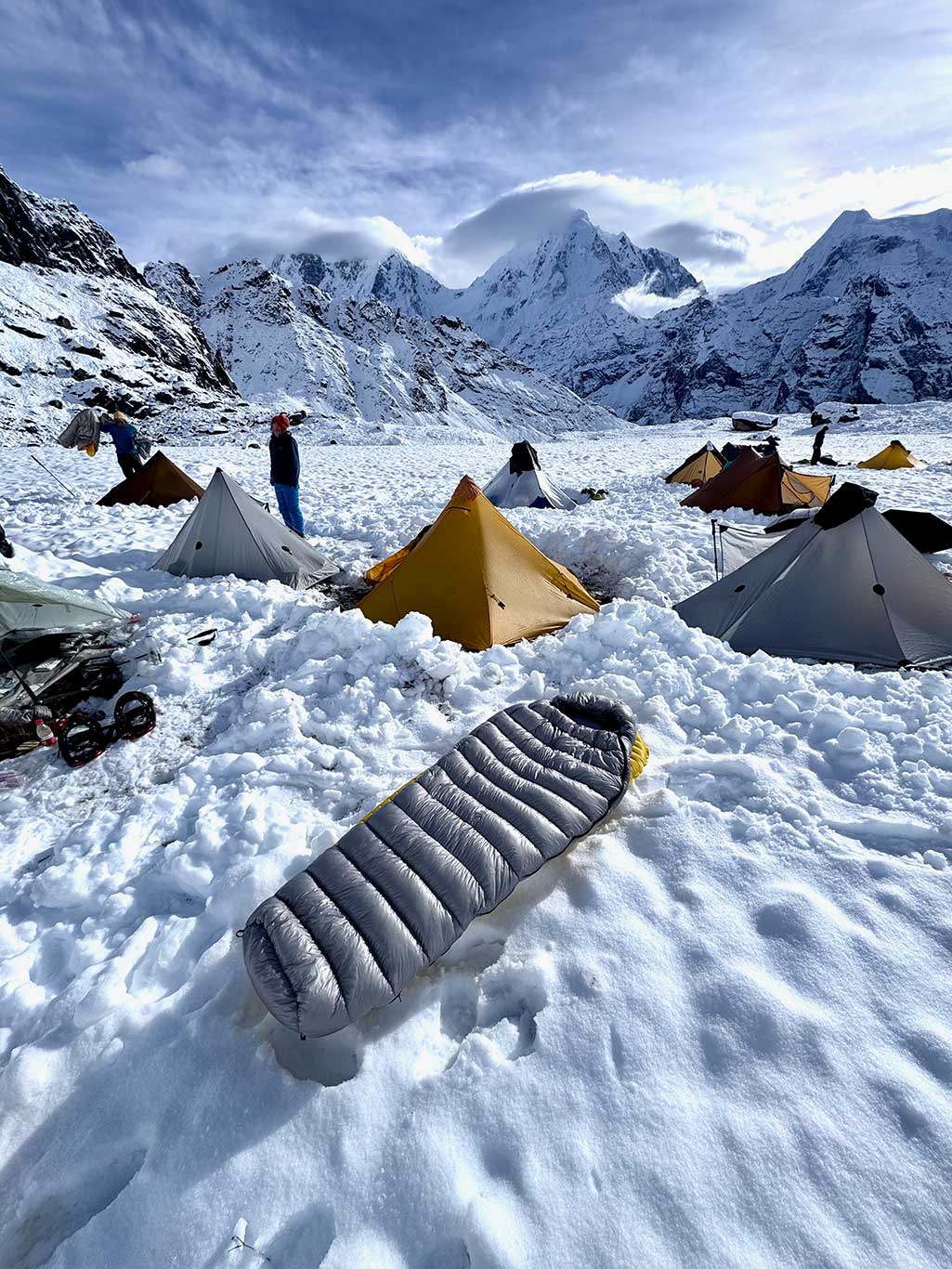
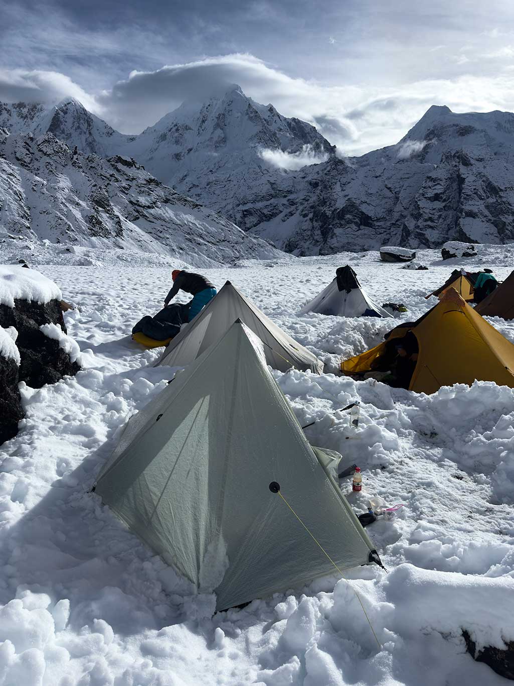
The camp itself was nearly perfect: flat, moss- and grass-covered, geologically stable, and surrounded by mountains, a fine viewing platform. Shortly after setting up, snow began to fall, growing heavier.
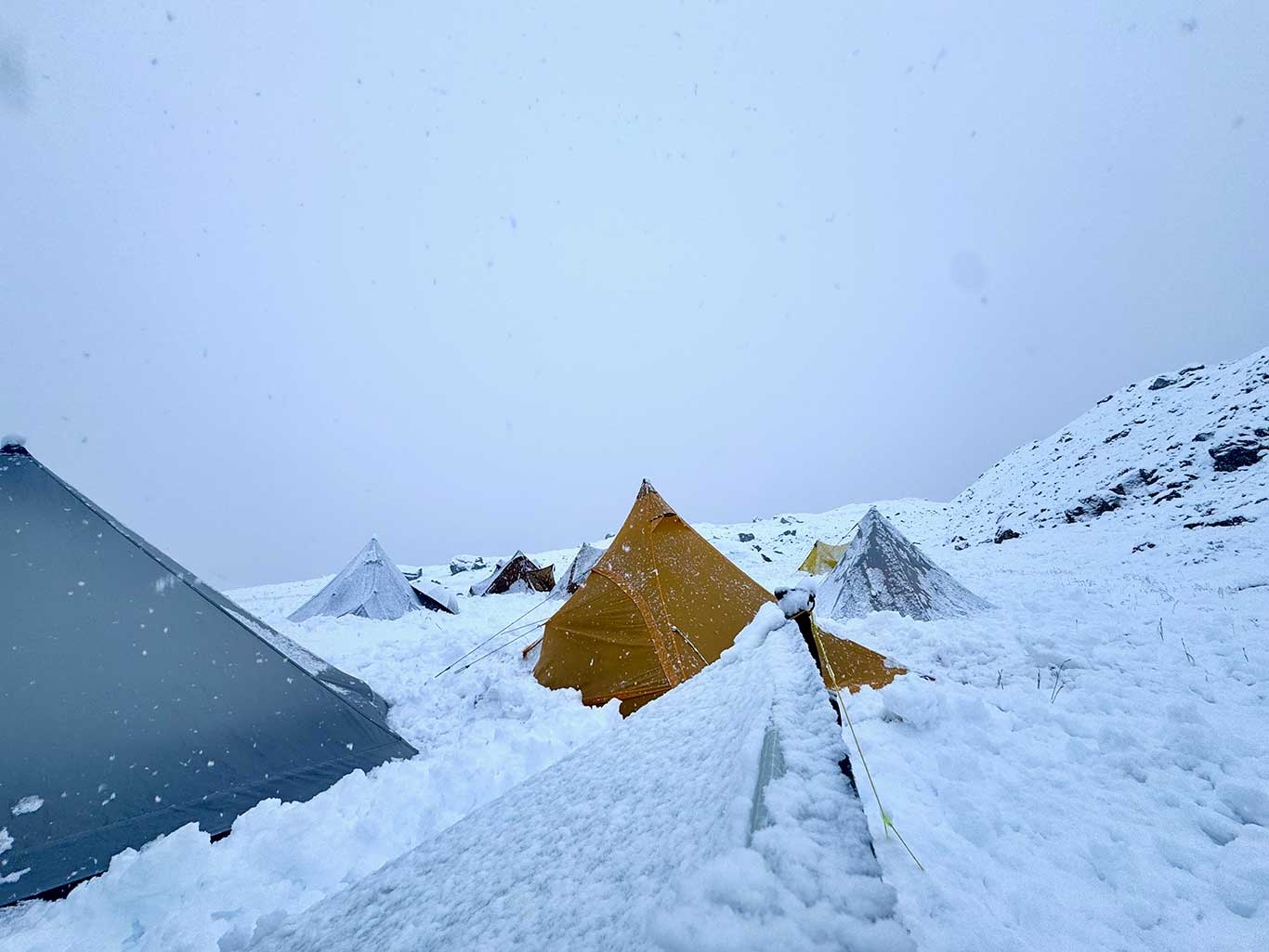
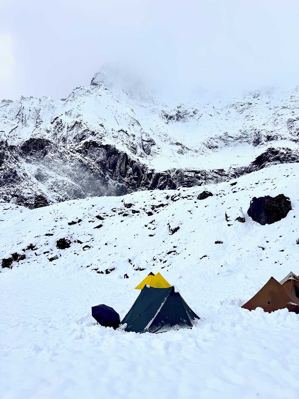
Day 4: Blizzard, waiting at camp
The blizzard and thunder tormented our mind. Some teammates considered retreat, but I reassured them that the camp was safe: away from rockfall and avalanche zones, sheltered from the wind, and enough food. We only needed to wait for the north wind; that would signal the time to depart.
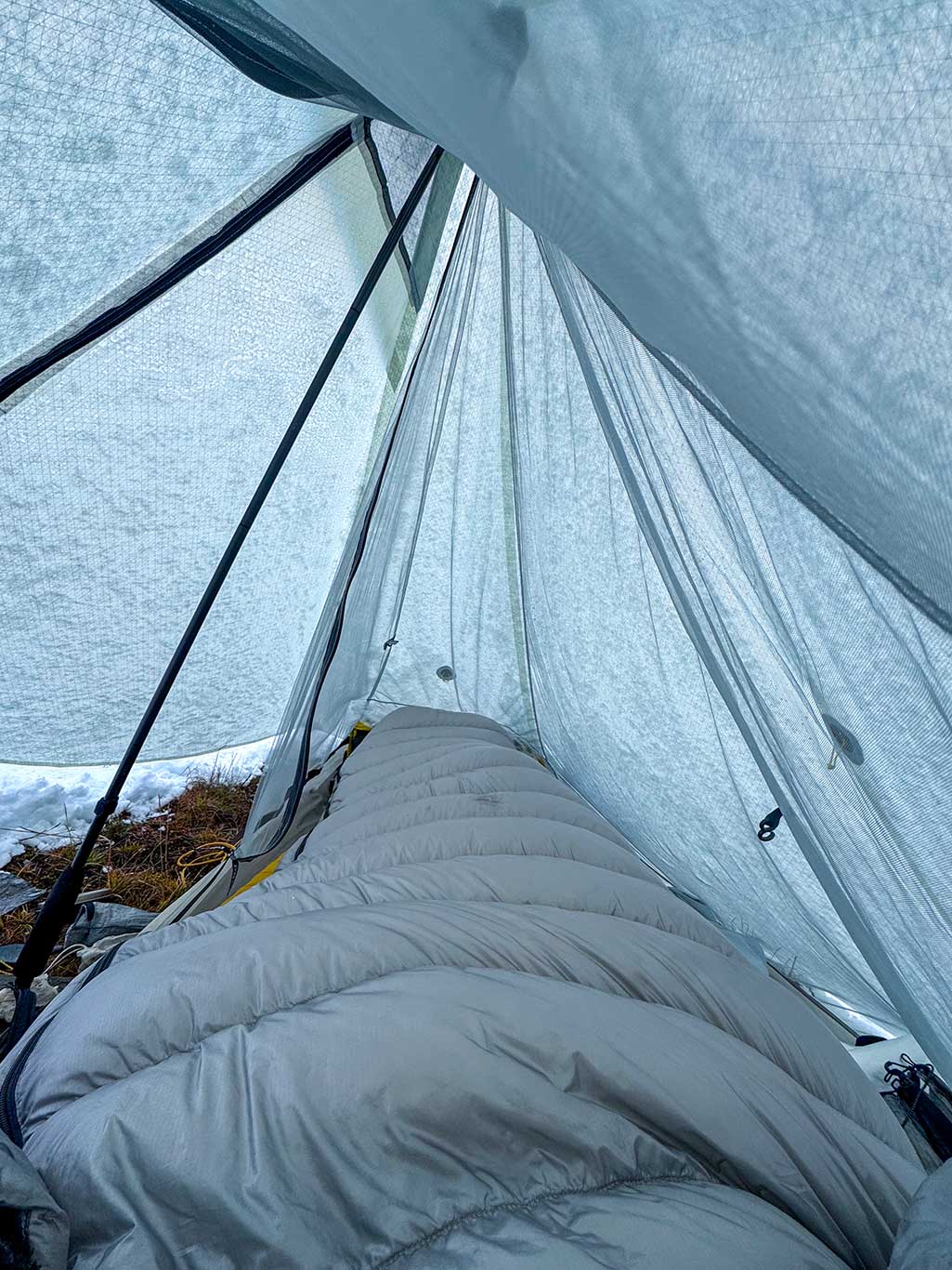
Snow accumulation required clearing the tents every 20 minutes, or risk collapse. Snow piling around the tents blocked ventilation. Everyone used trekking poles to prop open tent vestibules. At high altitude, ventilation is far more important than insulation; proper oxygen intake is critical. AMS (acute mountain sickness) is a serious risk here.
That afternoon, I called my wife via satellite phone to check the weather. The forecast was encouraging: high pressure would arrive, north wind would come, and the snow would stop.
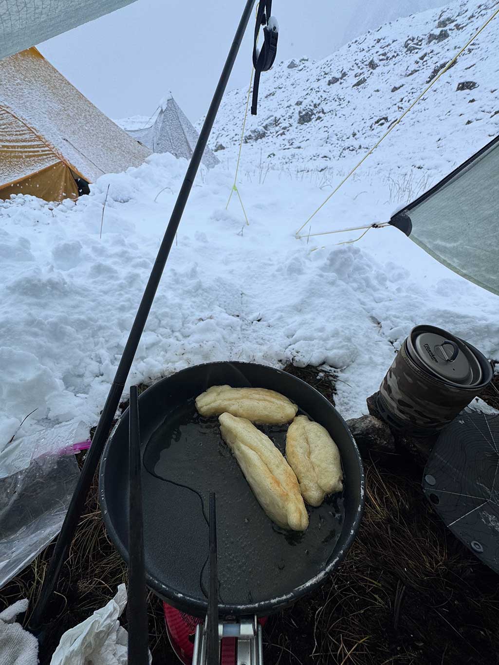
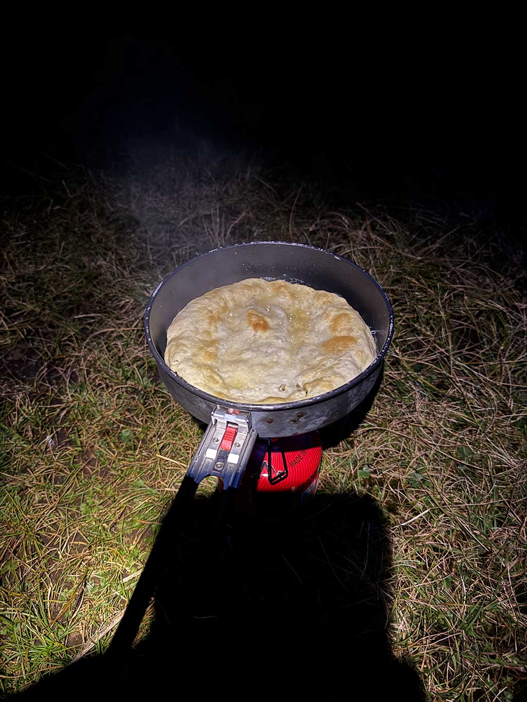
At 3 a.m., the snow eased. Finally, the last tent clearing before sleeping. I went outside and used a frying pan to clear snow around each tent, ensuring the bases had ventilation gaps. I walked the camp perimeter to check that everyone’s tents had sufficient ventilation, then finally returned to sleep.
Day 5: 6 km, ascent 610 m, descent 493 m
4,650 m Camp – 5,100 m Pass – 4,779 m Camp
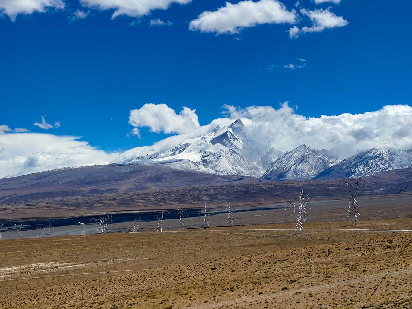
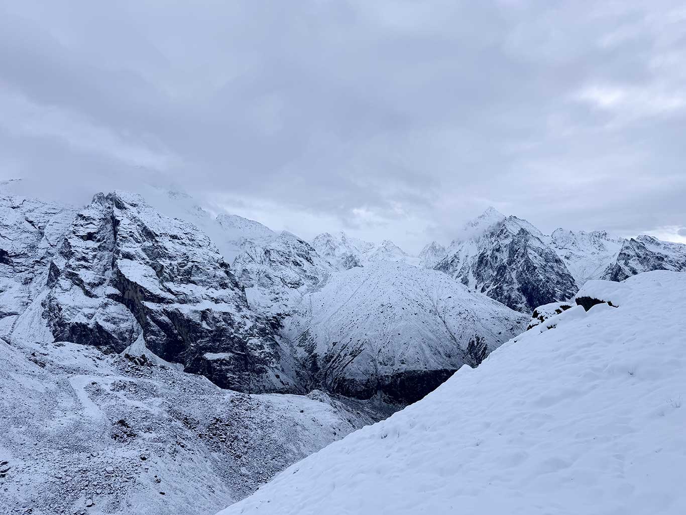
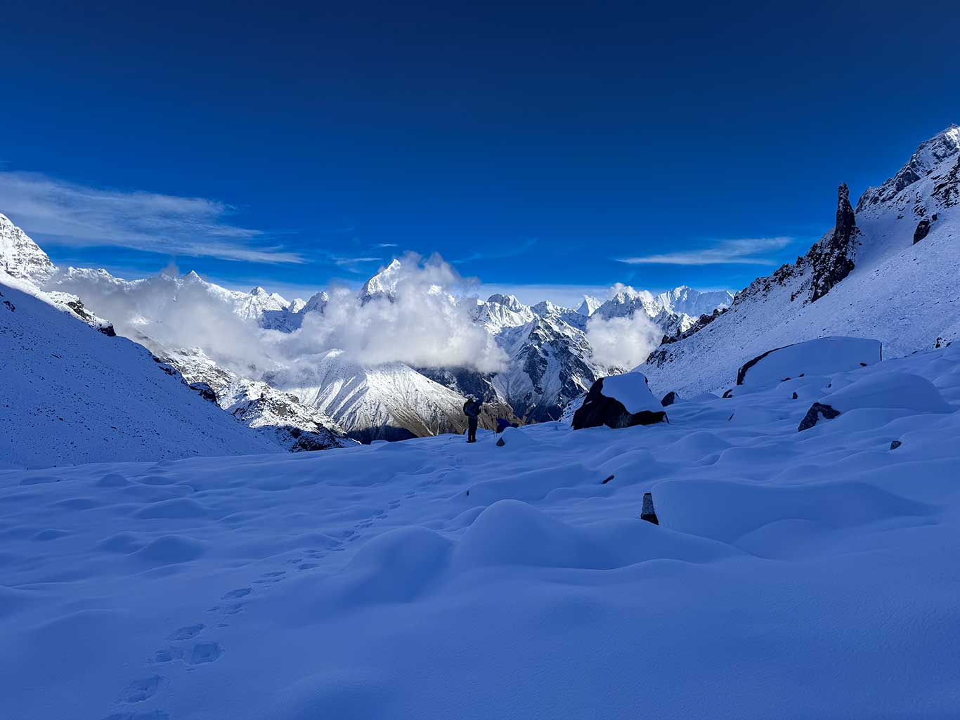
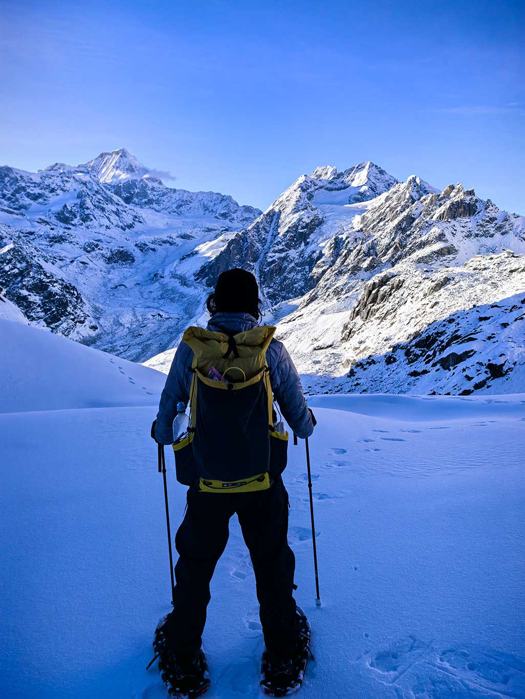
Morning was overcast; we waited until ~10 a.m. for the sky to clear. High pressure arrived, north winds blew away clouds, and the sun emerged, blindingly bright. The surrounding scenery changed dramatically: the colorful vegetation disappeared, replaced entirely by white and black. Strong UV felt like a furnace on the body.
I decided to move immediately. If temperatures continued to drop, snow would freeze into ice, making the stone slop dangers.
Descending to the valley bottom consumed enormous energy. I would not recommend this campsite to future trekkers; reverse traversal may be better.
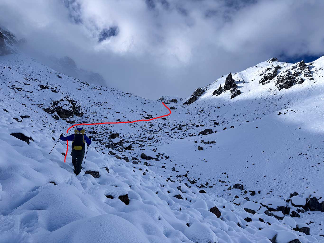
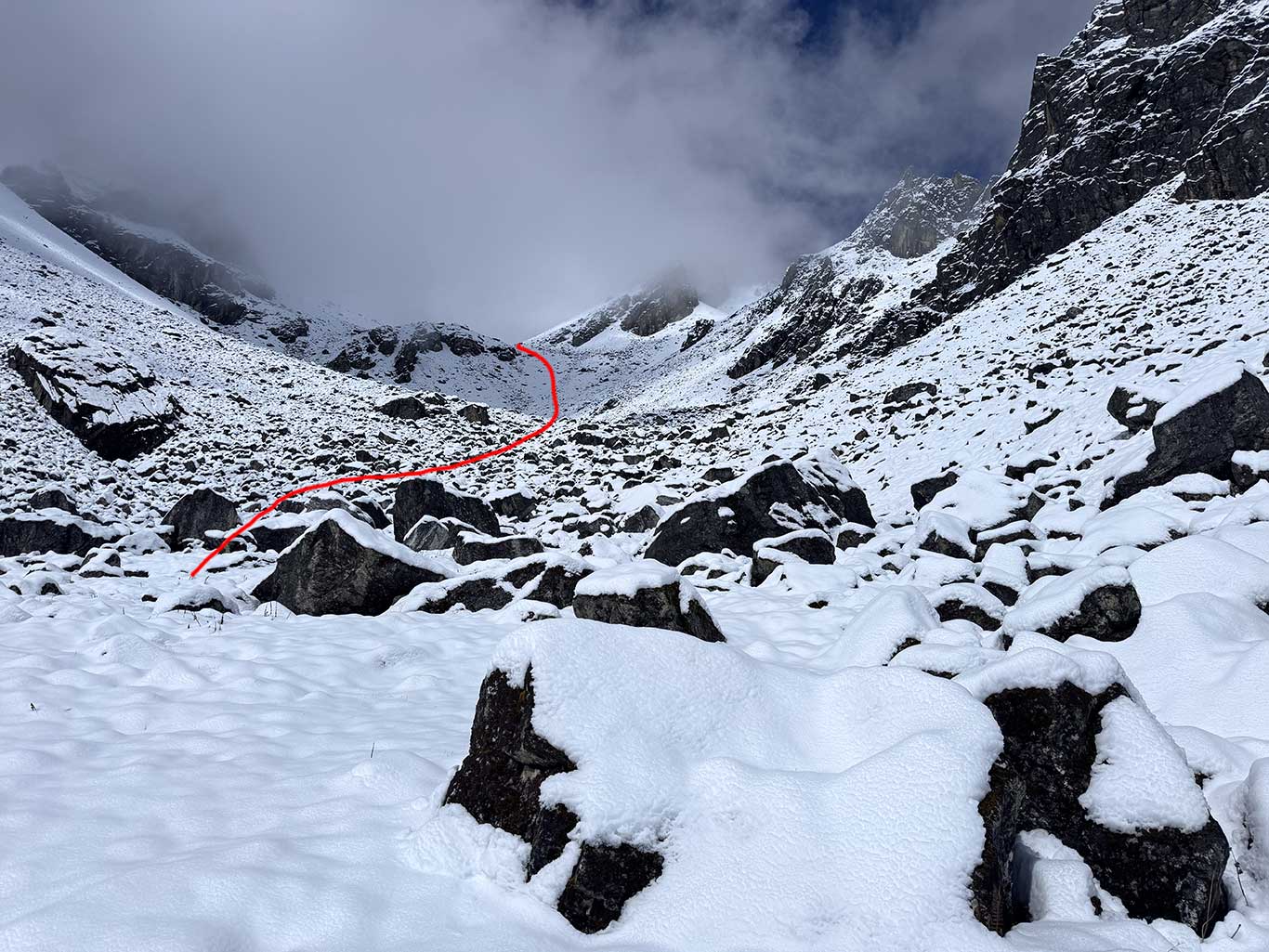
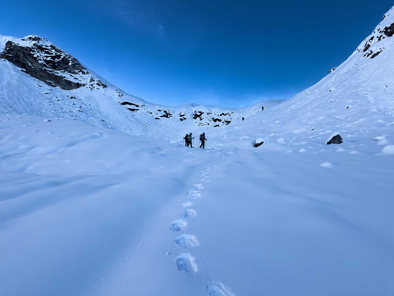
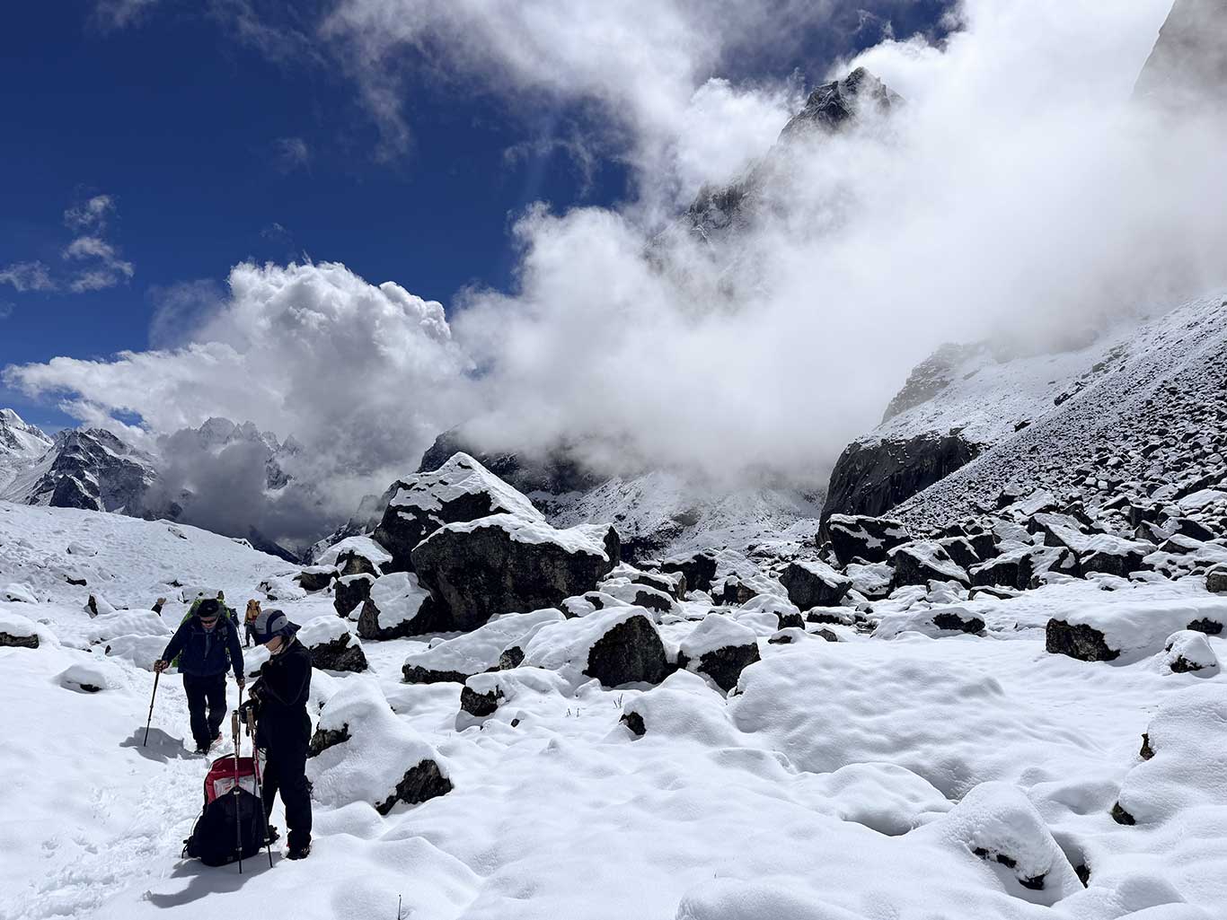
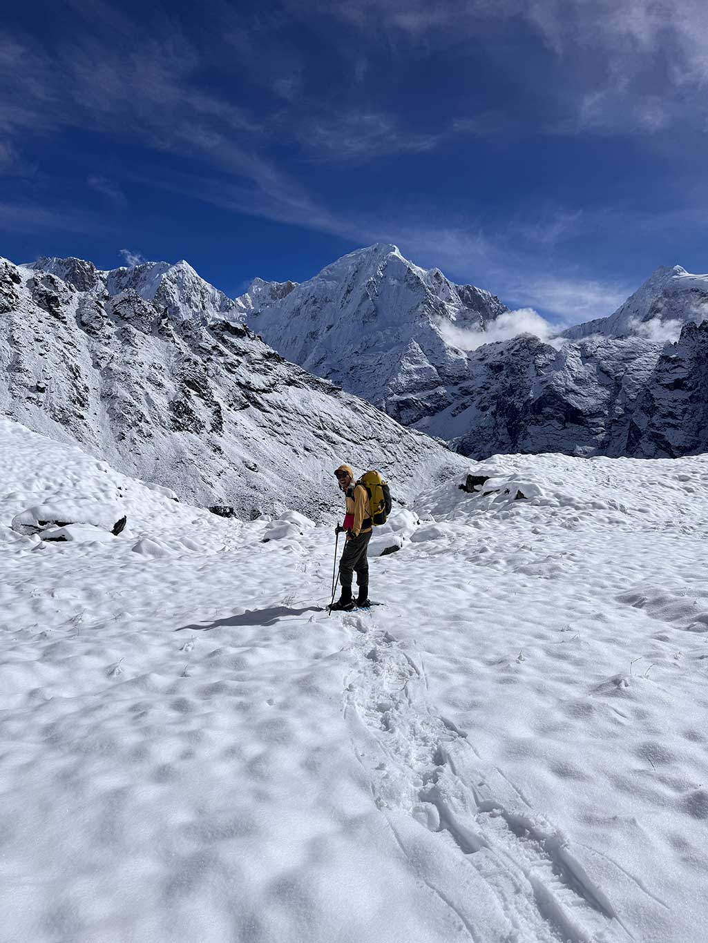
The valley floor to the north was covered by snow over the boulder field, visually flat but dangerous without snowshoes, as hidden gaps in rocks could cause injury.
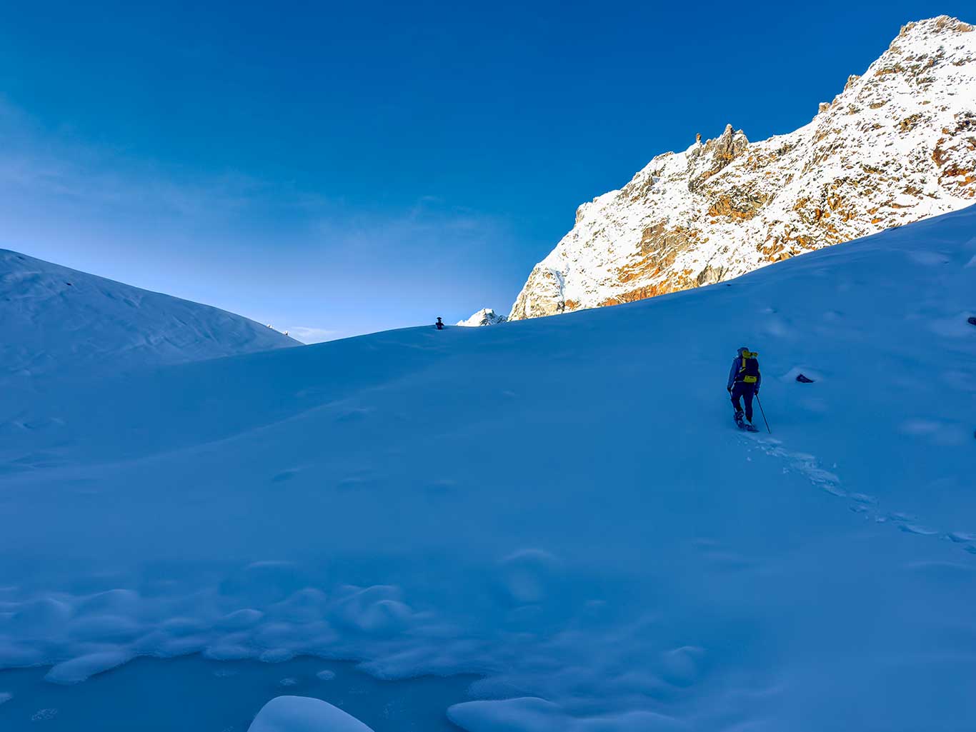
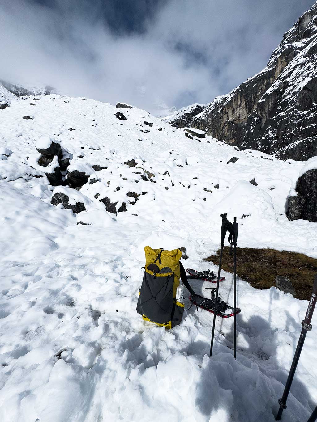
Above 4,600 m, no trail existed, only a boulder sea, extending to the 5,100 m glacier. Using snowshoes allowed us to float on the snow. In summer conditions without snow, our tracks would not be a useful reference.
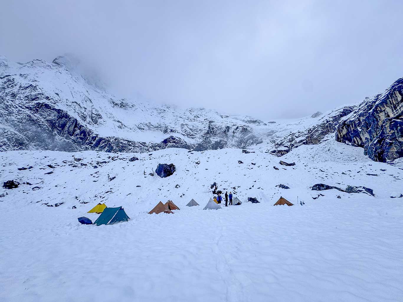
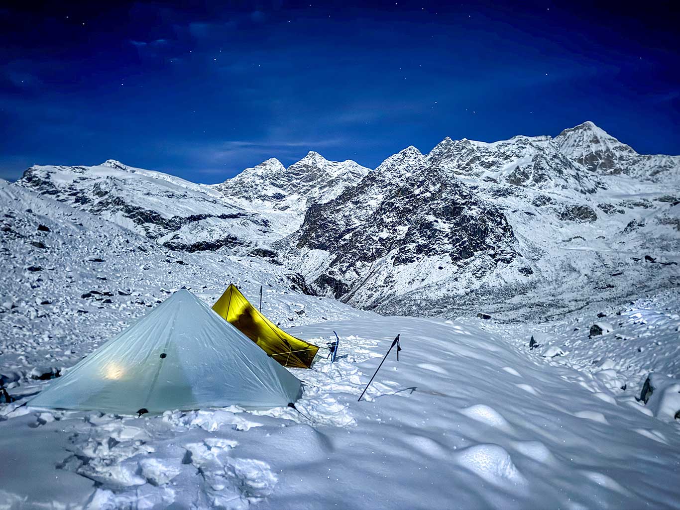
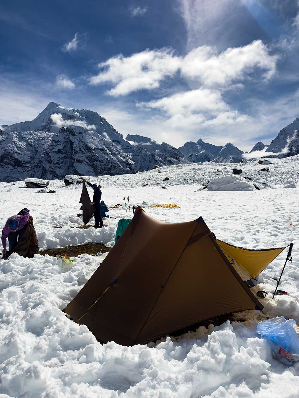
After reaching the 5,100 m pass, a very steep descent led to a glacier. In other seasons, crampons and ice axes would likely be necessary due to crevasses. We descended approximately two hours to a flat snow-covered camp as darkness fell. Temperature was estimated near −10°C, evidenced by tent stakes freezing solid quickly in the snow.
Day 6: 13.37 km, ascent 283 m, descent 942 m
4,779 m Camp – River Junction Camp 3,967 m – Crossing – Xiare 3,945 m
Morning temperatures were extremely low, likely −15°C. High pressure persisted, sky was clear. Everyone’s shoes were frozen solid and had to be thawed over a stove before wearing.
I used hot water in insulated bags and Kandy Befree water bag inside sealed insulation, both to retain heat and protect my water purifier from freezing. With a 300 g sleeping bag and full insulation system (down blanket, pants, foot covers, Climashield jacket), plus hot water bag, I stayed warm even in this cold. The camp’s location on a saddle prevented cold air pooling.
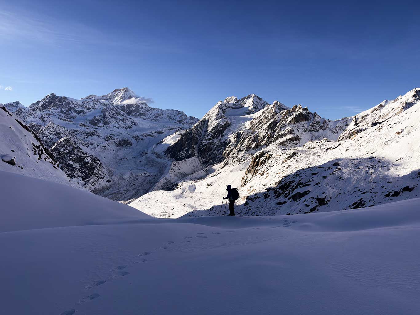
Descending to the valley floor was quick. We followed the left side of the river as Daxiang advised, proving wise. At 4,100 m, trails reappeared, speed increased, and vegetation grew richer.
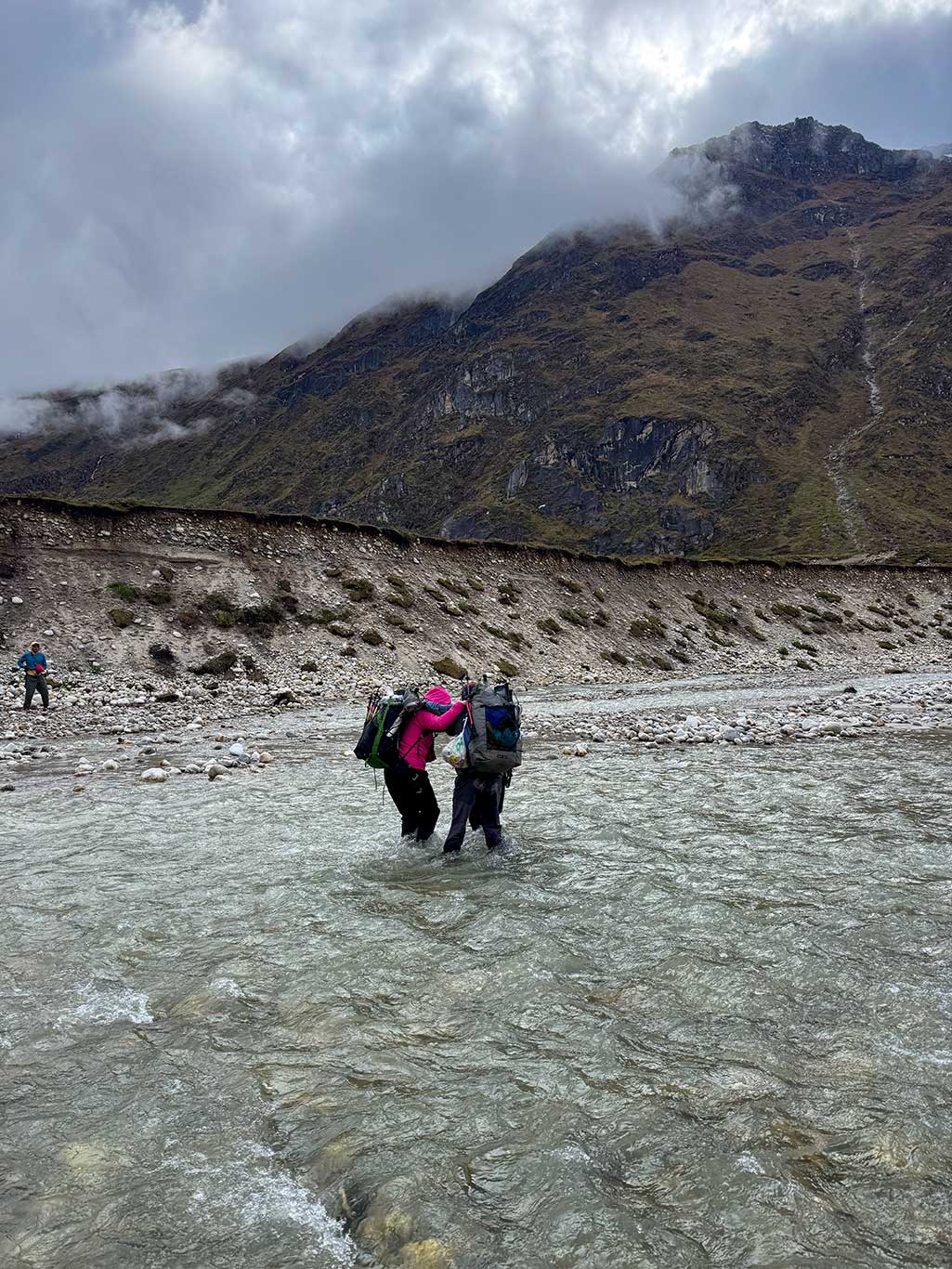
Near the river junction, we found an excellent campsite, flat, clean, and close to water. Another advantage: morning river levels were low, easing the river crossing ahead.
We mistakenly judged the next section and had to backtrack 2 km after encountering a waterfall and cliff. Across the river, a deserted pasture house was filthy with spoiled milk and cow dung; we camped outside instead of inside.
Day 7: 15.04 km, ascent 413 m, descent 890 m
Xiare – Sangbudo 3,600 m – Langpu 3,400 m – Zhuo Village 3,400 m
A lighter day, mostly descending on good trail with clear paths. Sangbudo is a summer pasture with clean small houses; if not for yesterday’s detour, we could have stayed there. From Xiare to Langpu, 8 km of excellent scenery—a pleasant hiking section. Langpu has a China Unicom signal tower; we used it to call vehicles. Remaining route retraced the initial path through beautiful pastures back to Zhuo Village.
Upon arriving early at Zhuo Village, we visited a Tibetan family, warmly offered butter tea. Liang attempted to pay, but the hosts refused; Mingyue said it would violate tradition.
Locals resemble Han Chinese more than Tibetans, and their clothing differs from traditional Tibetan attire, somewhat resembling Sherpas I met in Chentang. Despite being in China’s remote southwest, villages are well-maintained; roads clean; yards full of flowers, showing pride in their land. Families share the valley as a summer pasture, each owning 20–50 yaks, sold for over ¥10,000 each. Mid-June, yaks are driven to 4,000 m to produce butter and cheese. Vegetables and meat are kept in cold streams as natural refrigeration. By late August, fat yaks return to village pens, some sold, others retained for breeding.
Summary
The Secret Realm of Gyirong is a high-altitude mountain expedition disguised as a trekking route. The first two days are leisurely trekking, manageable for almost any hiker. However, days three and four, crossing the 5,100-meter pass, are equivalent to a snow-mountain expedition, requiring snowshoes and other alpine equipment.
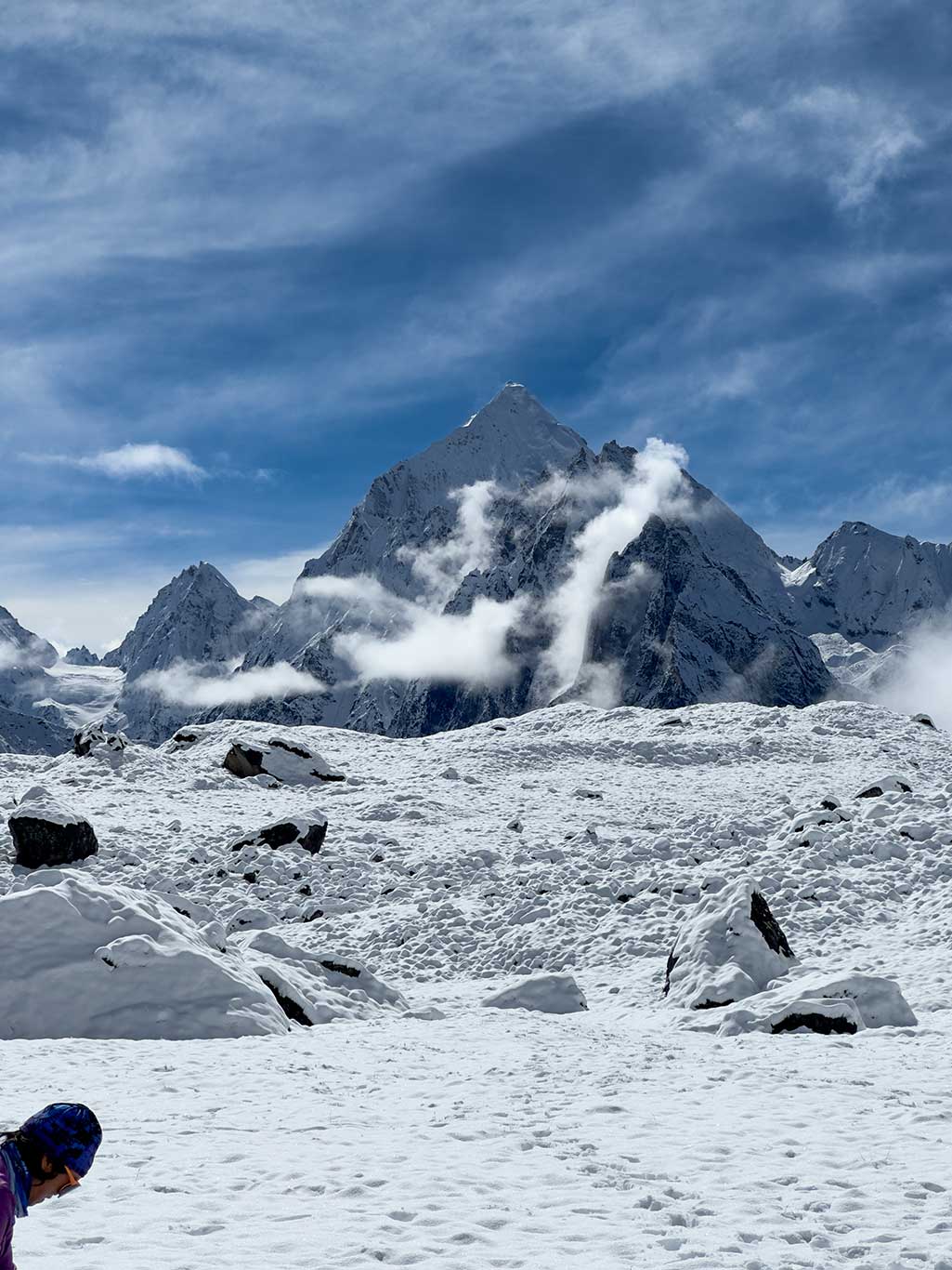
The eastern slope of the mountain has fully melted glaciers, leaving only boulders and scree. The western slope remains covered by a complete glacier, stretching from 5,100 m down to 4,700 m. Crevasses are numerous. While not technically difficult, the western route remains dangerous. Between 5,100 m and 5,000 m on the west slope, traces of minor avalanches exist. Snow is thick on both sides; at higher elevations, it can reach 60–80 cm.
During the ascent, wind was light, possibly due to the pass’s east–west orientation rather than north–south. The eastern slope has more loose rock and heavily weathered spires, making camping in the east valley inadvisable.
Based on this expedition, we concluded that reverse traversal (ascending from the west slope) is superior:
1. The advanced camp can be set at 4,700 m, closer to the pass summit.
2. The western slope’s geology is more stable.
3. There are no suitable campsites in the east valley. Using our camp (a platform on the west-side slope) consumes significant energy to reach.
4. Crossing the glacier and potential avalanche zone in the morning is safer.
Outdoor Ethics
Most of this route is uninhabited. Above 4,500 m is grazing boundary land, with moss and grass vegetation. East of 4,700 m, only moss and lichen remain. The ecosystem is extremely fragile; all trash, including biodegradable waste, must be carried out.
Below 4,000 m lies Tibetan pastureland. Herders’ stone houses can be used when vacated, but all garbage must be removed, and doors (usually boards and stones) closed after use.
Equipment Tested
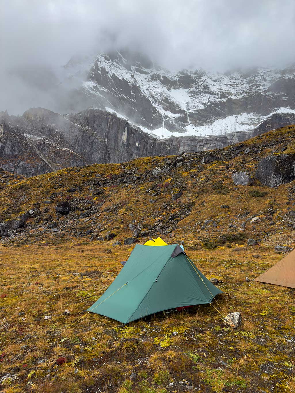
Tents: We carried different versions of Lanshan tents, both old and new, all performing well. Notably, the Lanshan SilPoly version features two condensation flaps and non-absorbent fabric, excellent for the humid southern Himalaya.
Sleeping Bags: I used my self-designed CoreLite sleeping bag, made by ICEFLAME, filled with 300 g of 900FP down. The shell weighed 150 g; total weight 450 g. Combined with ICEFLAME 145 g down blanket, down pants, down foot covers, and Climashield insulated jacket, the system contains ~500 g down and 100 g synthetic insulation. On the coldest nights (~−15°C), I used 700 ml boiling water for warmth, reheated twice every three hours. My partner Liangxueyan used a 600 g ICEFLAME Extraquilt Zip (900FP down) with good performance.
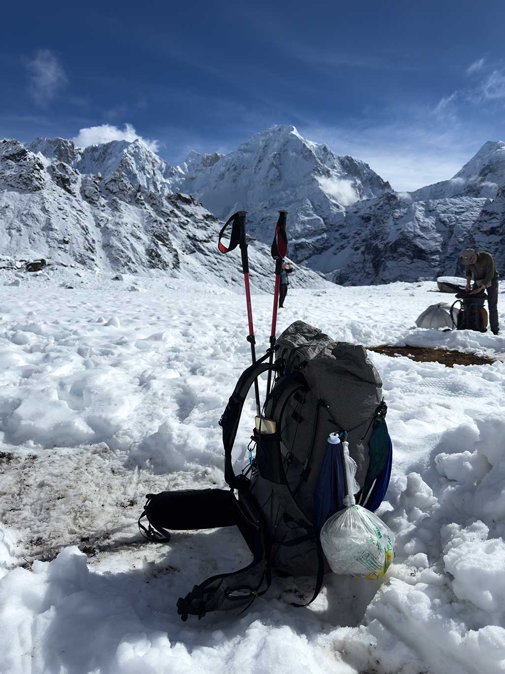
Backpack: The new Tutor backpack weighs only 650 g. It includes two ultra-light carbon rods for support. I carried 12 kg without issue.
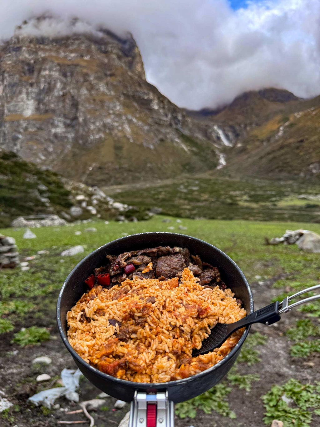
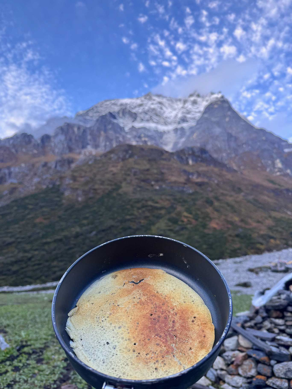
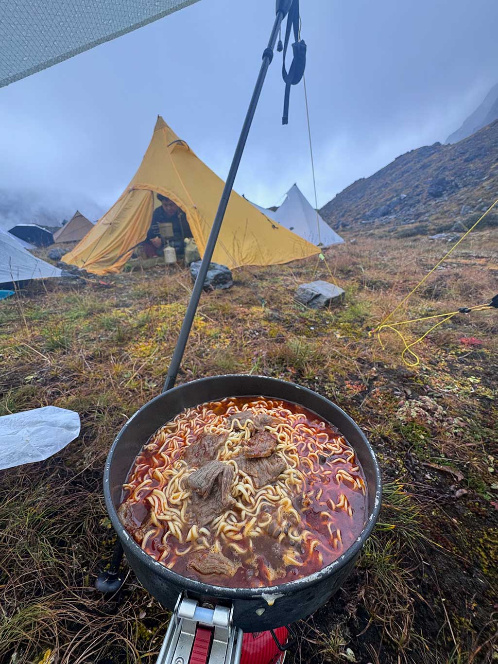
Improved Firemapple Heat-Collecting Pot: Prototype G3 modified to remove handle; we made an insulation sleeve and lid. Thermal efficiency improved without added weight (148 g). A single 230 g medium gas canister with Soto-310 stove sufficed for 7 days due to excellent thermal efficiency.
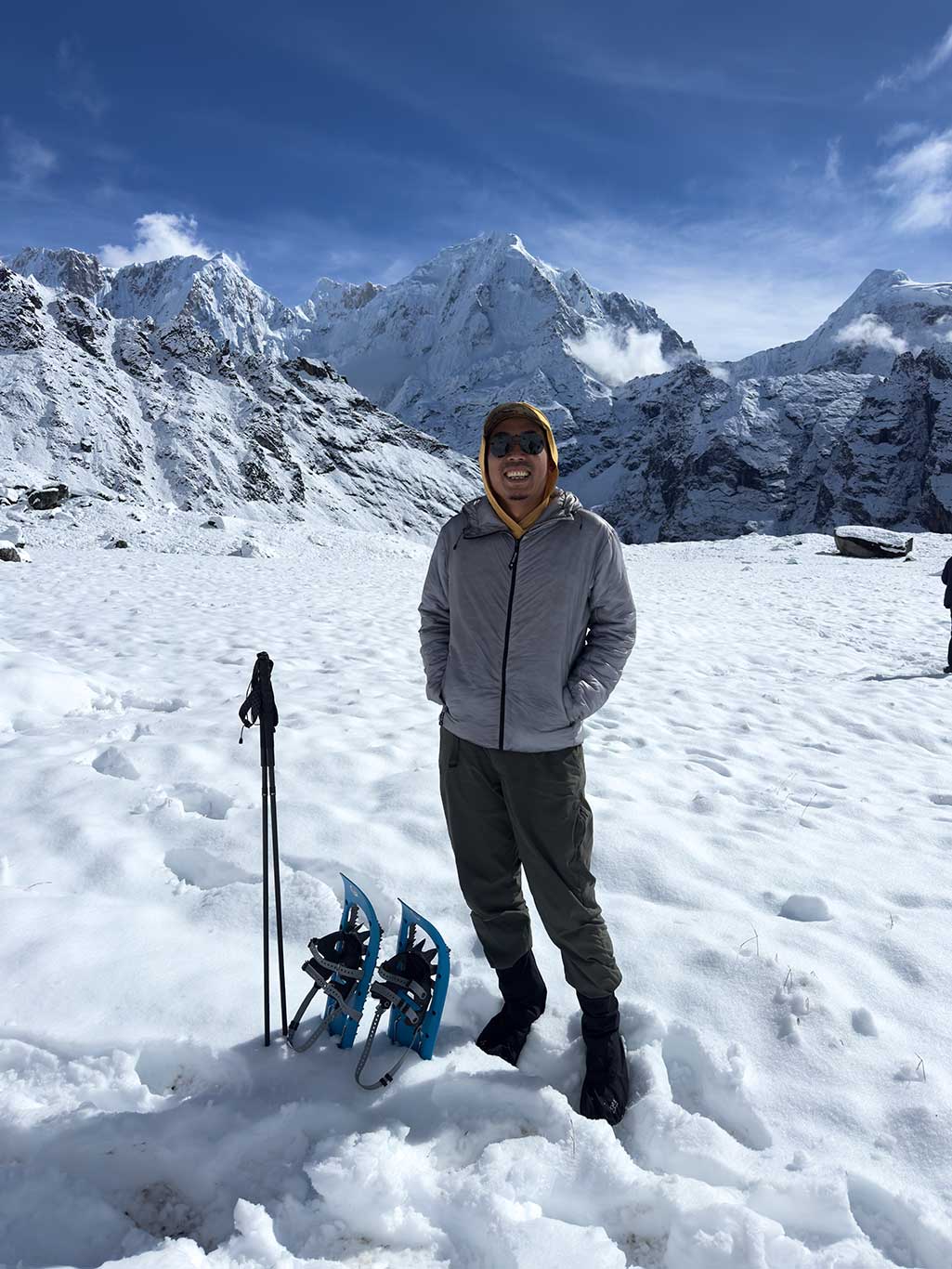
Climashield Jacket (ICEFLAME): 210 g, shell of high-breathable 7D fabric, 2 oz Climashield Combat synthetic insulation. Light grey color ideal for high-altitude UV; breathable enough for high-intensity activity without a hard shell during snow. Comparable to Enlightened Equipment jackets.
Often Overlooked Gear:
• Water Purifier: Water is generally good but can be contaminated by livestock or dead animals—essential.
• Snowshoes: Non-summer passes are snow-covered; snowshoes save energy.
• Shell Jacket / Rain Poncho: Heavy precipitation almost daily.
• GPS Offline Maps and Satellite Phone: No trail, hazardous terrain; maps aid route assessment, satellite phone enables emergency contact.
• Snow gaiters – essential gear. Prevents snow from entering your shoes.
