
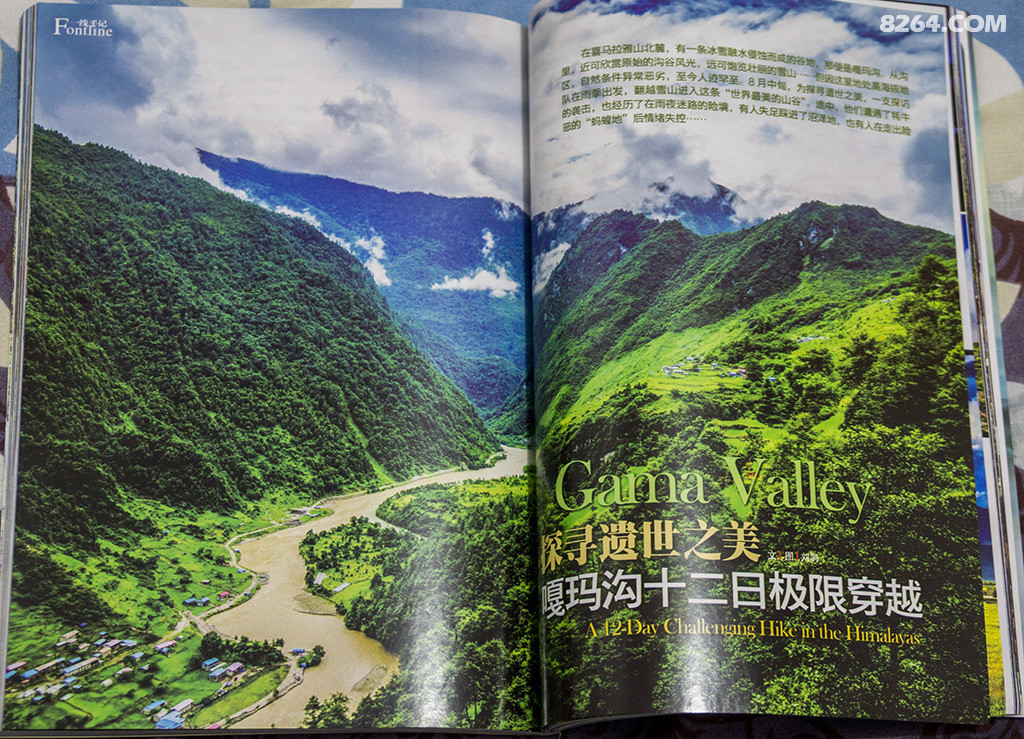
Adventure Report: Everest East Face and Kama Valley
Team member: Liu Yu, Mingyue, Jundao, Ruguo,Tusheng, etc.
Time: August 2014
Length: 140km 10 days
Location: Tibet
Difficulty: 5.5/10
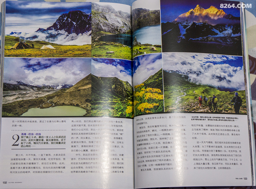
This travelogue was published in “Cultural Geography” Magazine, Issue 12, 2015, Pages 128-137 by Liu Yu
This expedition took place ten years ago, and at the time, it was likely the first recorded attempt to explore the Kama Valley during the rain season.
Now, a decade later, I’ve decided to revisit this adventure, not just in memory but in writing. This retelling includes details and reflections that were omitted from the original article, as well as previously unpublished photographs.
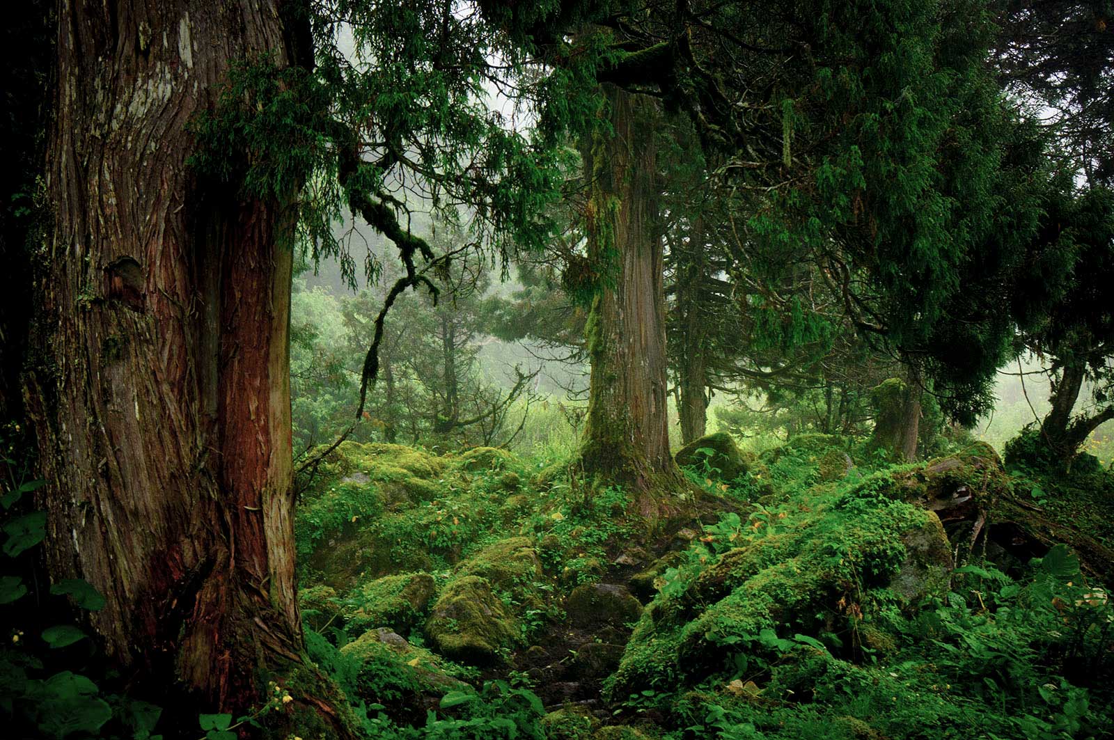
The Kama Valley remains a place of mystery and wonder, a testament to the untamed beauty of nature.
There are now commercial adventure companies offering services similar to the itinerary in this article.
Note: Gama Valley and Kama Valley are both transliterations of the Tibetan word ‘嘎玛沟’, which may differ from other sources because the place names in this article are all in Tibetan.
Due to occasional GPS battery failures, some segments weren’t recorded:
- A 2 km stretch from Lunzhulin Village to Xuemala.
- A 3 km segment starting 1-2 km below Langmala Pass to a pasture.
- Poor signal in the valley due to bad weather and deep gorges, especially on the final day.
Some areas in the Kama Valley had interference, causing signal offsets. Manual corrections were attempted but aren’t guaranteed.
Adventure Report:
August 22, 7:30 PM 2014 China-Nepal Border Outpost
“It’s the first time I’ve seen anyone come out during this season,” a border guard greeted us.
What he saw was a small group of exhausted travelers, but they showed no intention of resting. Instead, they began scratching themselves frantically in front of the outpost. Seeing this, the soldier fetched several bags of salt and handed them to the group.
After a brief exchange, the soldier learned that this was Team A, a group of hikers from Shandong. They had lost contact with Team B and Yak team on a treacherous mountain path near Chentang Town. The reason for the separation was none other than this spine-chilling trail.
Meanwhile, in Chentang Town
“*********???” Unintelligible words filled the air, tinged with curiosity.
I set down my backpack, finally reaching a sheltered spot from the rain. However, being surrounded by so many strangers made me uneasy. I had no choice but to strip off my insect-proof suit, covered in leeches, and toss it aside. I removed my shirt to inspect myself. My teammates, with the help of Sherpas, were busy dealing with the pesky creatures, letting out occasional screams. One member pulled out a nearly dead radio and began calling for Team A and the Yak team. Only the Yak team responded, suggesting that Team A’s radio had run out of power. Mingyue, who was traveling with the yak herders, informed us that the yak team couldn’t proceed due to a landslide and would have to carry the supplies back tomorrow.
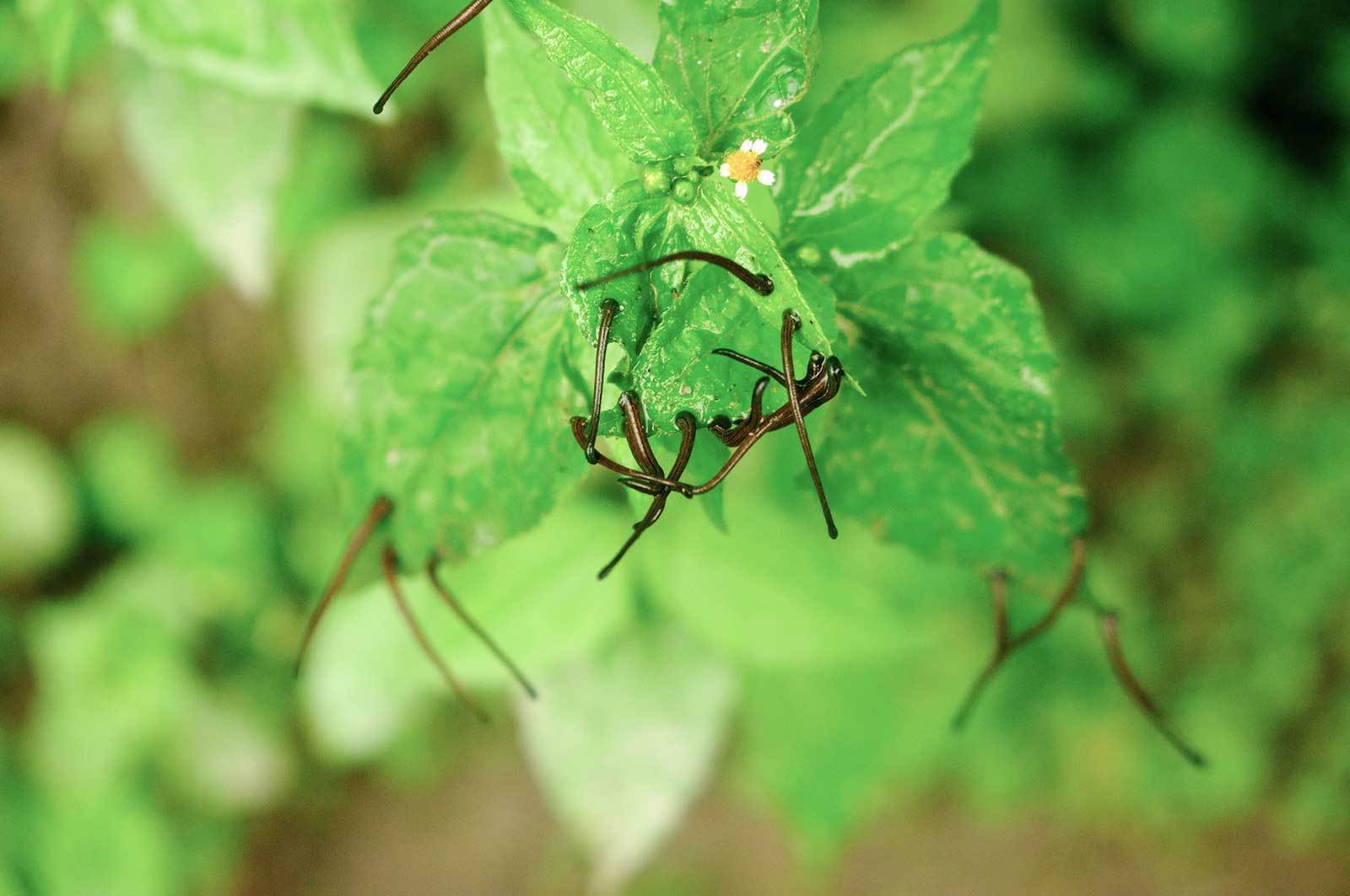
Despite being soaked and anxious about losing contact with the main group, I felt somewhat relieved. Just moments ago, we had traversed an unnamed path teeming with leeches, their suction-capped heads wriggling on the tips of grass blades. Fat caterpillars, thicker than sausages, squirmed with black and yellow bodies. Even though I usually wasn’t afraid of such creatures, I found myself sprinting in terror. Reflecting on it now, it must have been a primal fear of these soft-bodied creatures overwhelming my rationality. It’s easy to say you’re not afraid of something until you’re faced with an overwhelming number of them.
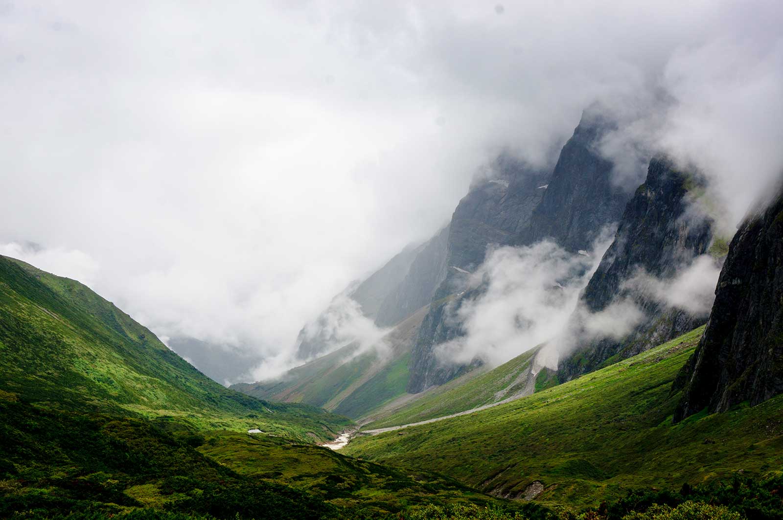
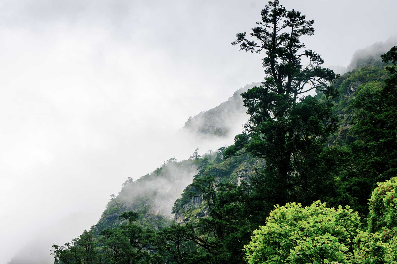
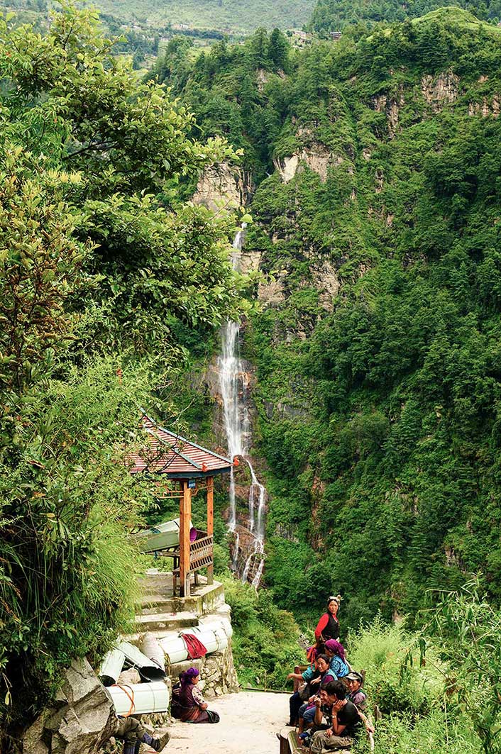
Now, the clouds began to disperse, revealing stunning layered peaks. Surrounded by a massive waterfall and mist, we found ourselves on a hillside in an ancient town, surrounded by locals who didn’t speak our language—all of us busy picking off leeches. It was an oddly surreal experience.
“Excuse me, is there a place to stay?” I gestured sleeping, and the Sherpa man opposite me seemed to understand some Chinese.
“Yes,” he replied firmly, eager to lead us there.
Following his directions, we arrived at a small square, perhaps the largest in town. We finally contacted Team A. As I spoke on the phone, I grew increasingly anxious. The Sherpa man, noticing my prolonged call, grew impatient, grabbed my bag, and started walking. We hurried after him. Our destination wasn’t a warm inn but the town government office. We were ushered into a living room, where officials warmly inquired about our situation and offered hot water and bread. It seemed we were temporarily detained as suspicious individuals. After consulting with the local police station, they suggested we head down to Zangga Village to reunite with Team A, mentioning that there were accommodations and showers available. It seemed Team A had already communicated with the police.
Down in the village, Team A and the caravan had already prepared food. After a quick meal, we retreated to our rooms to continue battling the leeches.
This marked the end of our journey, which began on the eastern side of Mount Everest and concluded at the end of the Kama Valley.
Ten Days Earlier
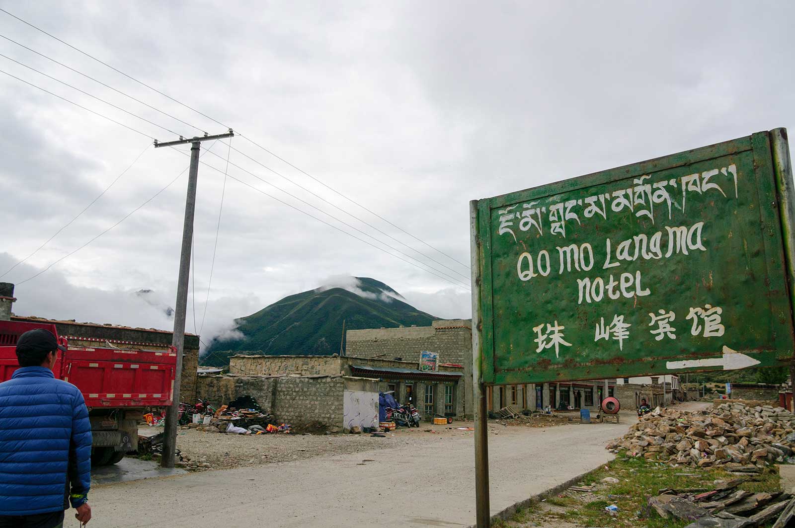
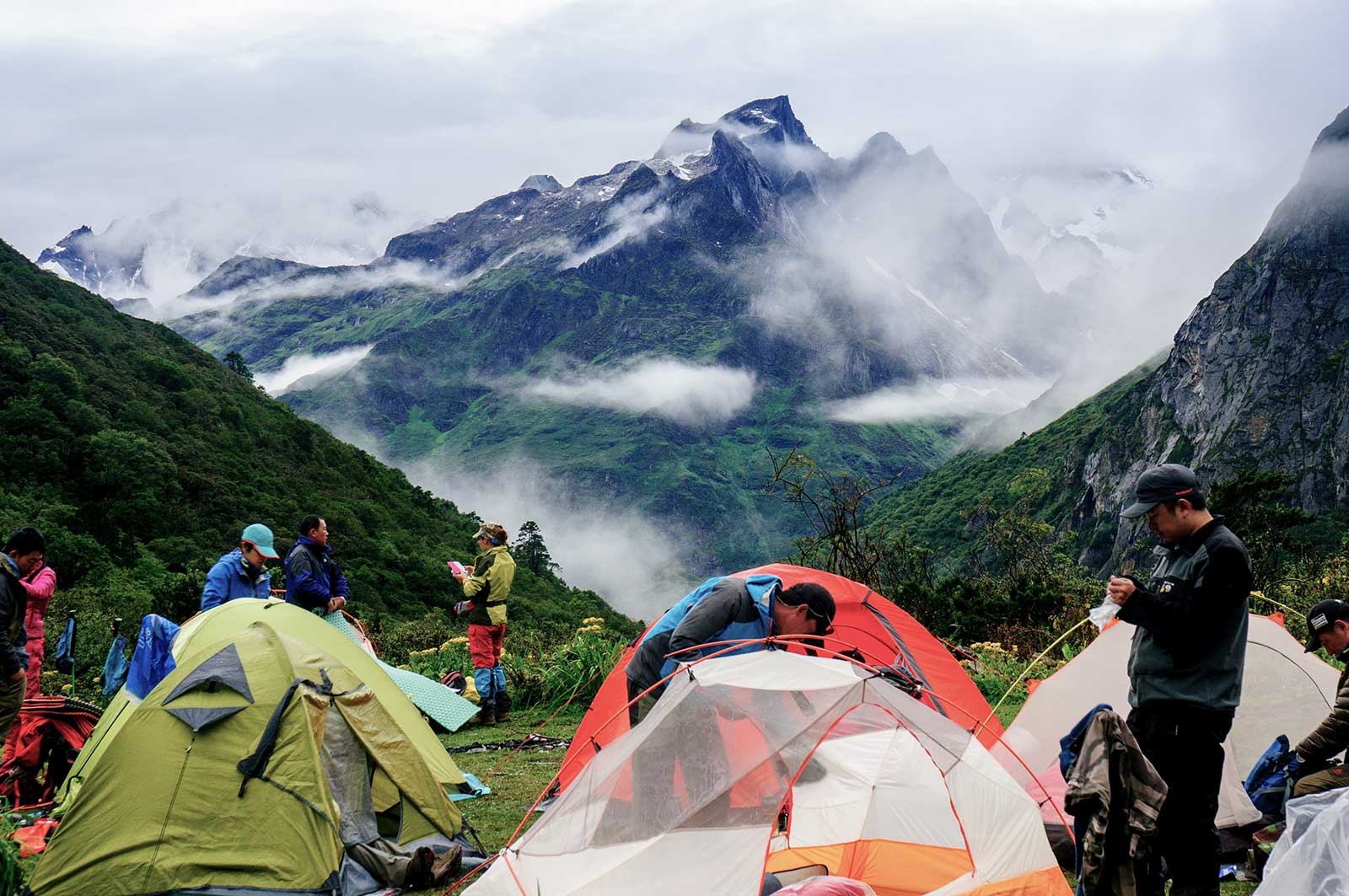
Our neatly packed gear lay outside the Everest Hotel. This was the first Himalayan expedition for most of us, and everyone was visibly excited. As Mingyue had said, the Everest East Face-Kama Valley route is a hallowed trail, an experience that would repeatedly surface in our lives and profoundly influence us. The trip had just ended, but its impact was already evident.
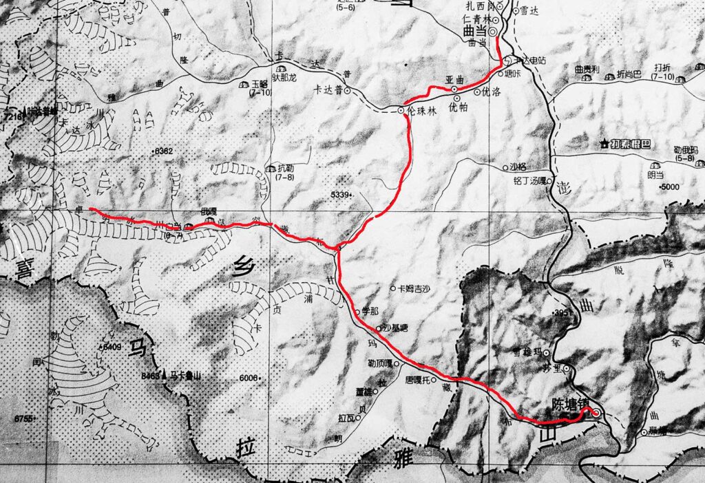
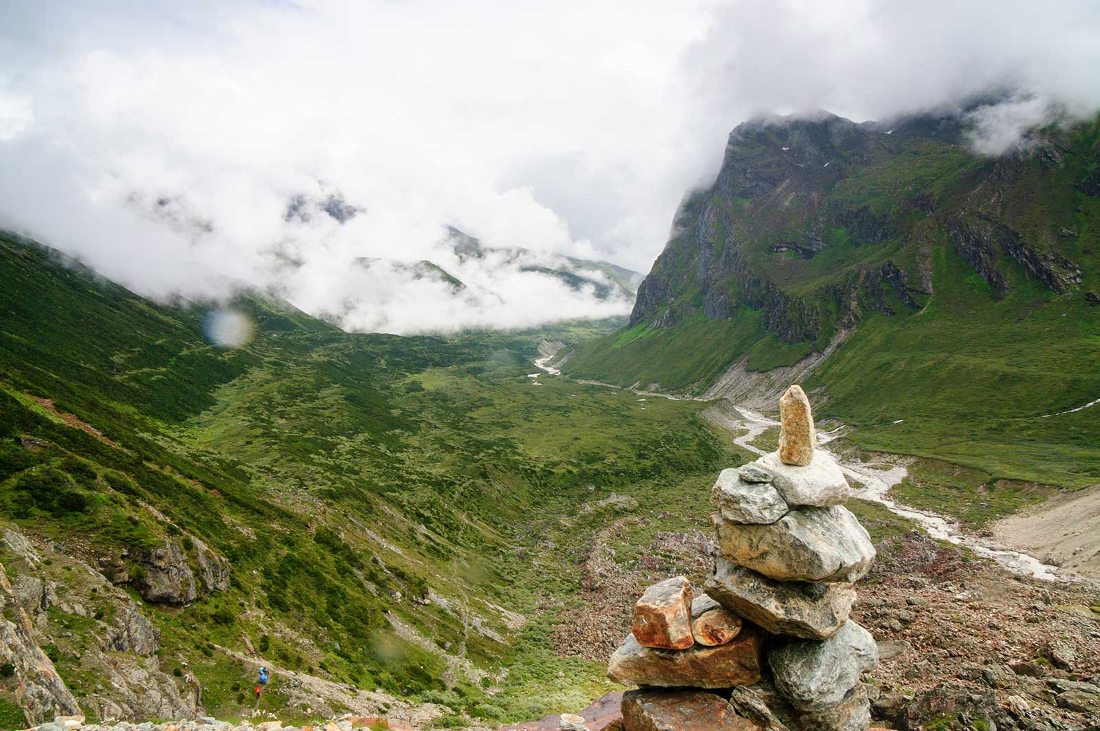
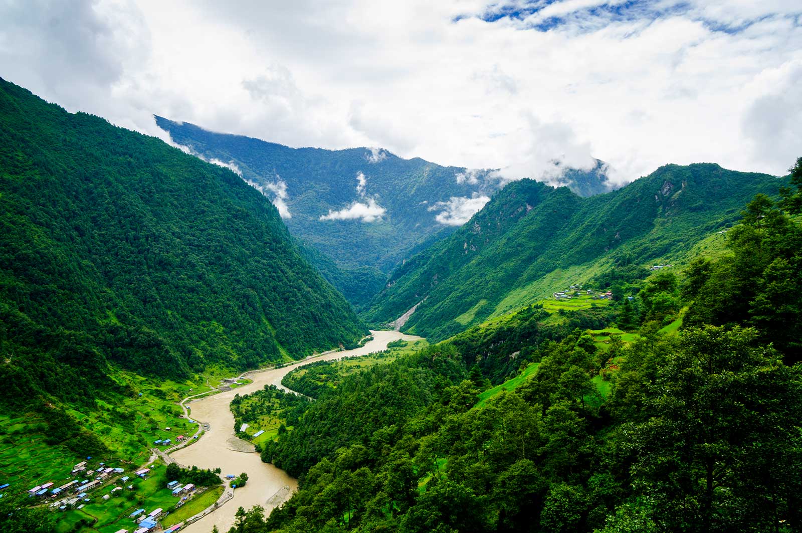
The route began in Qudang Township, Dingri County, following the Kadapu River upstream through Lunzhulin Village, then southward over the Langmala Pass (5,339 meters), past Tangxiang (4,500 meters), across the Kama Tsangpo River into the Zhuoqu Tsangpo and Zhuoqu Glacier area (4,200-5,300 meters), through the Badang, Ega, and Baidang pastures, crossing a tributary of the Zhuoqu Tsangpo, returning to Tangxiang from the Everest East Face Base Camp, then entering the Kama Valley (Kama Tsangpo Basin) via Zhuoxiang. Along the way, we passed Rega, Xuena, Shajitang (3,600 meters), Xiaowumi (3,000 meters), and numerous seasonal pastures, the Kama Tsangpo Glacier (Makalu and Everest East Face Glacier) outlet, and the Makalu South Face Glacier outlet, finally reaching Chentang Town (2,500 meters) in Dinggye County, the only Sherpa settlement in China, located on the Sino-Nepalese border. The entire journey spanned 111 kilometers and took 9 days and 10 hours.
Itinerary:
Day 1: Qudang Township – Lunzhulin Village (3,907 meters) – Xuemala (nearest campsite to Lunzhulin) – Lhatse (4,800 meters)
Day 2: Lhatse – Langmala Pass (5,400 meters) – Tsho Sholma (4,750 meters) – Tangxiang Hut (4,500 meters)
Day 3: Heavy rain, rest day
Day 4: Tangxiang Hut – Kama Tsangpo Bridge (4,200 meters) – Badang (4,300 meters) – Ega (4,600 meters) – Baidang (Peidangrenmu, 4,800 meters)
Day 5: Baidang – Everest East Face Base Camp (5,200 meters) – Baidang
Day 6: Baidang – Ega – Badang (4,300 meters) – Kama Tsangpo Bridge (4,200 meters) – Tangxiang Hut (4,500 meters)
Day 7: Tangxiang Hut – Shanong (4,220 meters) – Zhuoxiang (4,000 meters)
Day 8: Zhuoxiang – Rega – Luobai (3,650 meters) – Shajitang (3,620 meters)
Day 9: Shajitang – Naisangba (3,340 meters) – Ripu (3,100 meters) – Xiaowumi (3,080 meters)
Day 10: Xiaowumi – Wobalong (2,960 meters) – Danmudan (2,900 meters) – Guolapu (2,720 meters) – Zhaxiladuo (2,680 meters) – Chentang Town (2,500 meters) – Pengqu River Bridge – Zangga Village (2,200 meters)
Note: The pasture locals call Baidang is the closest campsite to Everest Base Camp, referred to as Peidangrenmu by the government. The place locals call Badang is called Baidang by the government. Be mindful of the distinction.
Day 1: August 13 – Qudang Township – Lunzhulin Village – Xuemala – Lhatse
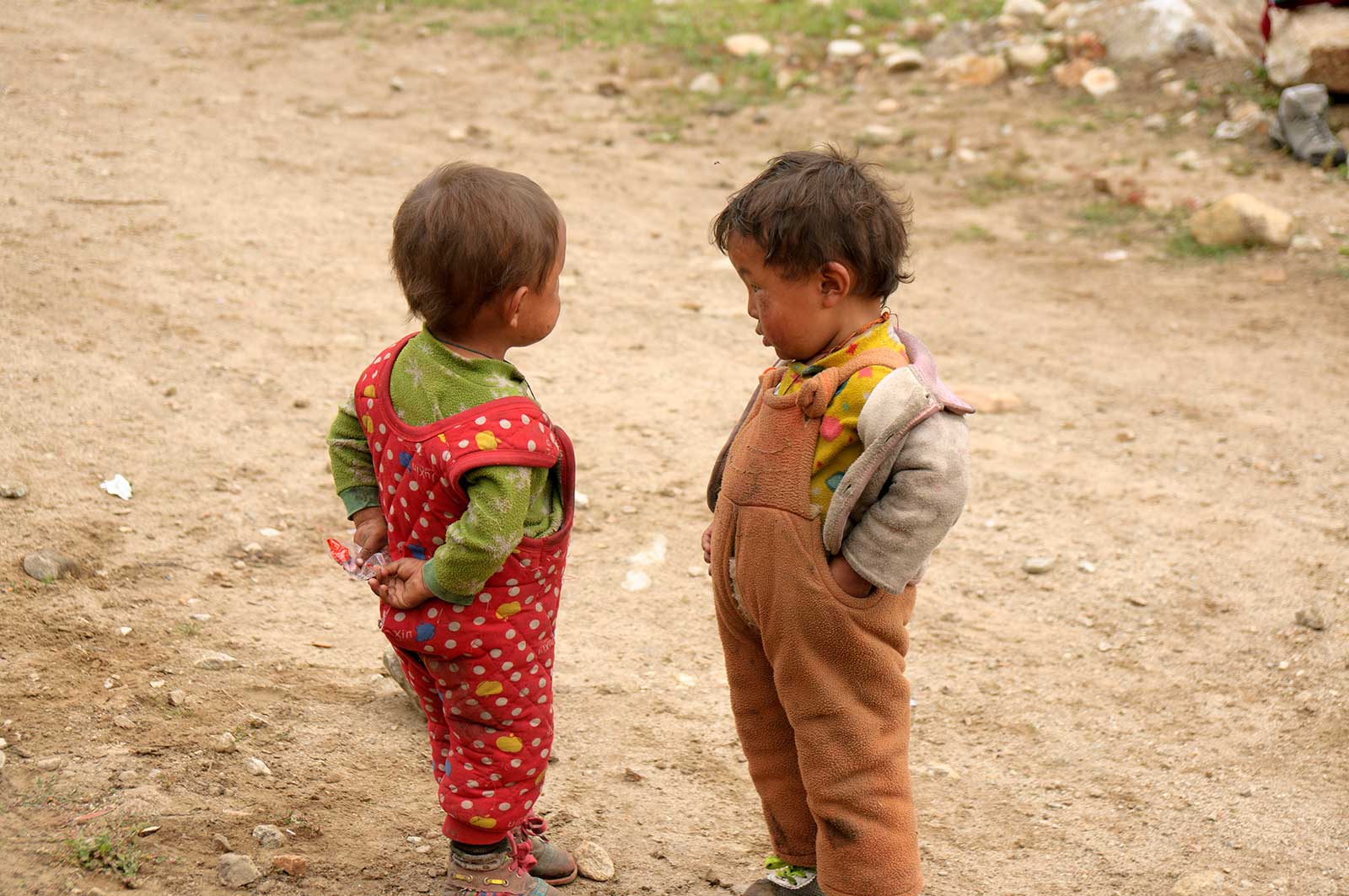
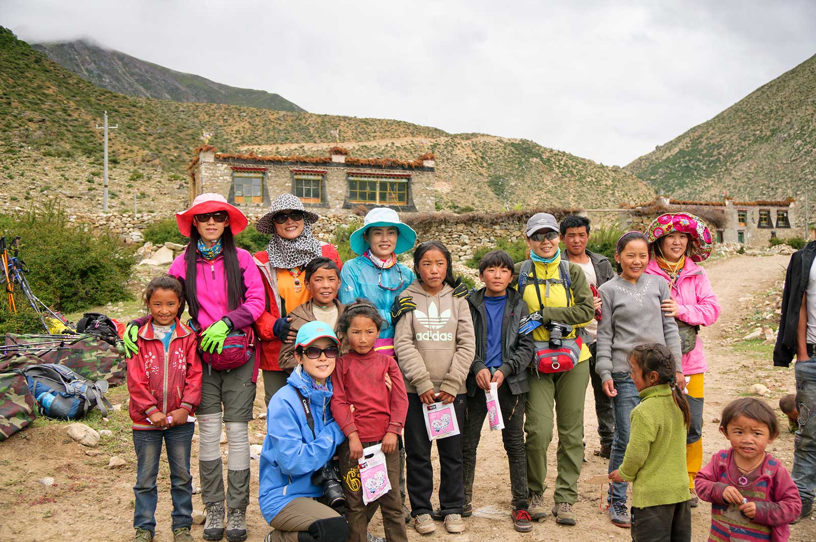
We woke at 8 AM, had breakfast at a Sichuan restaurant opposite the Everest Hotel, and took a truck to Lunzhulin Village for 350 yuan. The yak herders were late, so we called the village secretary, who informed us that one yak had wandered off, leaving only seven. Another yak was brought from Lunzhulin Village, but we didn’t set off until 2 PM. Village children surrounded us, begging for candy, not even going home for lunch. One child had a large gash on his head but stopped crying after a while. I disinfected the wound and applied ointment.
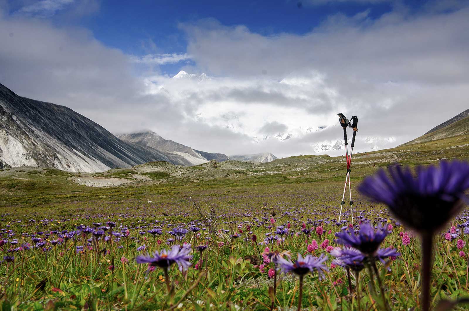
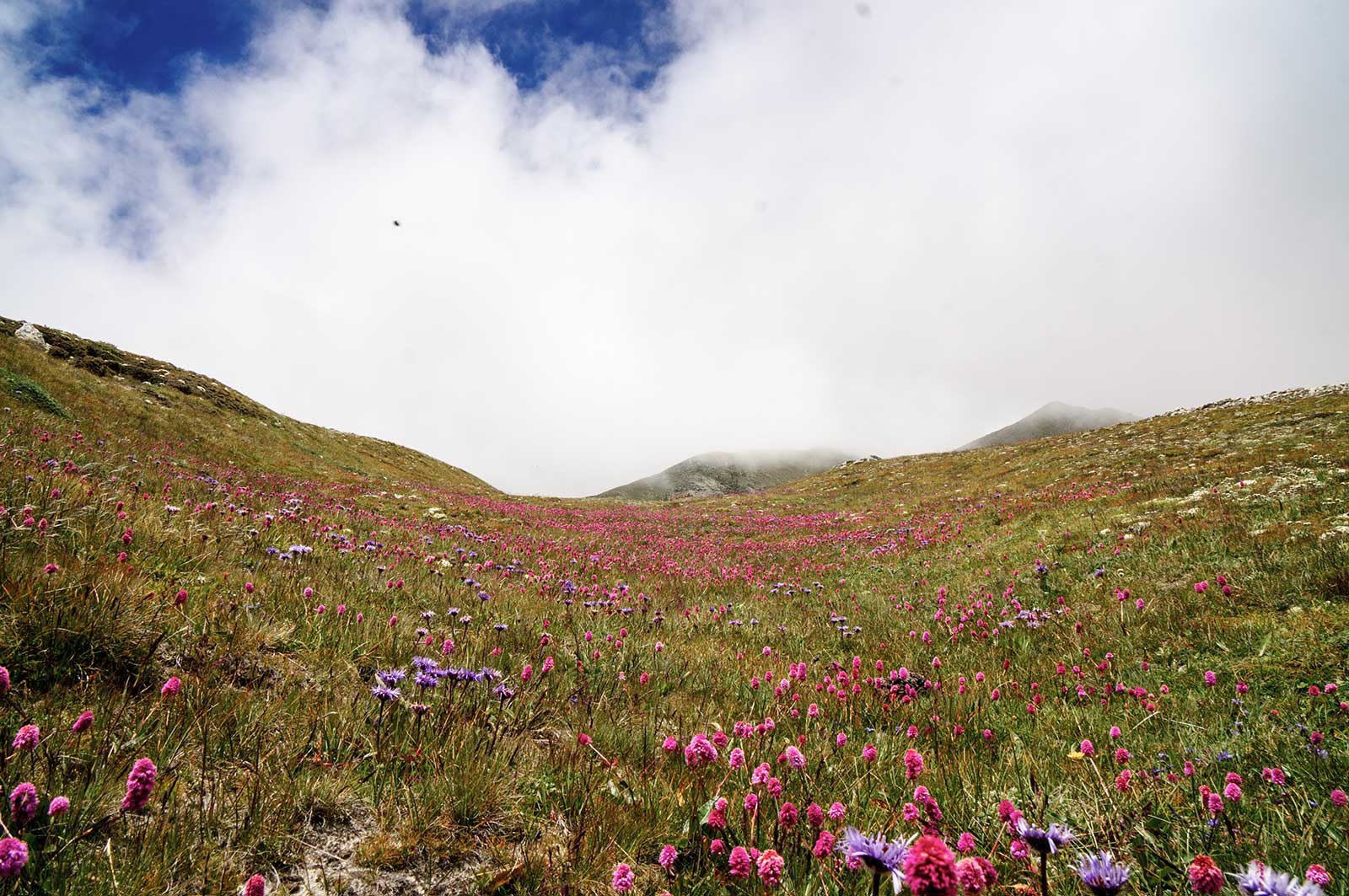
The mountain trail was beautiful, lined with wildflowers, and everyone was excited. We arrived late, drenched by heavy rain, and too exhausted to eat. Mingyue, Feiyang, and I fetched water and cooked porridge to stave off hunger.
Lunzhulin is a poor, primitive village. The children seemed to have little parental supervision. They appeared to skip lunch and would go anywhere they thought might have food to beg for something to eat.The cradle local women carry is fascinating, allowing them to work while rocking the baby.
To hire yak herders, you need to contact the local government, which is fully responsible for assigning tasks to qualified herders. At the time, the rate was 90 yuan per day. However, it’s important to note that the fee is not calculated based on the actual days of the trek but includes the herders’ return journey. For example, our trip lasted 10 days, but according to government regulations, our designed routes are approved as 14-day routes, resulting in a total fee calculated for 28 days.
Day 2: August 14 – Lhatse – Langmala Pass – Tsho Sholma – Tangxiang Hut
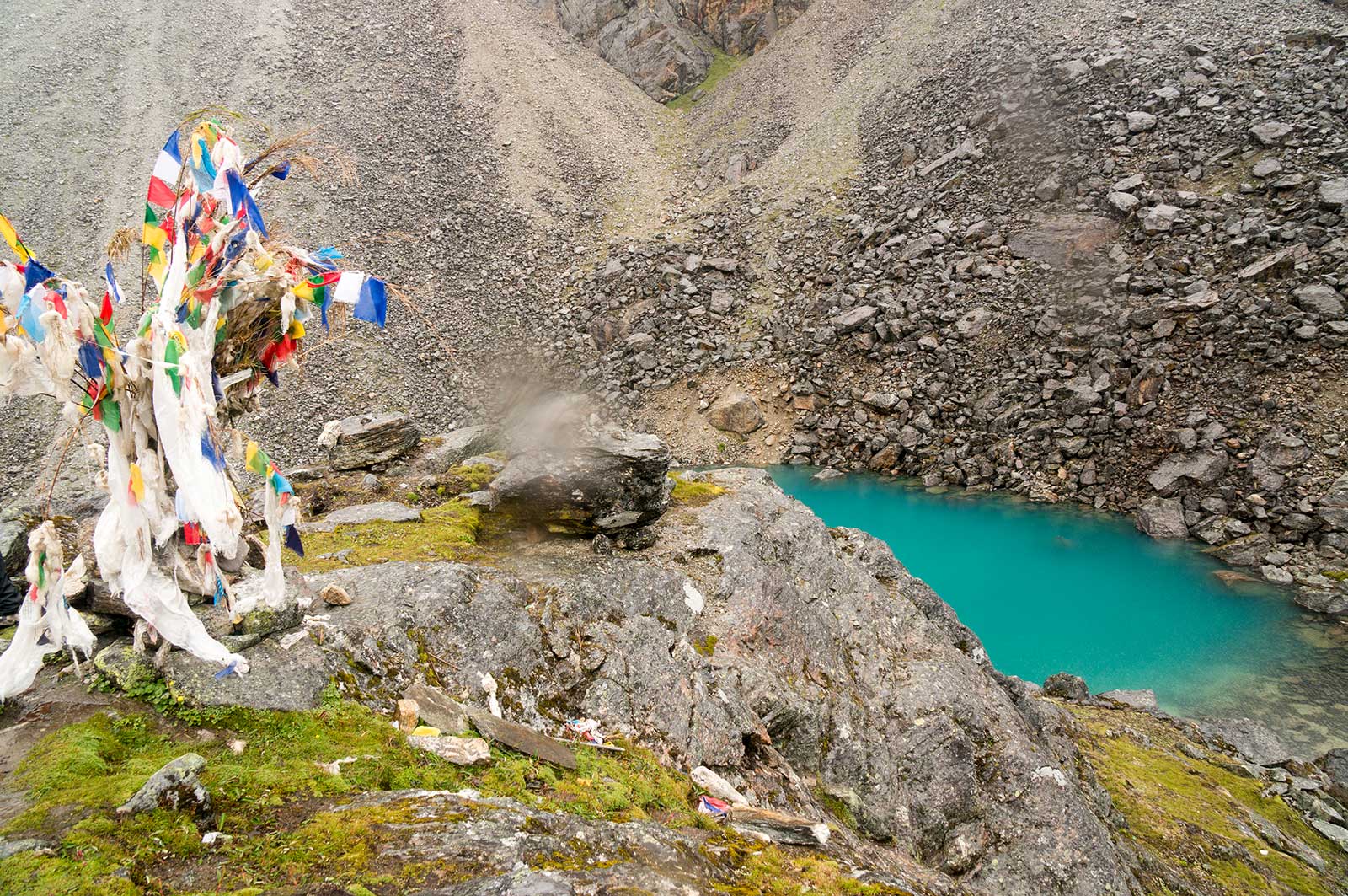
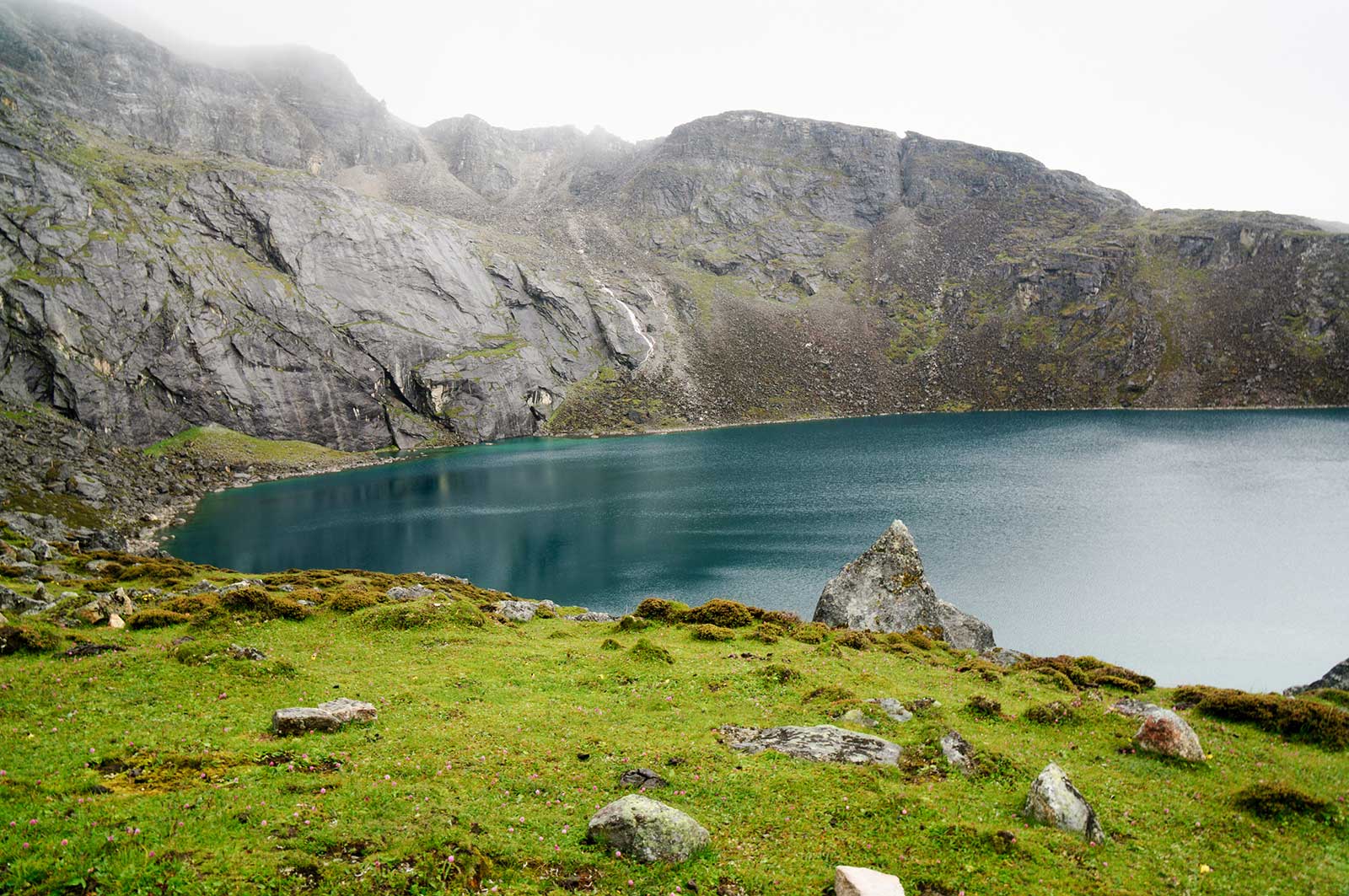
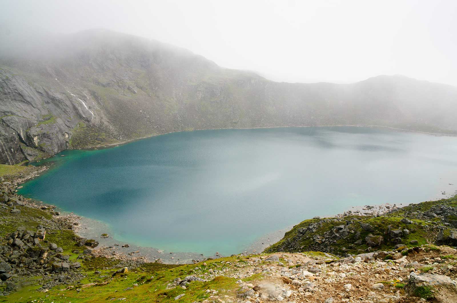
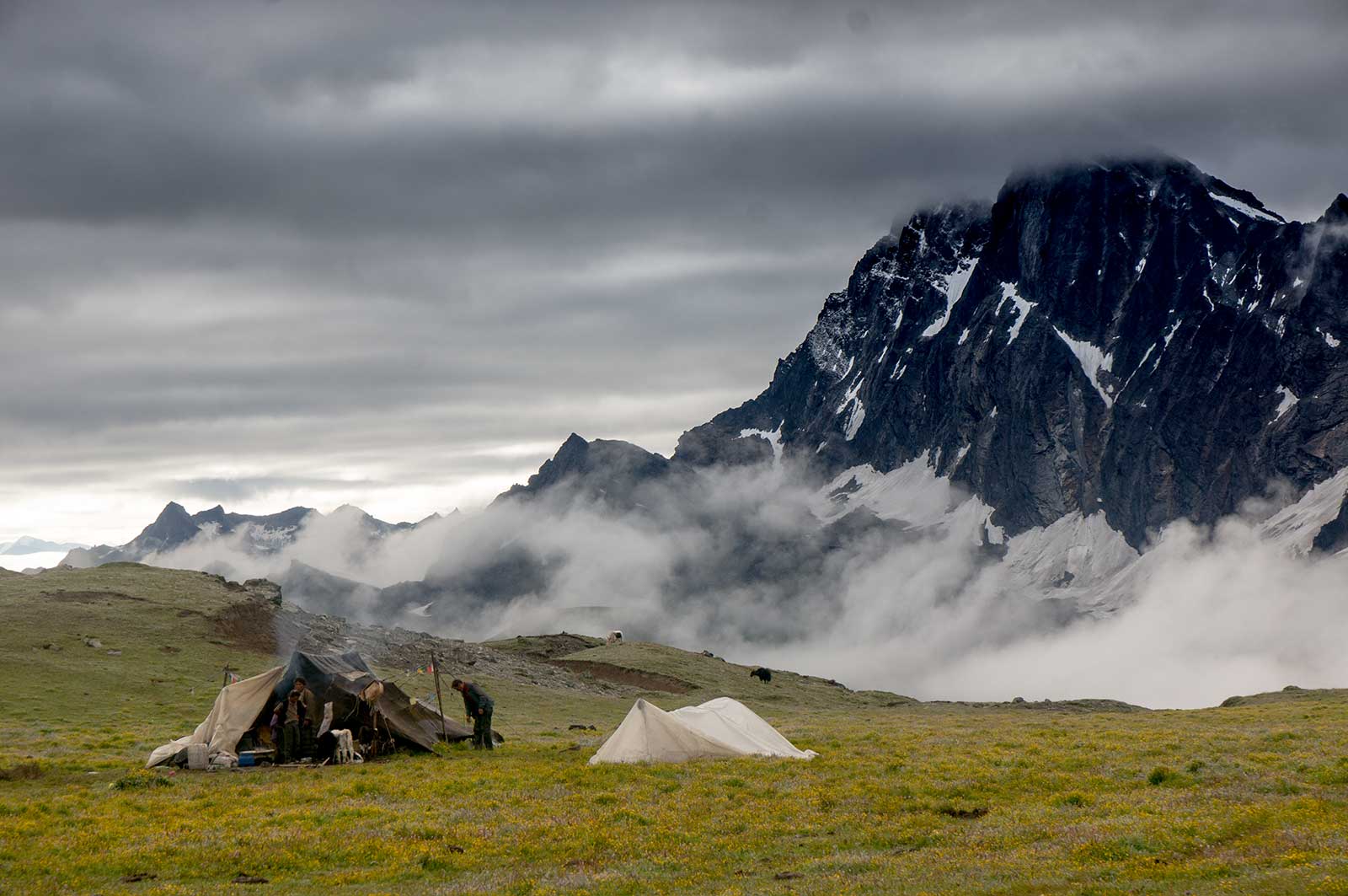
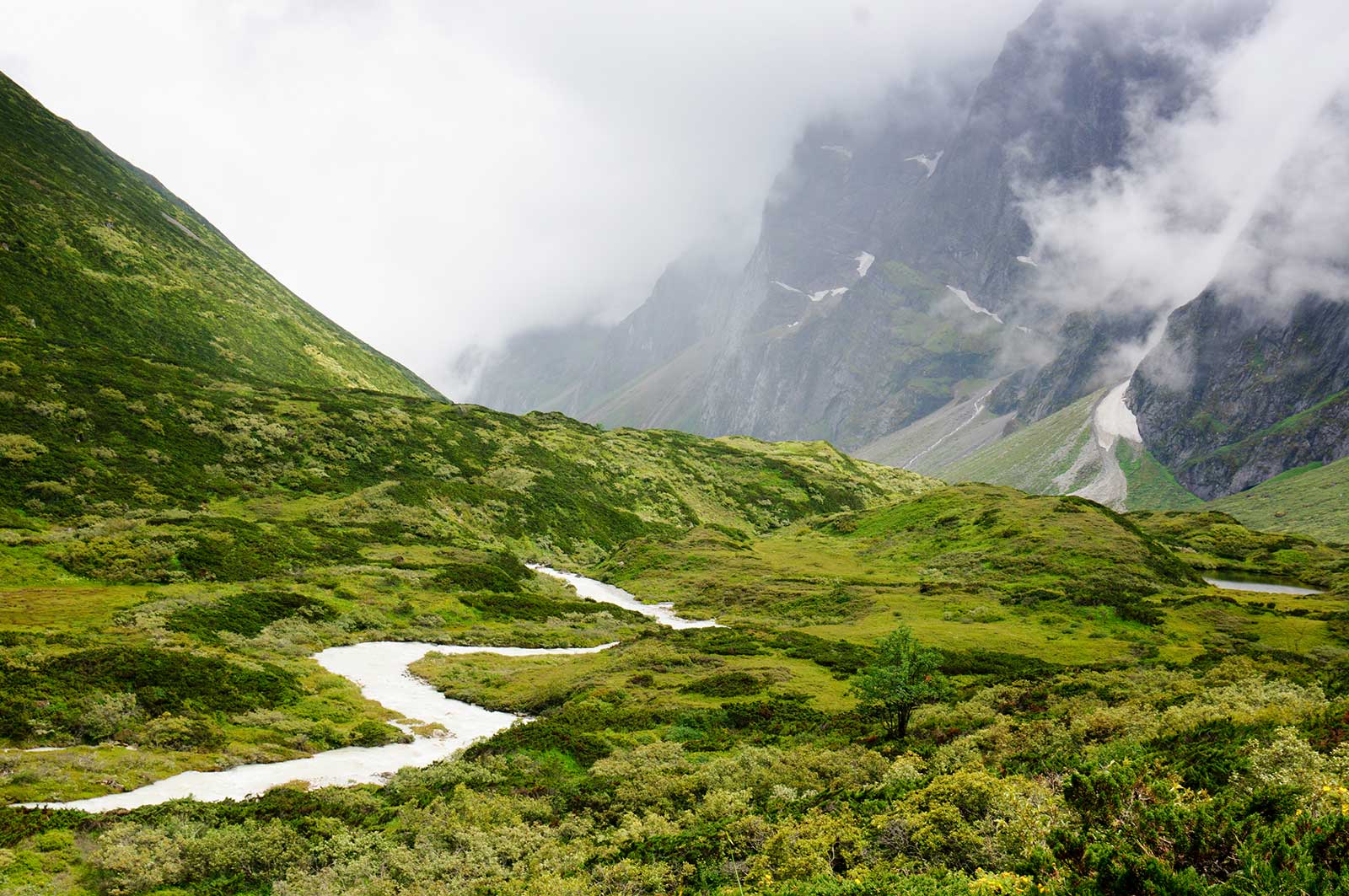
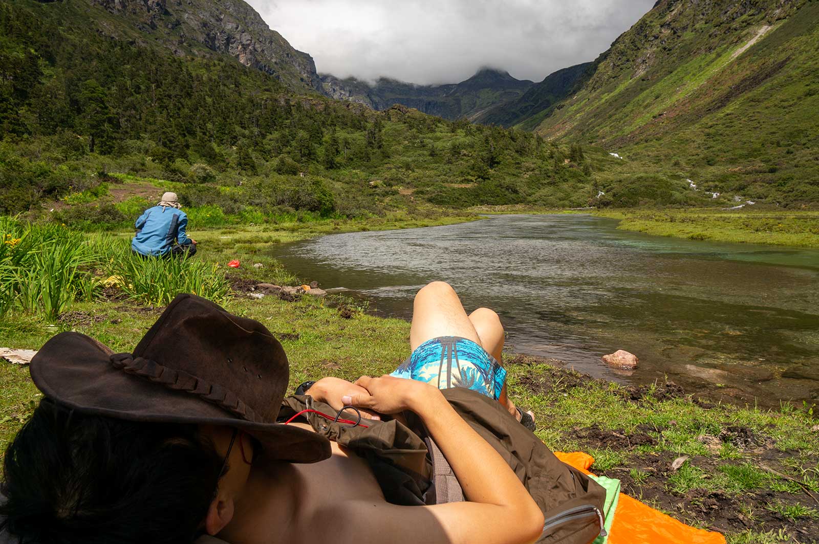
The rain continued. We met a group on a longer trek who had better weather. Our yak team had issues, delaying our start, likely due to load distribution disputes. They used a stone-throwing method to decide who carried what… Mingyue, Feiyang, and I set off last, following the yak team. Langmala Pass, at 5,400 meters, had several false summits. The weather was terrible—strong winds and icy rain nearly caused hypothermia. After the pass, we found a cluster of snow lotuses in a valley. Descending further, we saw four alpine lakes. We reached Tangxiang Camp around 9 PM, staying in a herder’s hut instead of camping.
Day 3: August 15
Heavy rain forced us to rest. Bored, I slept all day, earning the title “Sleeping God.”

Day 4: August 16 – Tangxiang – Badang – Ega – Baidang
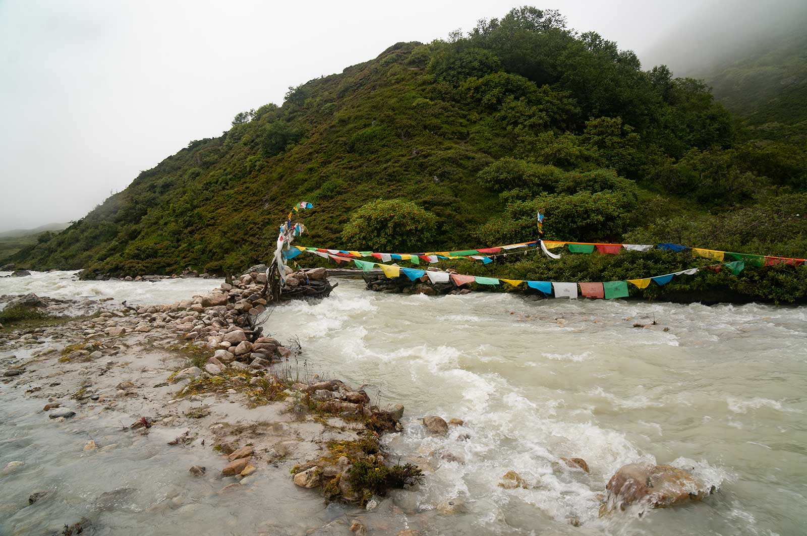
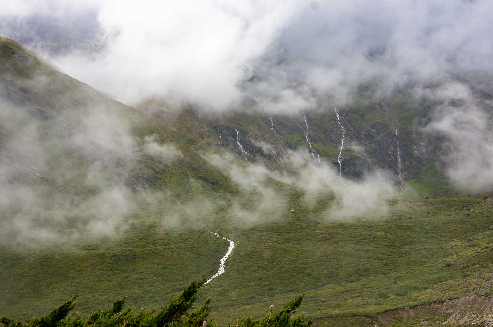
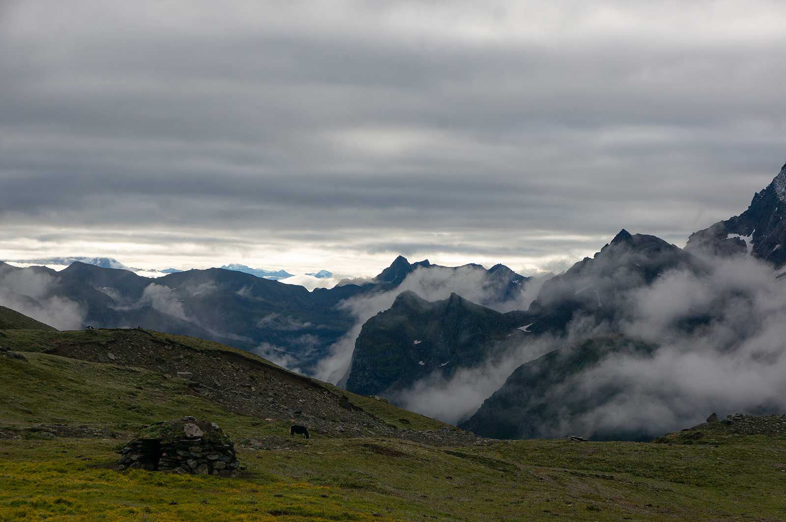
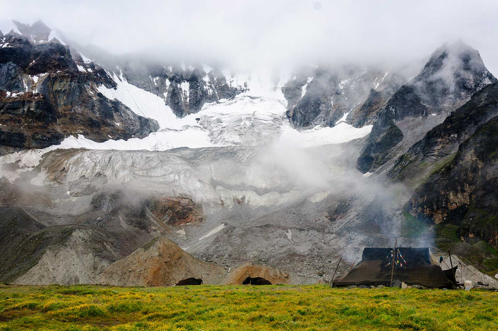
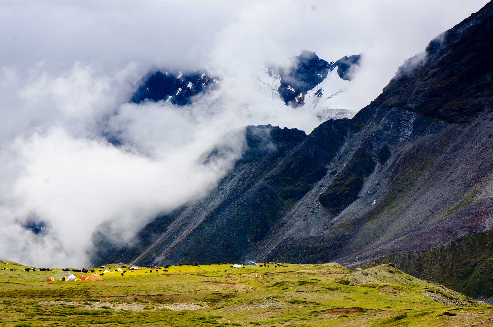
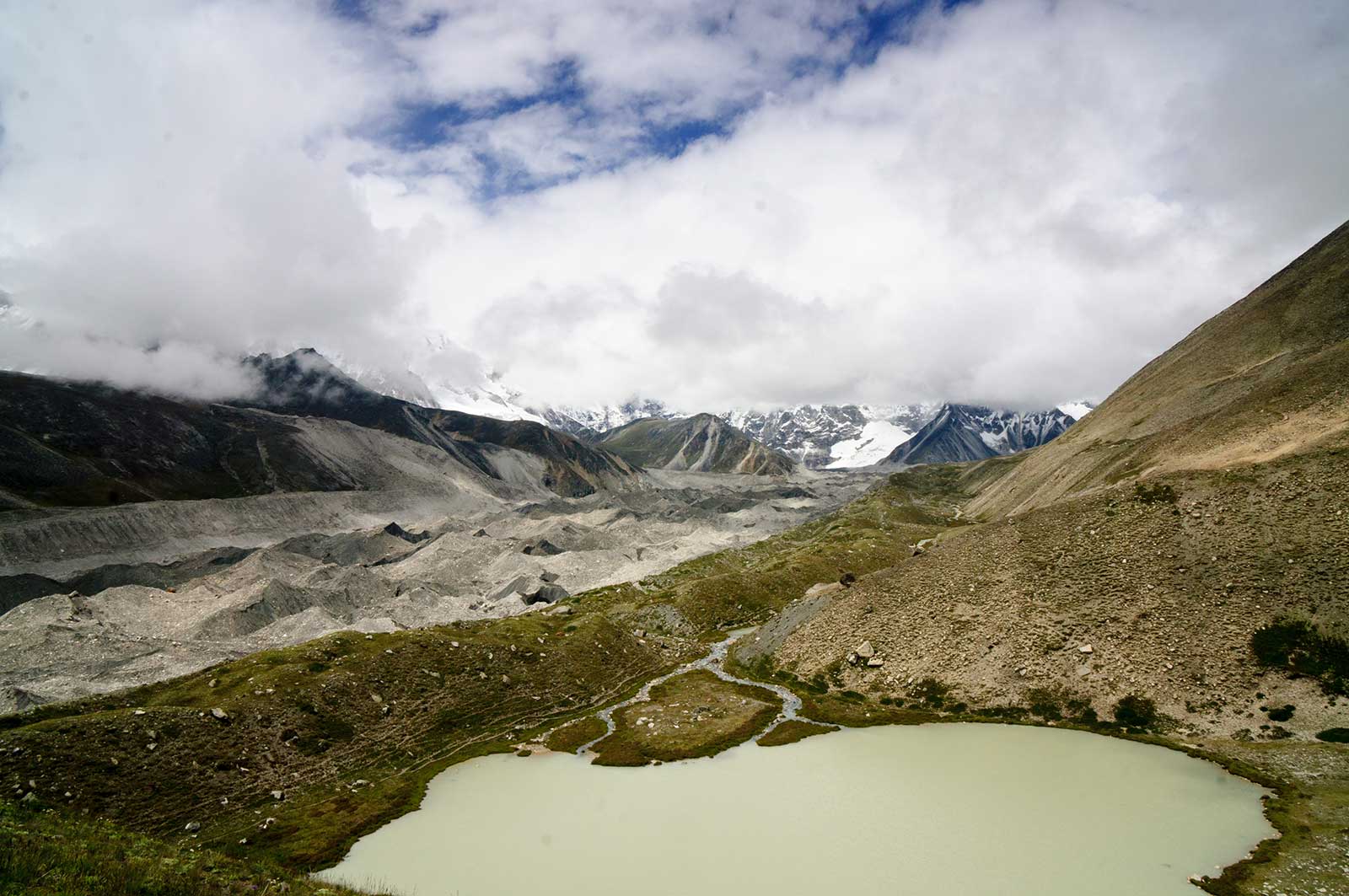
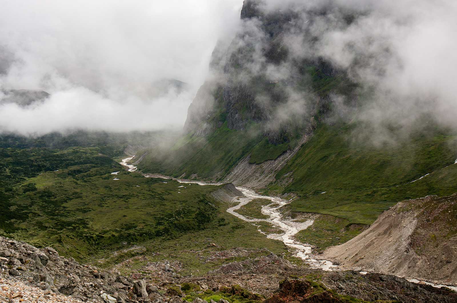
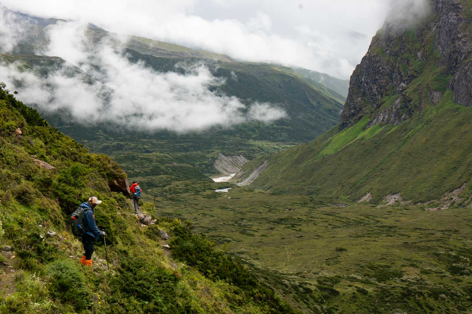
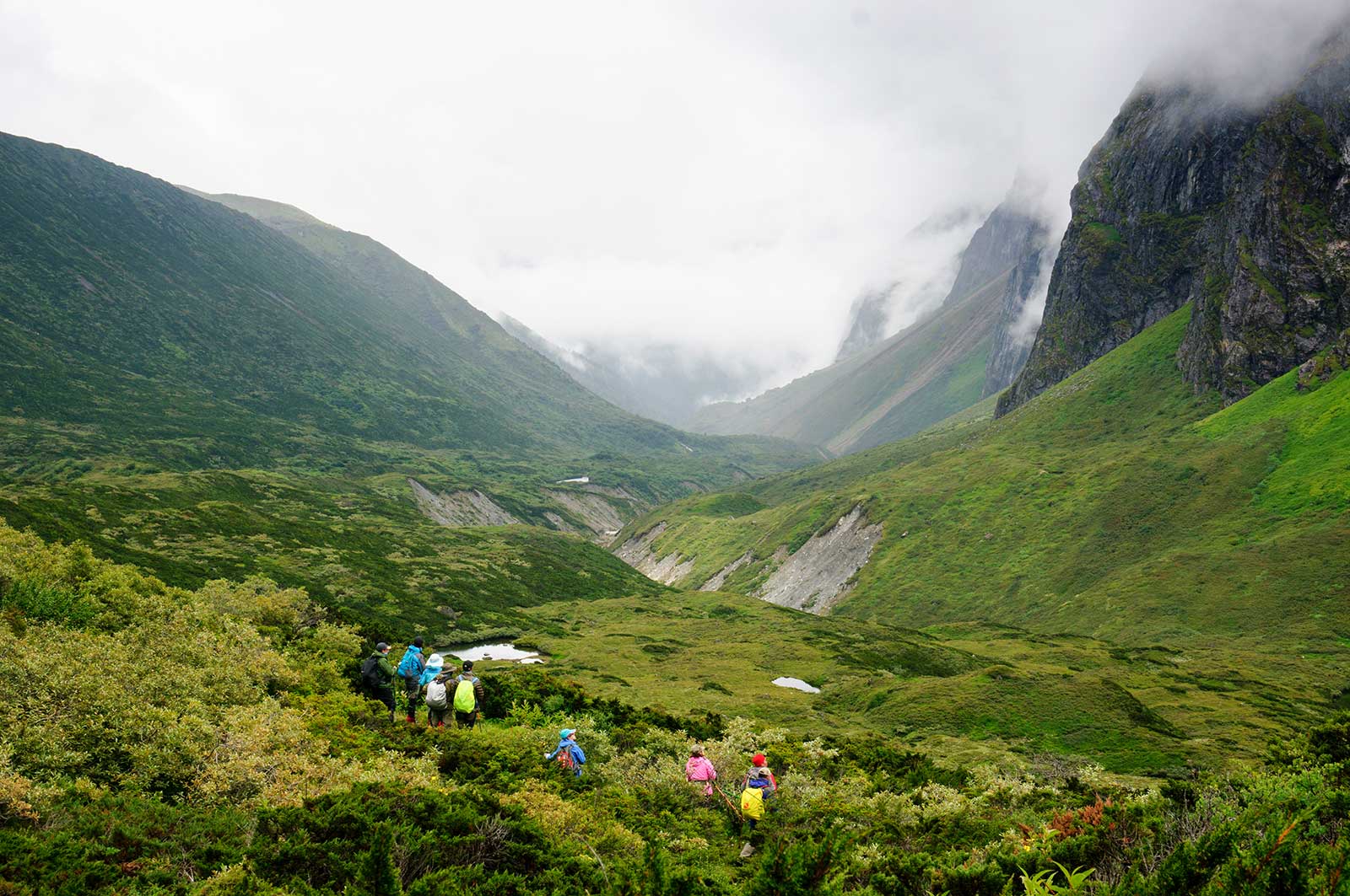
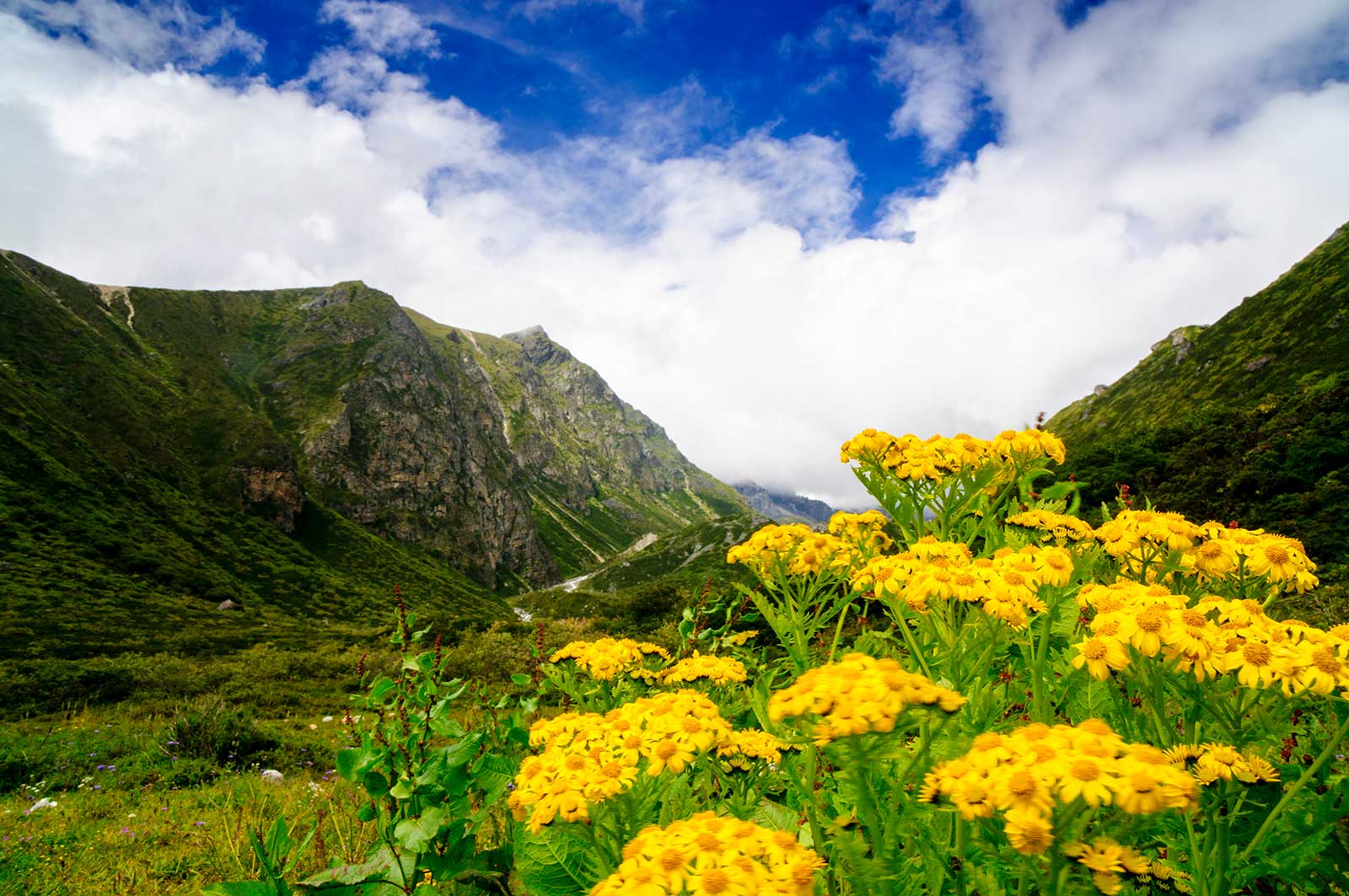
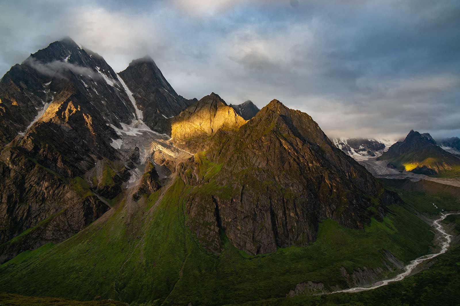
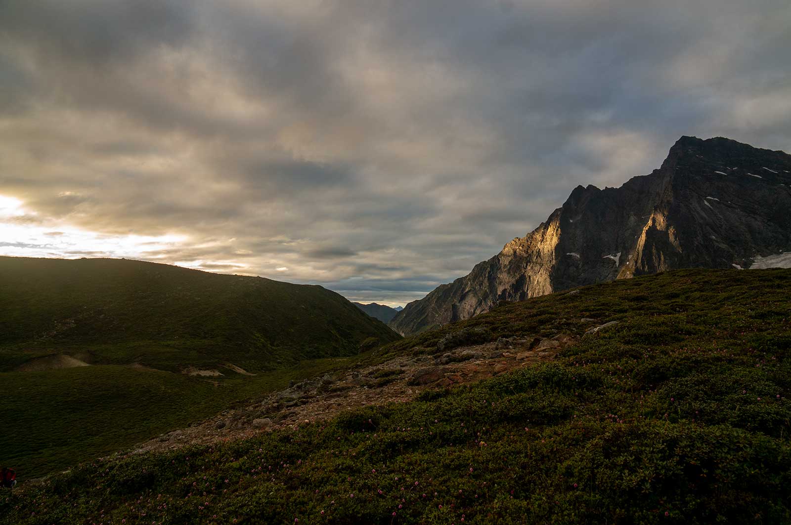
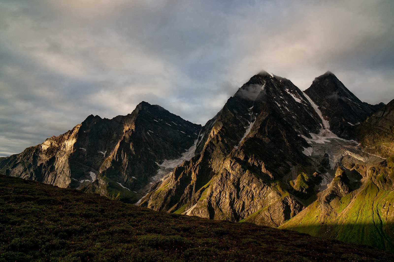
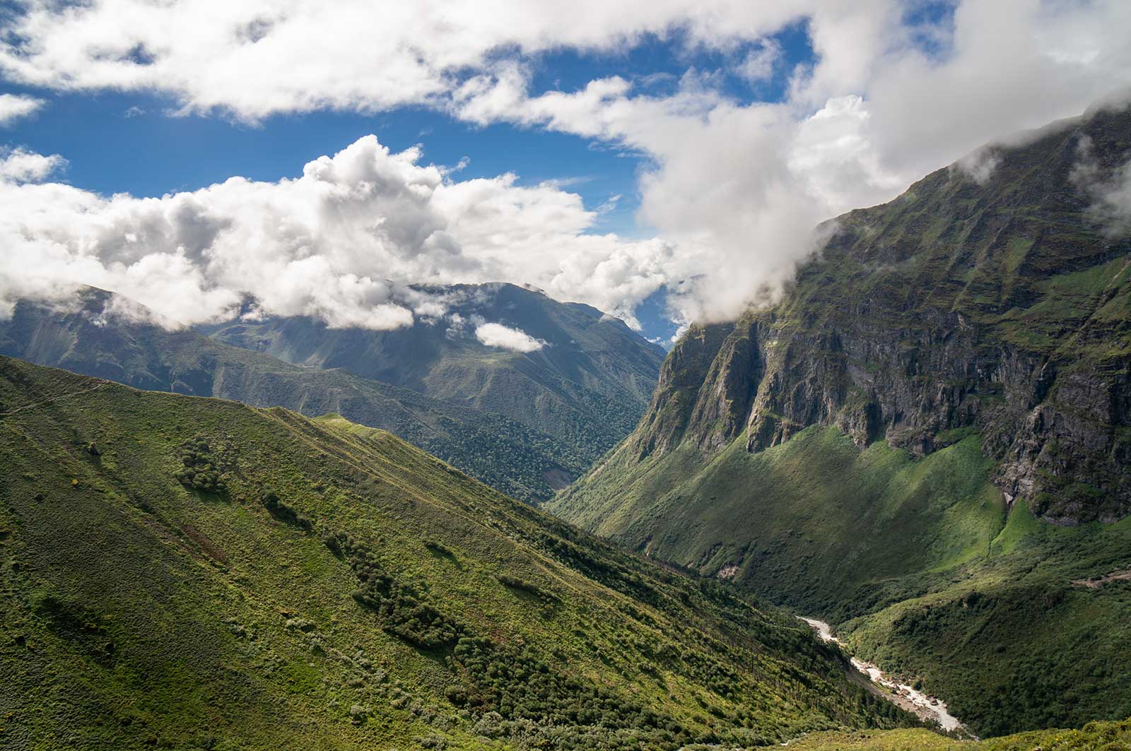
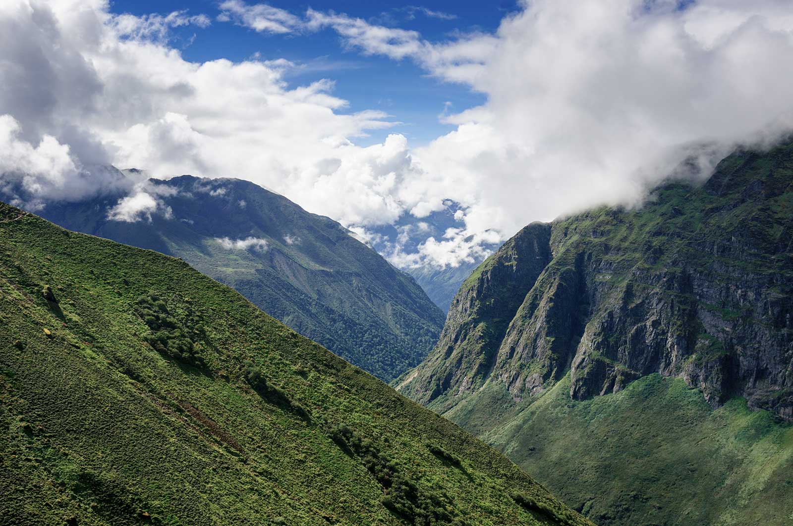
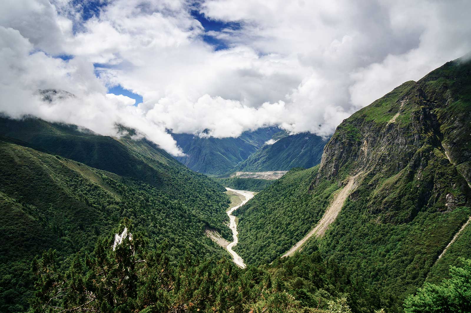
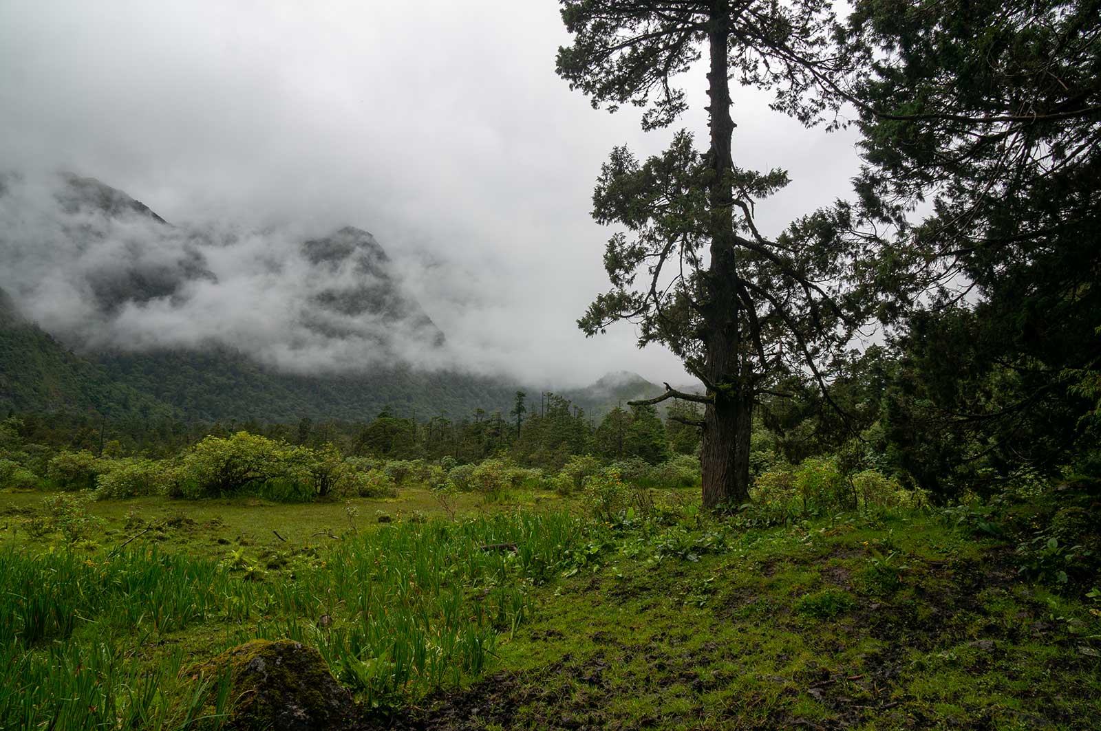
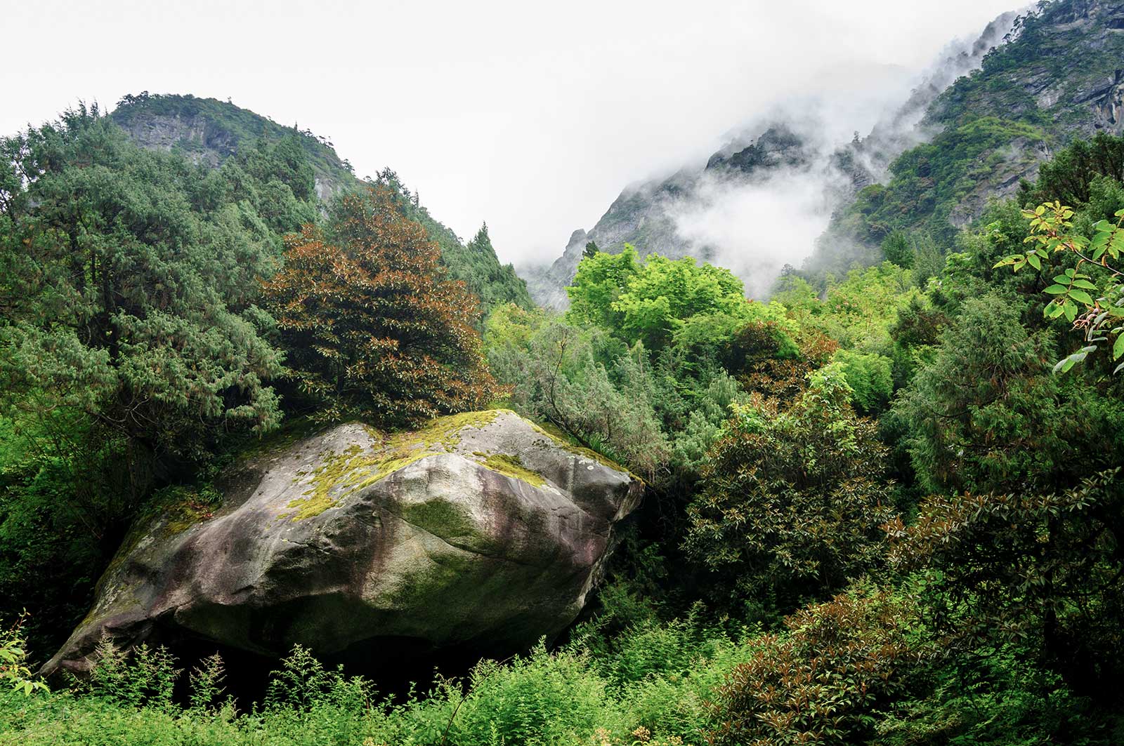
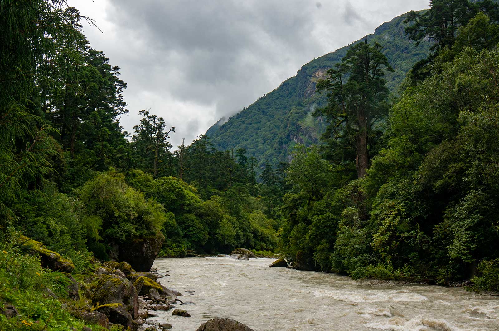
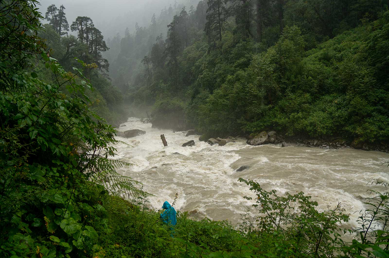
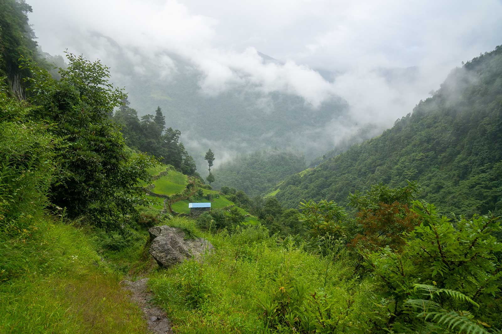
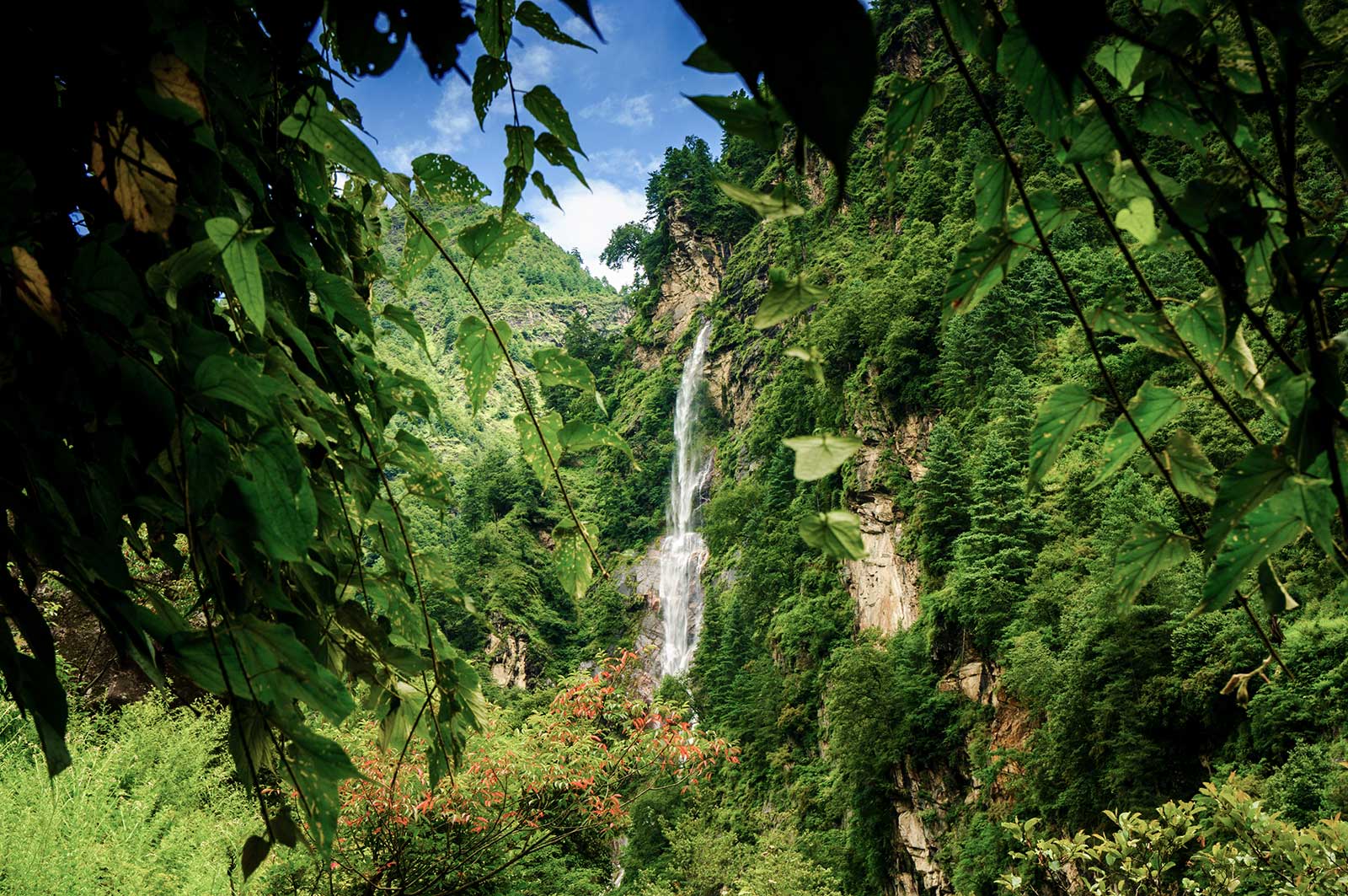
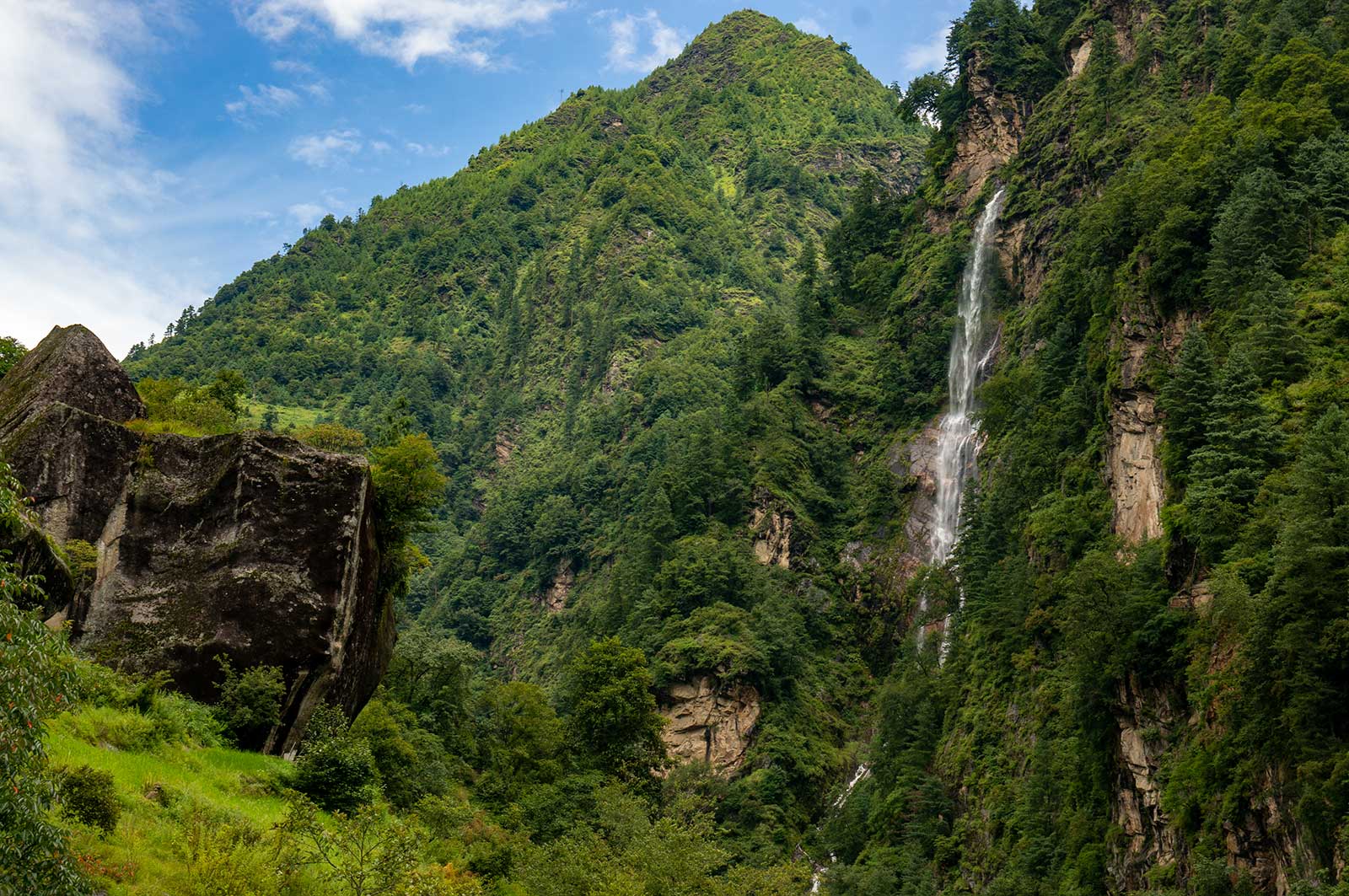
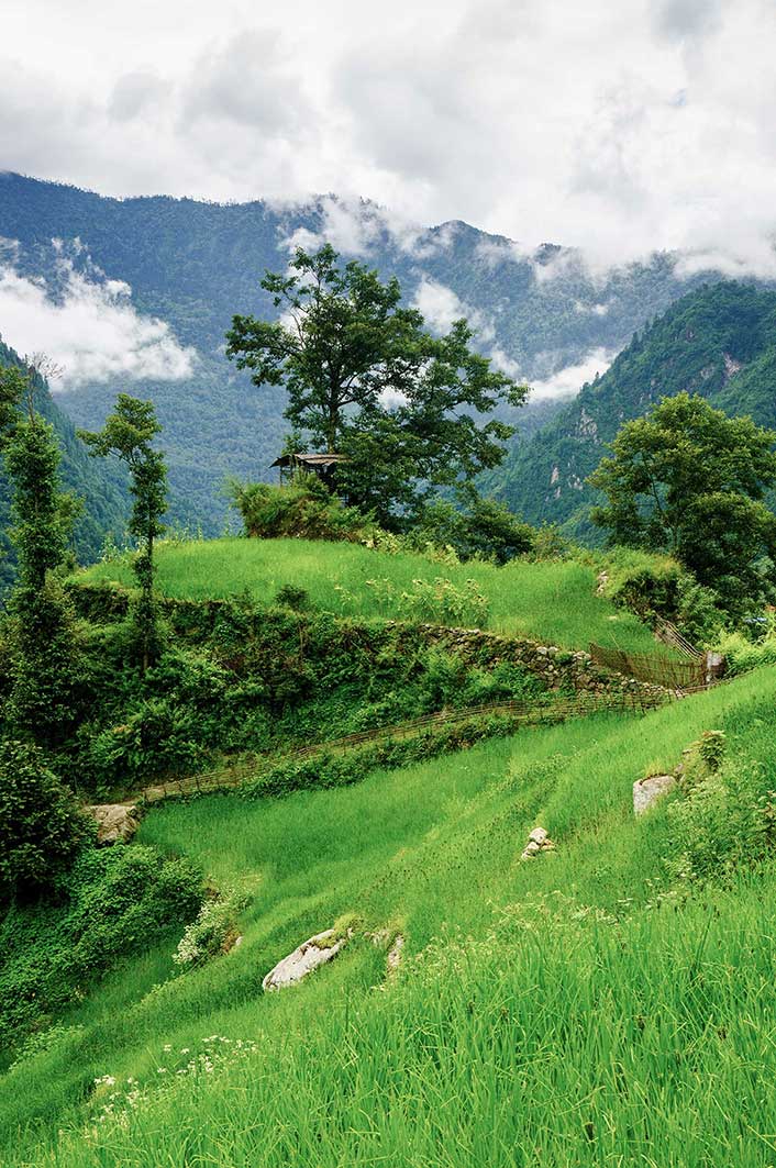
The rain lightened, and the clouds thinned. We decided to head to Baidang. As we descended, the roar of the Kama Valley’s waters echoed. The Kama Tsangpo River meandered through mist-shrouded mountains. Crossing a wooden bridge, we passed through dense shrubs, and the vegetation changed dramatically as we ascended. At 4,500 meters, we found a lingzhi mushroom.
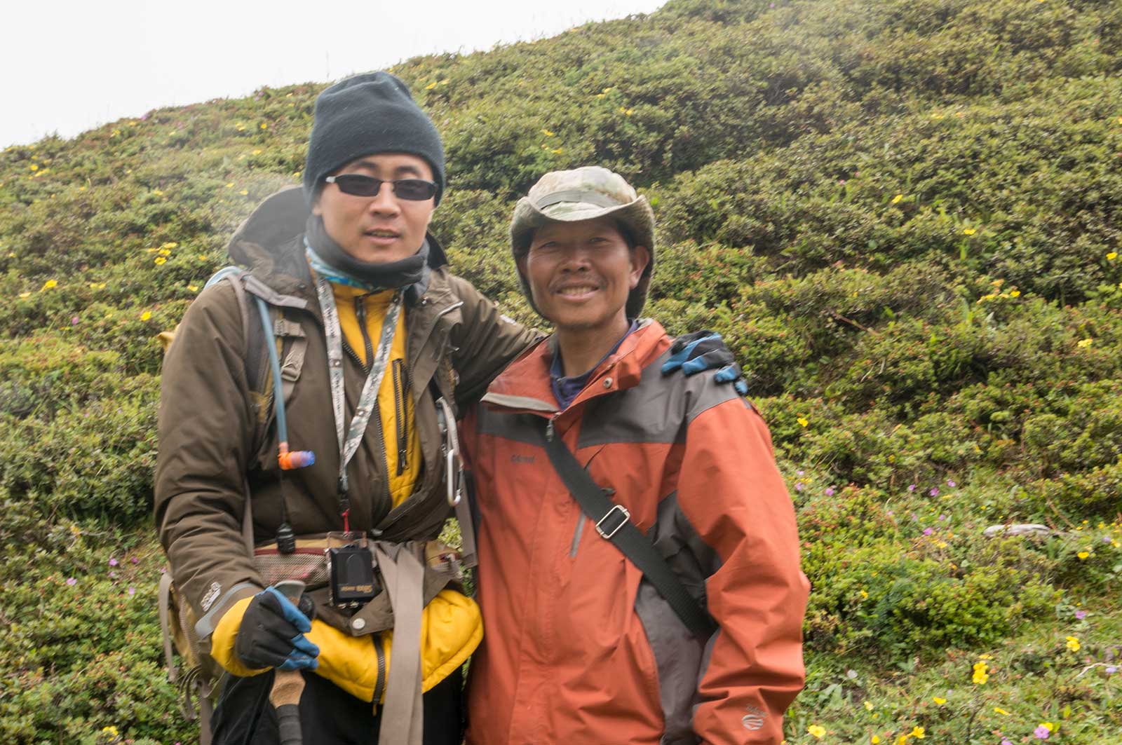
At Ega Camp, we met a solo traveler, Li Congming, trail name is “独孤骑者”Lone Biker, who had just crossed the Changtang Plateau with only a bike pack. A legendary cyclist.
We reached Baidang Camp as dusk fell. After a brief chat with Li, we learned he planned to traverse the entire Changtang. We then launched into a discussion about winter crossings of the Changtang uninhabited region. We agreed that such an expedition in extreme cold would require highly reliable gear and sufficient fuel. However, Li Congming was far more optimistic than the rest of us.
That night, yaks overran our camp, damaging my tent and stepping on me. In anger, I used pepper spray to drive them away, but the entire camp suffered, coughing fits echoing everywhere.

Day 5: August 17 – Baidang – Everest East Face Base Camp – Baidang
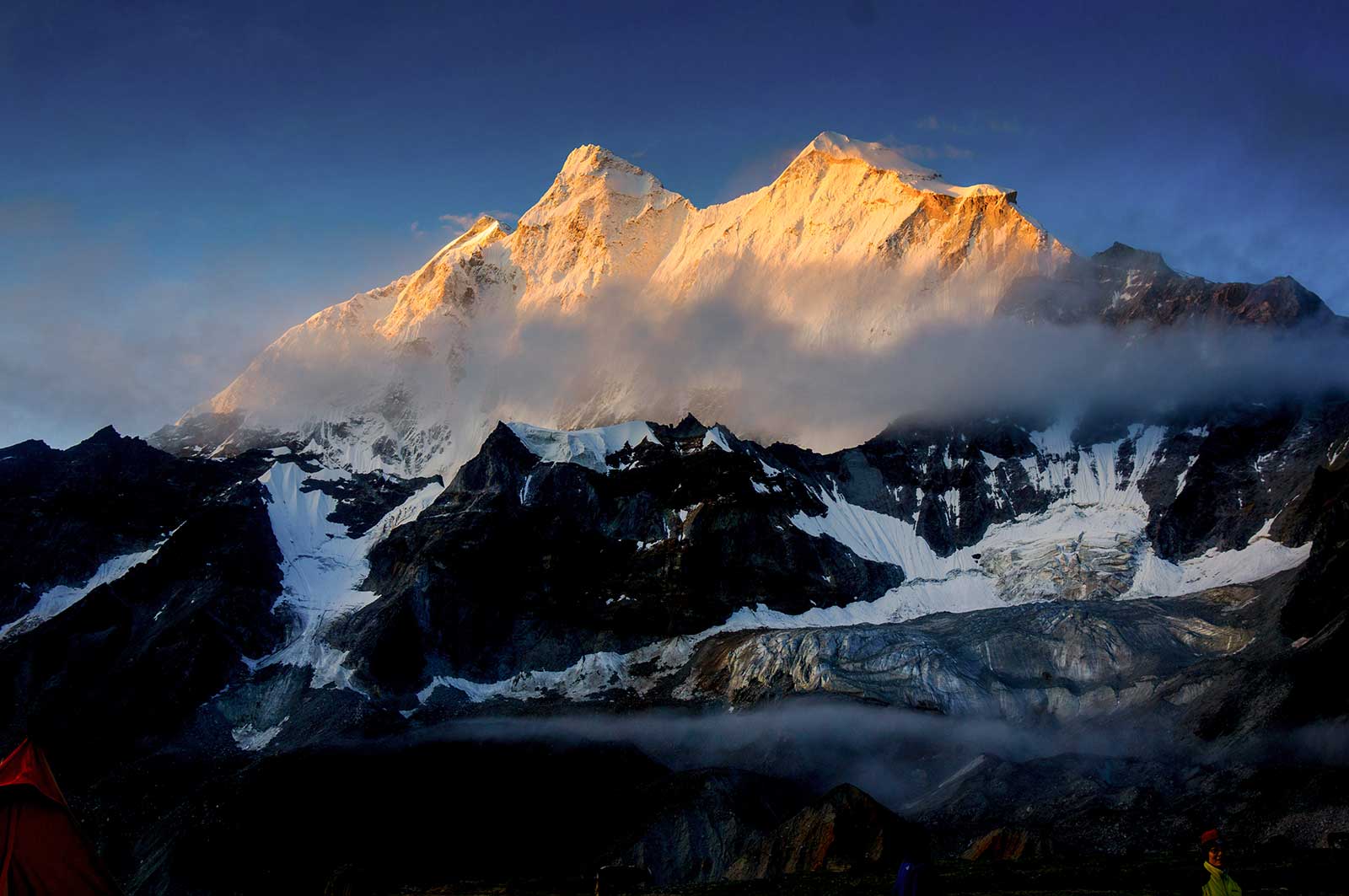
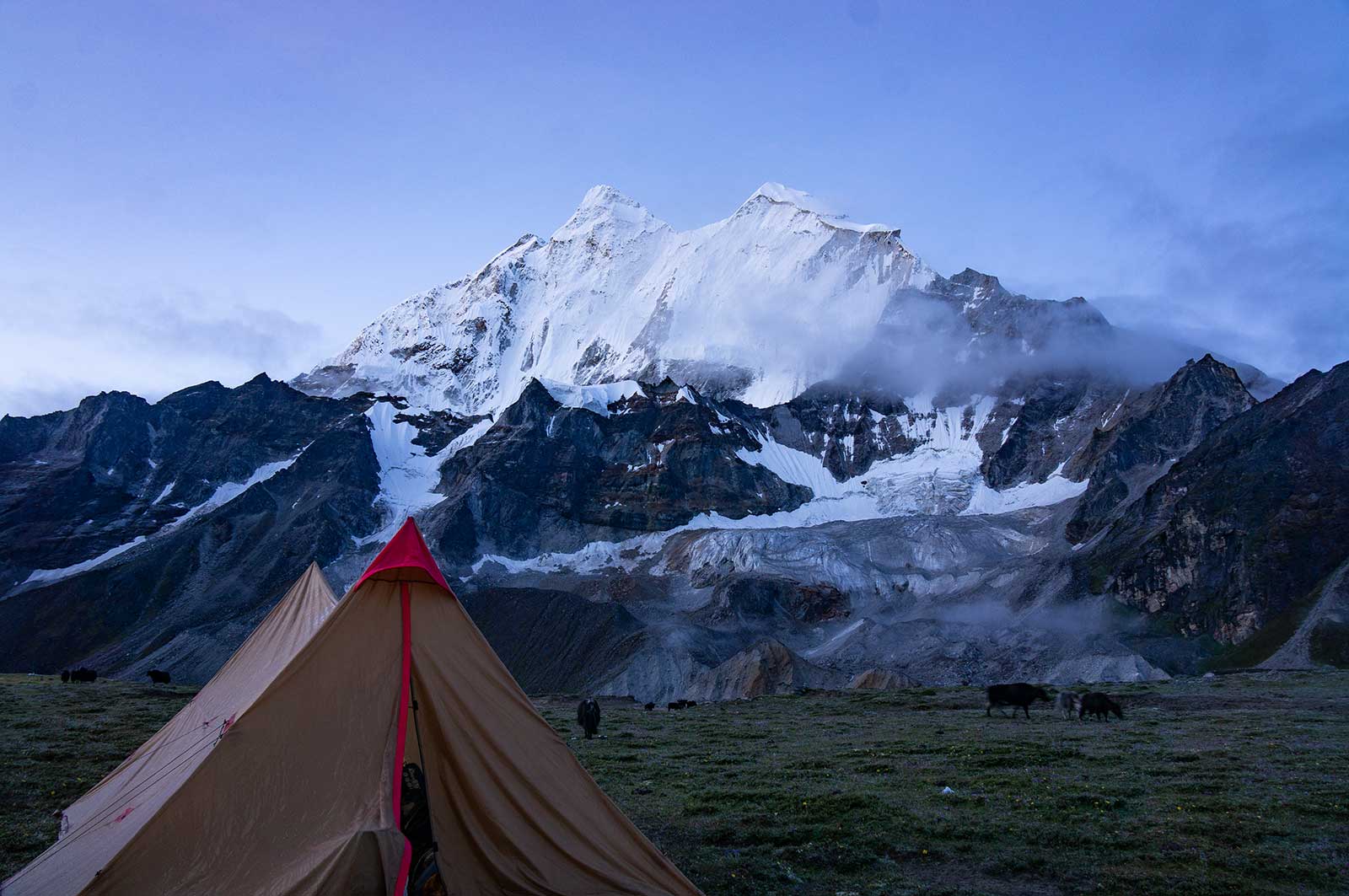
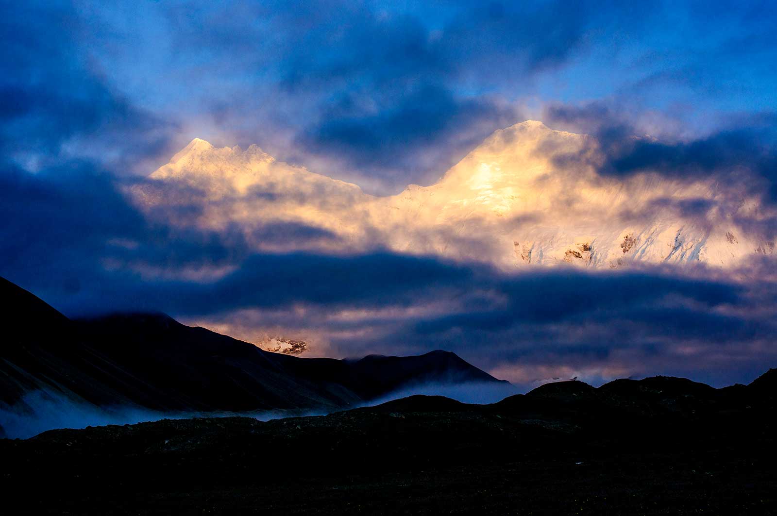
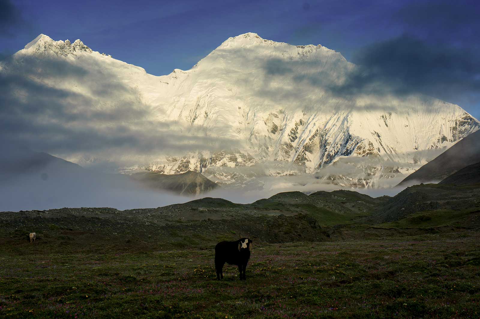
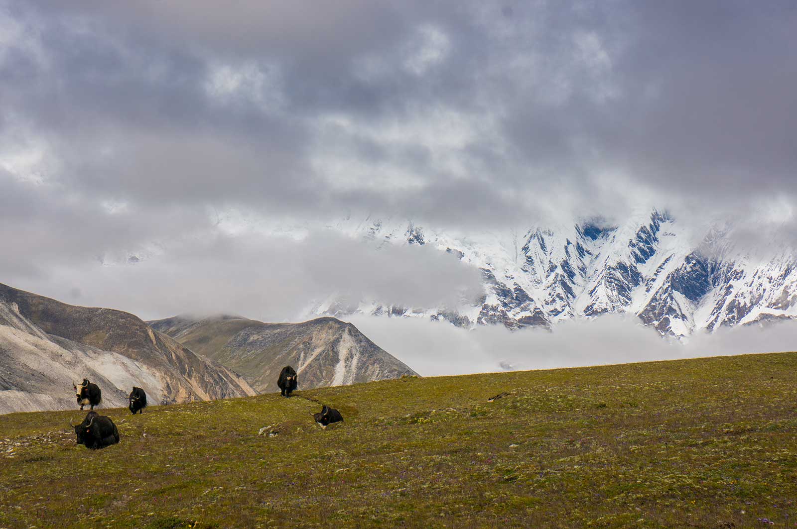
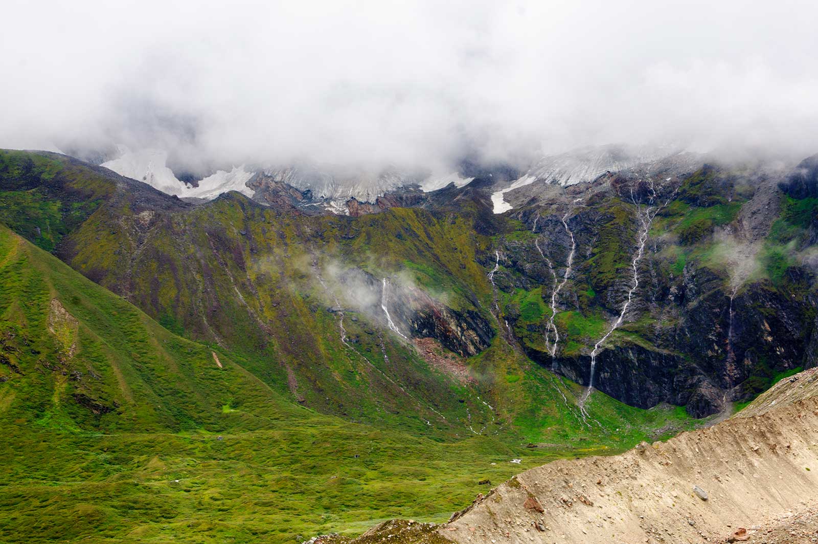
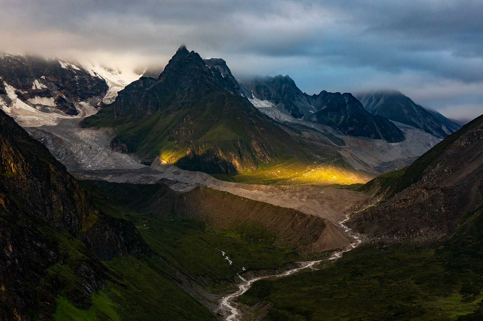
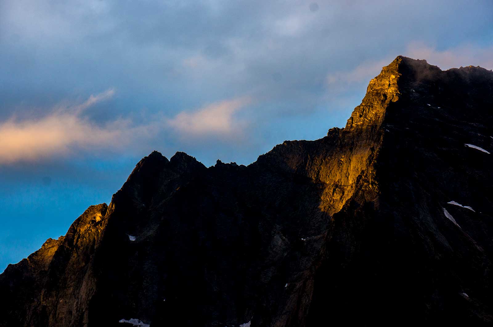
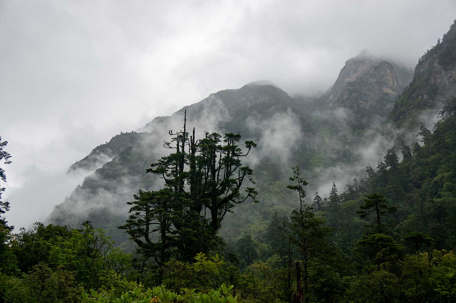
I woke early to shouting and found Mount Everest and Lhotse bathed in golden sunlight. The 7,500-meter-tall Chomolonzo is even more striking than Everest and Lhotse. Its shape resembles that of a majestic eagle, with its massive form unfolding before the camp, exuding an overwhelming presence. There has been much debate over the name of this peak, but for now, I believe “Chomolonzo” is the most authentic.
The trail to the base camp was rough. Bo Ge and I stopped at a high-altitude lake, as thick clouds obscured Everest. We saw a solar halo instead. By 4 PM, we returned to camp. I repaired my tent, washed my socks and gaiters, and the others trickled back.
In the afternoon, Li Congming packed up his tent, telling me he sensed the weather was about to turn bad. I agreed with his assessment, as I had noticed the increasing humidity through the presence of a solar halo. He, on the other hand, relied on a lifetime of intuition honed from wandering the mountains.
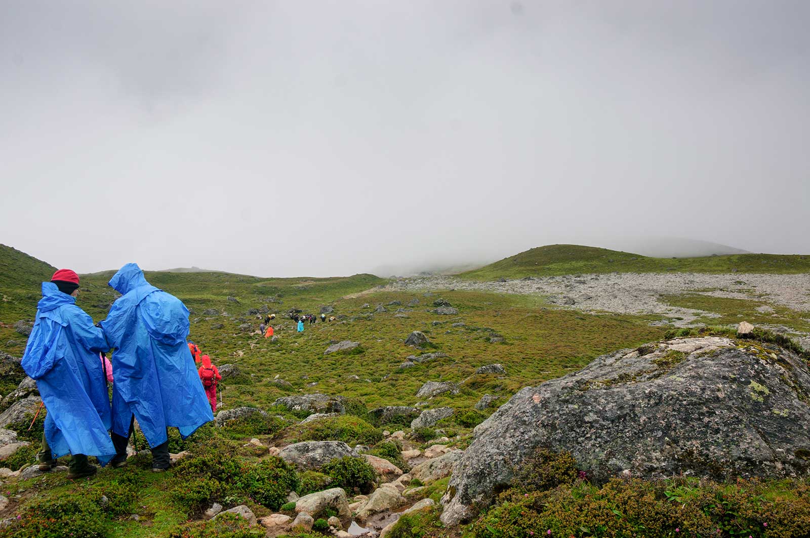
8:00 PM – The Valley Shrouded in Fog. As the evening settled in, a thick fog enveloped the valley, reducing visibility to just a few meters. A four-person team had yet to return, and concern grew among the rest of us. We convened a meeting to discuss our options. After some deliberation, I made the decision: if the team hadn’t returned by 10:00 PM, we would initiate a rescue operation.
By 10:00 PM, there was still no sign of the missing team. I assembled a four-person search and rescue squad, all seasoned hikers with extensive experience in challenging conditions. Armed with GPS devices, compasses, and detailed topographic maps, we set out into the foggy night. The visibility was so poor that we had to constantly recalibrate our position using the tools at hand. By analyzing the terrain and the location of nearby glaciers on the map, we identified potential areas where the missing team might have sought shelter.
Around midnight, we spotted a faint glimmer of light in the distance. Using this as a reference point, we adjusted our course and moved in a tangential direction. Ten minutes later, through triangulation, we pinpointed the coordinates of the missing team. The search proceeded smoothly, and Jundao, one of our most skilled rescuers, used ropes to safely extract the stranded hikers from a maze of ice pinnacles. Fortunately, aside scared, they were unharmed. The cause of their disorientation was the dense fog, which had obscured their path and landmarks.
Day 6: August 18 – Baidang – Ega – Badang – Tangxiang Hut
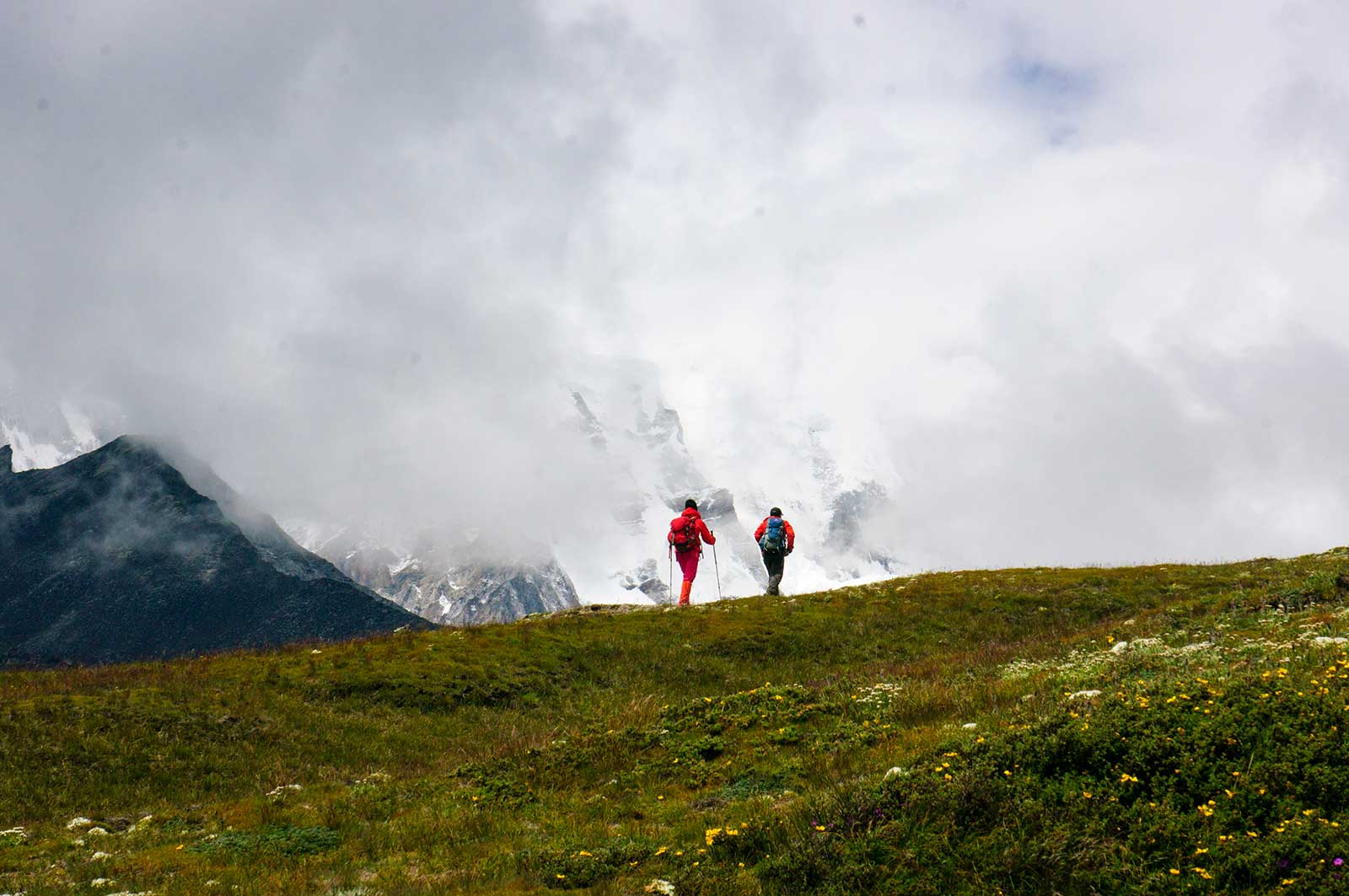
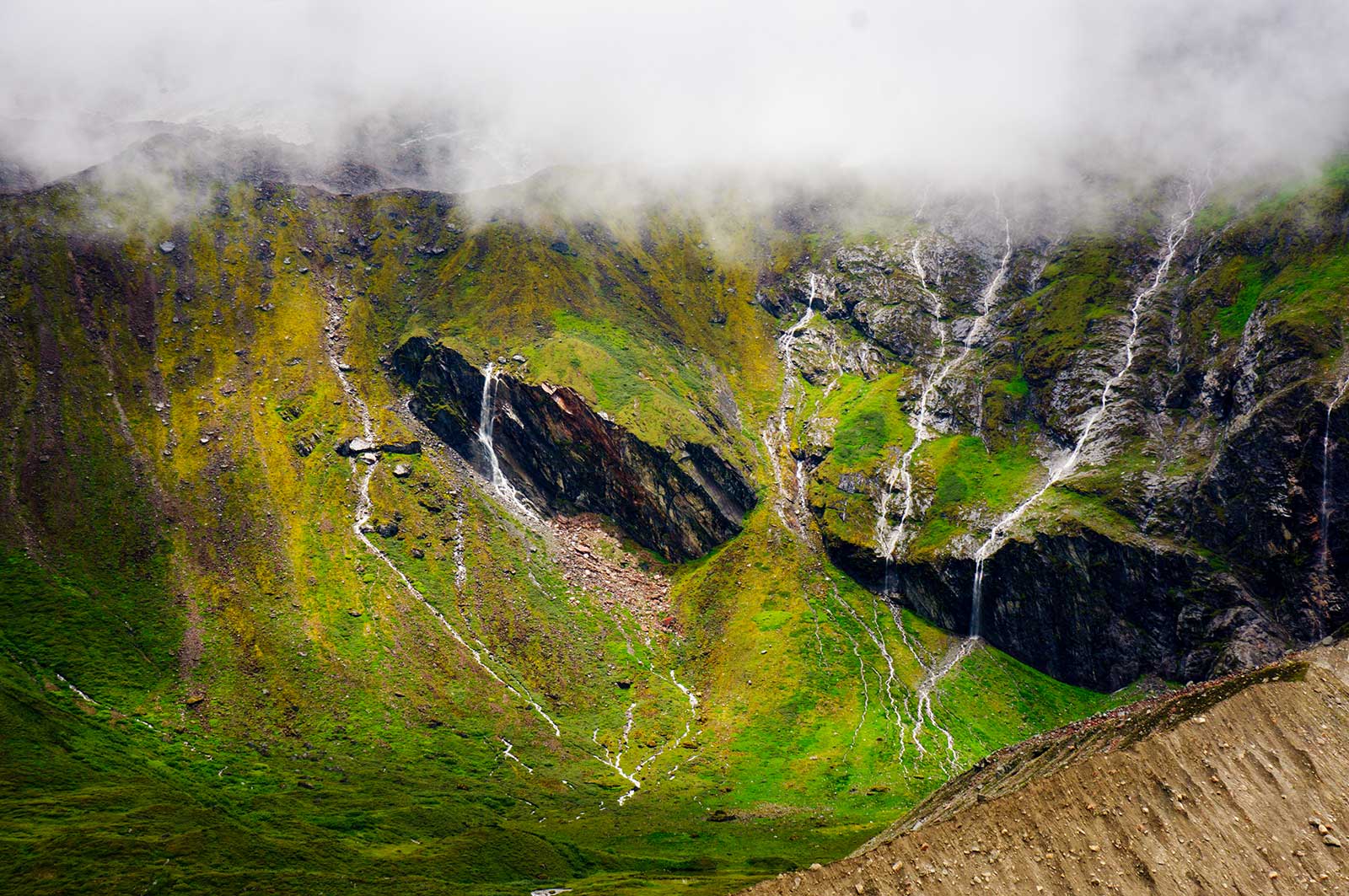
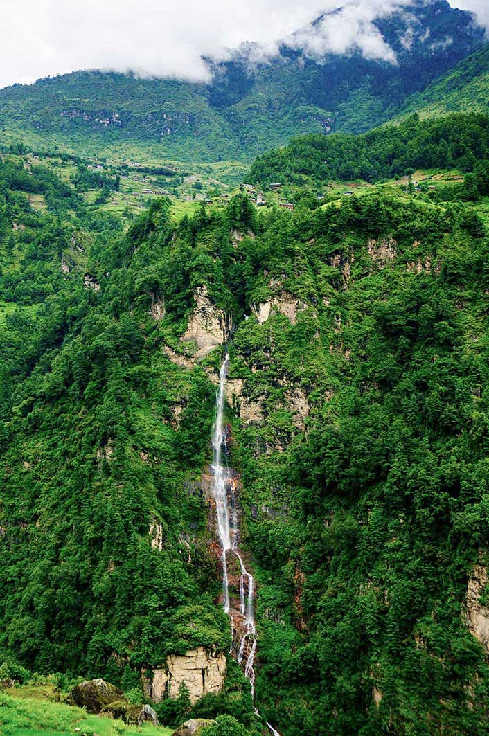
We slept until 9 AM, likely due to yesterday’s exhaustion. Leaving Baidang, children begged for food. We moved quickly under cloudy skies with intermittent rain. Unlike our initial foggy ascent, we now had a clear view of the Kama Valley, with Makalu and Everest occasionally visible. Waterfalls cascaded down unnamed peaks. As we ascended to Tangxiang, rain began—typical of the Himalayan monsoon. At camp, we met a trio from Linyi, including a man in his 60s. I stayed in the same hut as before. Despite delays, we were still on schedule to reach Lhasa by the 25th.
Day 7: August 19 – Tangxiang – Shanong – Zhuoxiang
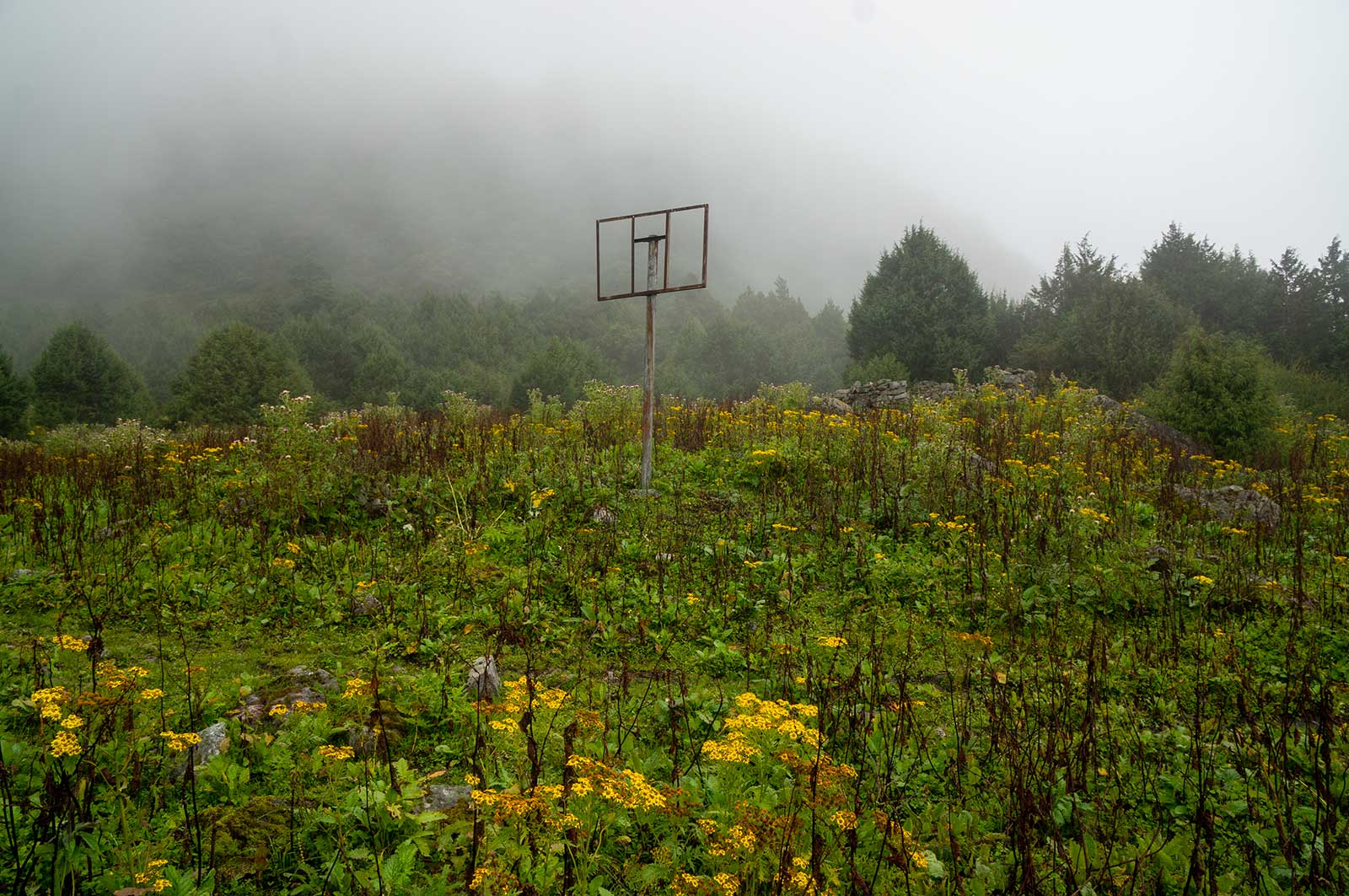
We rose at 6 AM to a dark, freezing morning. The yak herders were still asleep as we ate. The sunrise over the peaks energized everyone. Clouds came and went. The day’s short trek meant we reached Zhuoxiang by 2 PM. Some wanted to push on, but I saw little point. Descending into the valley would mean worse weather and water sources, saving only two hours. Better to rest at this five-star camp, dry our gear, and prepare for the next three days of dampness. The afternoon sun was glorious. I changed into beach shorts, set up a parasol, and felt like I was on a seaside vacation. We washed clothes, hair, and even brushed our teeth. That night, we had a feast, including hot pot, and the yak herders made delicious beef noodle soup. I even tried roasted barley.
It is worth noting that there is a path near this location that reaches the eastern face of Makalu, a more hidden corner that is rarely visited.
Day 8: August 20
Rain fell, but we couldn’t afford another rest day. The camp was surrounded by hundreds of wild chickens, unnoticed the day before. Entering the Kama Valley, the vegetation changed, with unfamiliar flowers appearing. We got lost, likely heading toward the Makalu East Face Glacier. Tsering Norbu spotted us from a hillside and guided us back. After lunch, we entered dense forests, experiencing relentless ascents and descents. Shajitang was an abandoned village overrun with thorny plants. The camp had good water but little flat ground. Dinner was canned meat stew and hot pot. The camp was infested with insects, so we avoided lighting lamps.

Day 9: August 21 – Shajitang – Naisangba (3,340 meters) – Ripu (3,100 meters) – Xiaowumi (3,080 meters)
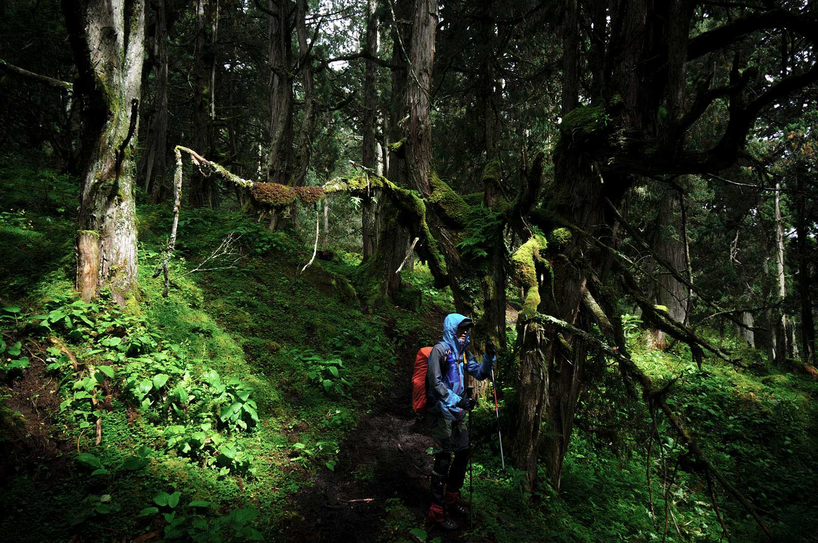
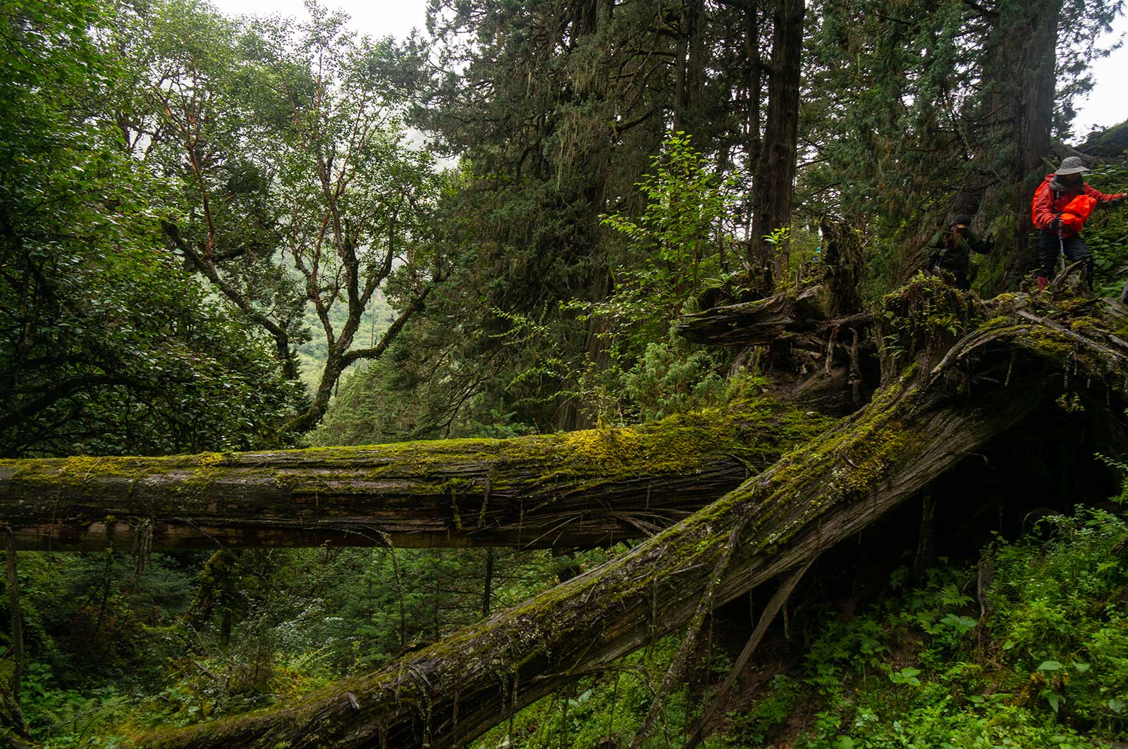
Today’s trek was easier, with fewer ascents and descents. Leeches were less frequent, with only 2-3 per hour. The trail was rough, mostly abandoned and swampy. We began to experience true subtropical rainforest scenery. Wooden paths had decayed into mud, with new planks laid over them, creating a cycle of decay and renewal, resulting in today’s swampy trails.
The trek was incredibly challenging, with nearly every step feeling like an ordeal. The rainforest was revealing its terrifying side. All of our waterproof gear was makeshift, and our rain jackets quickly became soaked. The air was oppressively hot and humid. In such conditions, I found that an umbrella was a far more reliable tool.
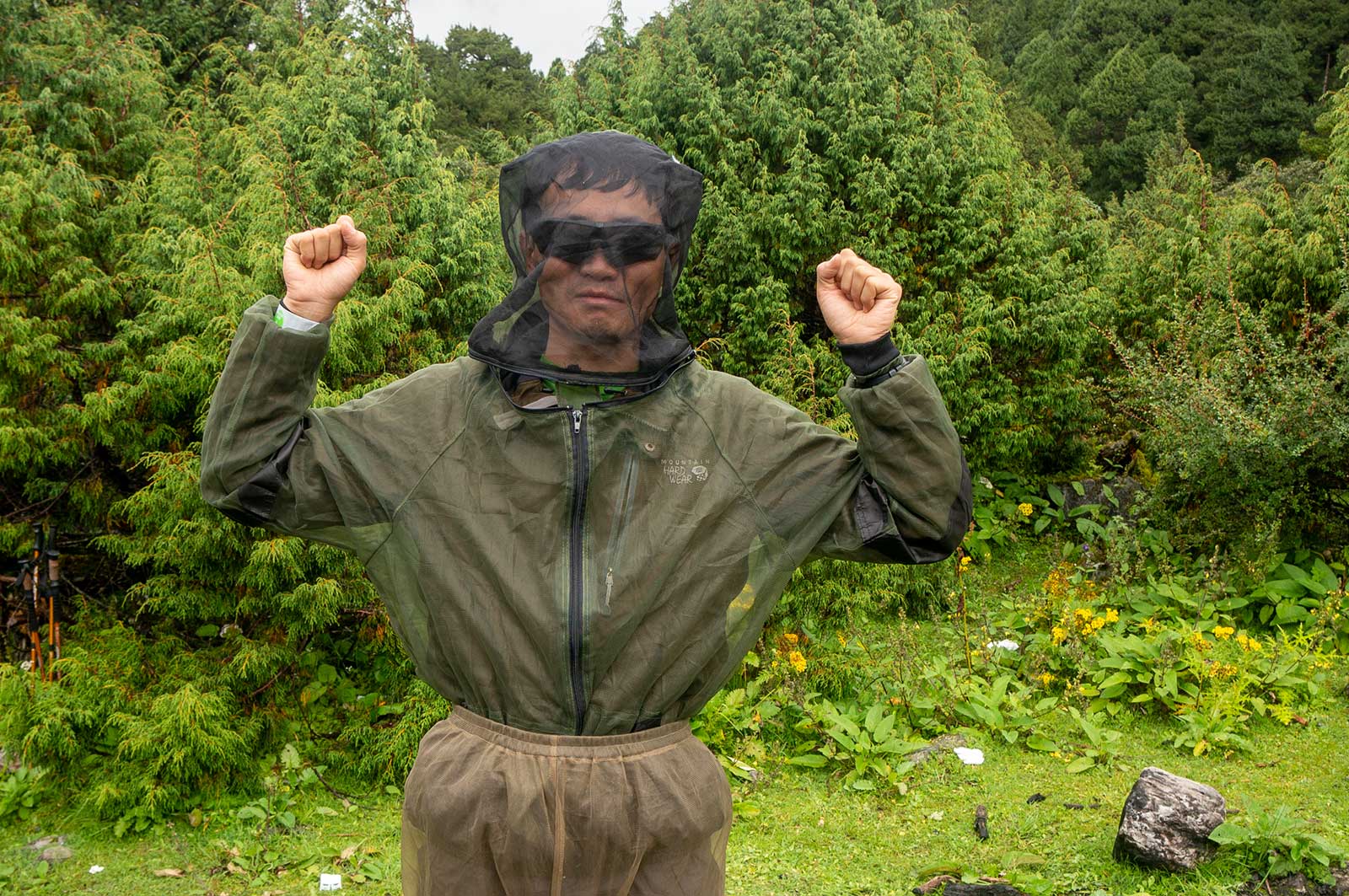
Additionally, any insect-proof gear we had prepared proved utterly ineffective at this point. Insects and soft-bodied creatures swarmed toward us as if we were a feast. It was nearly impossible to avoid extra “protein” in our food. Well, this was something we simply had to adapt to.
In this area, many old trees can be encountered on which the government has marked their age, the oldest about 3,900 years old, which looks like a huge high tower.
Day 10: Xiaowumi – Wobalong (2,960 meters) – Danmudan (2,900 meters) – Guolapu (2,720 meters) – Zhaxiladuo (2,680 meters) – Chentang Town (2,500 meters) – Pengqu River Bridge – Zangga Village (2,200 meters)
Xiaowumi was a nightmare camp, with leeches everywhere and swampy ground. Only a small uphill area was dry. In the morning, we found leeches covering our yaks’ backs and eyes, swollen to the size of fingers, leaving the animals bleeding profusely. It was too gruesome to photograph. Today’s trek was strenuous, with constant ascents and descents. The final 1-2 km to Chentang Town was infested with leeches—slow walkers could easily pick up over 1,000. We fled, leading to the opening scene of this account. Even so, I removed hundreds of leeches in Chentang. Later, I heard that even Tsering Norbu, our yak herder, was frightened by this stretch—a man I considered as tough as a wild beast.
Every blade of grass bore over ten leeches, and the area was densely covered in grass.
I discovered that the most effective way to deal with leeches was to continuously rub salt grains on my legs, which effectively prevented them from crawling upward. However, this had to be done every five minutes. Since I was wearing an insect-proof net, I managed to ignore the leeches to some extent, but they quickly covered my face. In the end, I had no choice but to kill them with saltwater.
Day 11: Chentang Town – Dinggye County – Lhasa
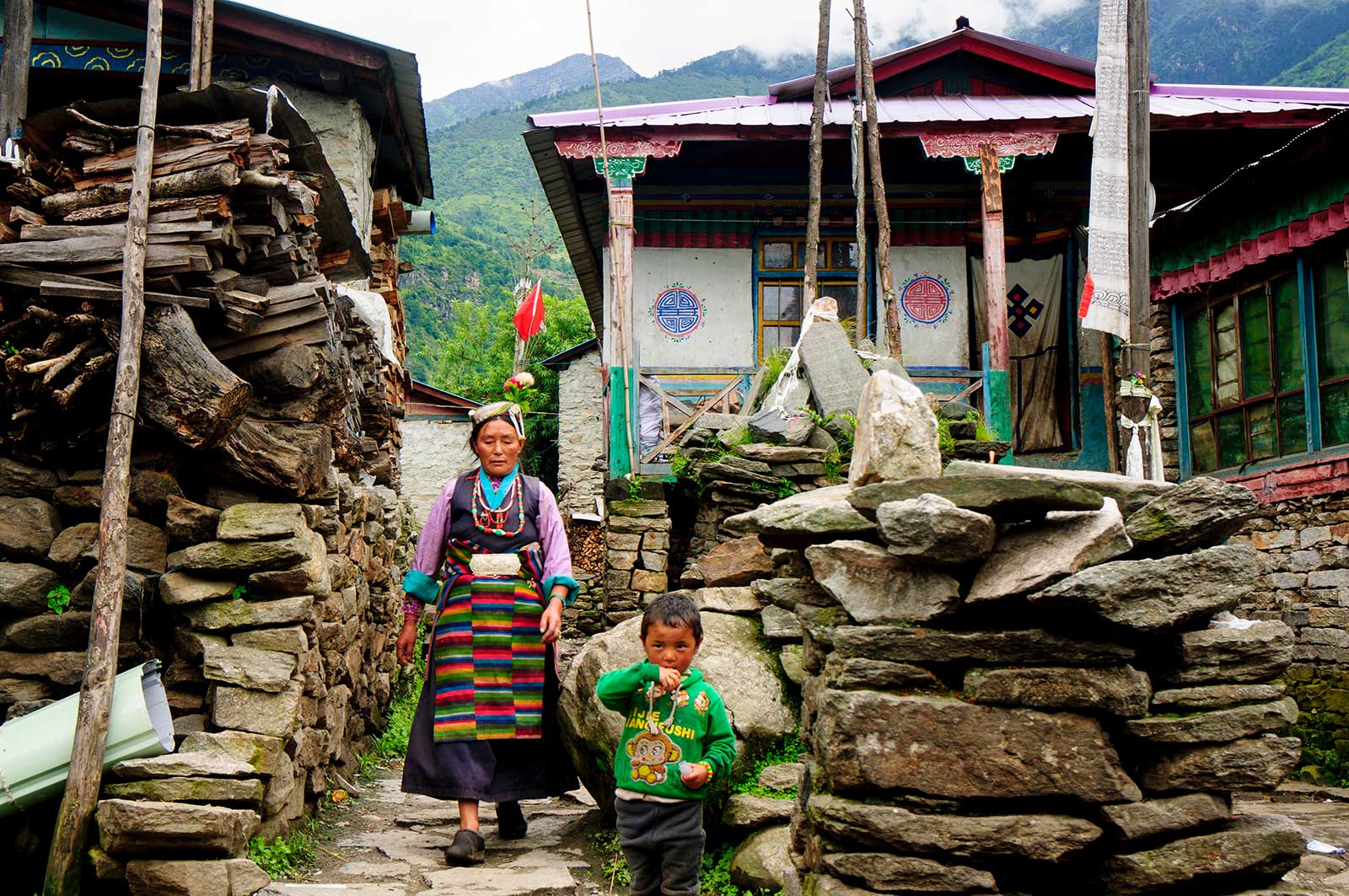
Chentang Town is undergoing significant development, likely for tourism. The town is densely populated with little arable land, less than one acre per person. The Sherpas, primarily farmers, are mostly poor. Tourism may change this. The Sherpas are shy and friendly, with children running away at the sight of us, unlike the candy-begging kids in Lunzhulin. I hope future visitors avoid giving candy, which encourages begging, and instead offer tools.
Few Sherpas understand Chinese, even among the youth. Once, at a teahouse, I asked for “tea” with a drinking gesture, but the owner handed me a business license, thinking I wanted to “inspect” it. It was both frustrating and amusing.
I find that here, women are mostly engaged in heavy physical labour such as carrying water and building materials. Men are mostly involved in skilled labour, such as carpentry and construction.
Summary:
The route itself is not difficult but the altitude is over 5000 metres in some places and care needs to be taken to prevent and control AMS.The valleys are very dangerous during the rainy season and locals do not enter the Kama valley during the rainy season and care needs to be taken for geological hazards.
Although the trek to the east face of Mount Everest is now successfully operated by many commercial adventure companies, but hardly any companies go here in the rainy season. If you wish to explore this area, I recommend planning your trip between late September and late October.

Postscript: Li Congming disappeared in his last expedition 2014, he entered the no man’s land of northern Tibet, a total of 1,500 kilometres, which he almost completed after consuming all his food after more than 70 days. After two years, a team of off-road vehicle explorers found his belongings: a tent, sleeping bag, bicycle, camera and notebook. But there was no sign of a human being.
He was a great cyclist and contributed his life to the Tibetan expedition.The books and travelogues he wrote are an invaluable legacy to later cycling explorers.